Property Record
7015 Westside Rd, Healdsburg, CA 95448


Save to a Folder
{{folder.Name}}
{{folder.ListingIds.length}} Properties
{{folder.ListingIds.length}} Property
Create a New Folder
Property Detail
7015 Westside Rd
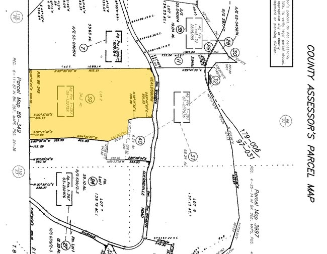
110-240-039
2007 FM REM 110-240-025 PER LLA 04-0088
Winery
Sonoma
LIA60
California
AE The base floodplain where base flood elevations are provided. AE Zones are now used on new format FIRMs instead of A1-A30 Zones.
2
2025
34.30 AC
2025
Healdsburg/Cloverdale/N.
153705
North Bay/Santa Rosa
4,272 SF
Santa Rosa-Petaluma, CA
NEARBY LISTINGS FOR SALE OR LEASE
-
-
View all Healdsburg listings for sale on LoopNet.com
DEMOGRAPHICS near 7015 Westside Rd
1 mile
3 mile
5 mile
2025 Total Population
33
5,711
34,657
2030 Population
32
5,632
34,370
Pop Growth 2025-2030
(3.03%)
(1.38%)
(0.83%)
Average Age
50
43
44
2025 Total Households
13
2,024
12,554
HH Growth 2025-2030
0.00%
(1.63%)
(1.00%)
Median Household Inc
$106,250
$131,160
$120,025
Avg Household Size
2.20
2.70
2.70
2025 Avg HH Vehicles
2.00
3.00
2.00
Median Home Value
$1,030,000
$782,227
$768,192
Median Year Built
1962
1980
1987
Nearby Places
Map Layers
Map Styles
 Street
 Aerial
Layers
 Traffic
 Biking
Places
Listings with unknown addresses are not visible on the map
- Restaurants
- Banks
- Shops
- Fitness
- Groceries
PUBLIC TRANSPORTATION
AIRPORT
Charles M Schulz - Sonoma County
Drive
Walk
Distance
Charles M Schulz - Sonoma County
28 min
17.2 mi
Freight Ports
Port of Richmond
Drive
Walk
Distance
Port of Richmond
92 min
70.1 mi
Nearby Properties
Address
Land Use
TOTAL SIZE
Lot Size
Zoning
Address
Land Use
TOTAL SIZE
Lot Size
Zoning
11,906 SF
0.12 AC
DA60
Address
Land Use
TOTAL SIZE
Lot Size
Zoning
13,953 SF
13.48 AC
LIA40
Address
Land Use
TOTAL SIZE
Lot Size
Zoning
1,540 SF
0.25 AC
LIA60
Address
Land Use
TOTAL SIZE
Lot Size
Zoning
7,213 SF
34.19 AC
LIA60
Address
Land Use
TOTAL SIZE
Lot Size
Zoning
26,690 SF
21.03 AC
Address
Land Use
TOTAL SIZE
Lot Size
Zoning
1,344 SF
20.71 AC
Address
Land Use
TOTAL SIZE
Lot Size
Zoning
7,791 SF
23.38 AC
Address
Land Use
TOTAL SIZE
Lot Size
Zoning
11,200 SF
24.43 AC
Address
Land Use
TOTAL SIZE
Lot Size
Zoning
5,880 SF
20.21 AC
Address
Land Use
TOTAL SIZE
Lot Size
Zoning
5,020 SF
20.09 AC
DA20
Address
Land Use
TOTAL SIZE
Lot Size
Zoning
2,988 SF
26.57 AC
LEA100
Address
Land Use
TOTAL SIZE
Lot Size
Zoning
6,082 SF
17.95 AC
Address
Land Use
TOTAL SIZE
Lot Size
Zoning
44,503 SF
18.49 AC
Address
Land Use
TOTAL SIZE
Lot Size
Zoning
600.36 AC
LEA100
Address
Land Use
TOTAL SIZE
Lot Size
Zoning
1,275 SF
7.13 AC
LIA60
Address
Land Use
TOTAL SIZE
Lot Size
Zoning
2,975 SF
638.94 AC
LEA100
Address
Land Use
TOTAL SIZE
Lot Size
Zoning
5,822 SF
30 AC
DA60
Address
Land Use
TOTAL SIZE
Lot Size
Zoning
2,616 SF
53.85 AC
LEA100
Address
Land Use
TOTAL SIZE
Lot Size
Zoning
50.04 AC
Address
Land Use
TOTAL SIZE
Lot Size
Zoning
3,050 SF
6.69 AC
Address
Land Use
TOTAL SIZE
Lot Size
Zoning
1,657 SF
92.15 AC
Address
Land Use
TOTAL SIZE
Lot Size
Zoning
20.60 AC
DA20
Address
Land Use
TOTAL SIZE
Lot Size
Zoning
2,000 SF
30.81 AC
Address
Land Use
TOTAL SIZE
Lot Size
Zoning
1,731 SF
5.45 AC
RRD20
Address
Land Use
TOTAL SIZE
Lot Size
Zoning
3,056 SF
22.84 AC
Address
Land Use
TOTAL SIZE
Lot Size
Zoning
1,748 SF
51.74 AC
DA60
Address
Land Use
TOTAL SIZE
Lot Size
Zoning
4,013 SF
120 AC
RRDW100
Address
Land Use
TOTAL SIZE
Lot Size
Zoning
20,416 SF
19.35 AC
DA60
Address
Land Use
TOTAL SIZE
Lot Size
Zoning
1,436 SF
130.52 AC
The World's #1 Commercial Real Estate Marketplace
Connect with us
© 2026 CoStar Group
The information above has been obtained from sources believed reliable. While we do not doubt its accuracy we have not verified it and make no guarantee, warranty or representation about it. It is your responsibility to independently confirm its accuracy and completeness. Any projections, opinions, assumptions, or estimates used are for example only and do not represent the current or future performance of the property. The value of this transaction to you depends on tax and other factors which should be evaluated by your tax, financial, and legal advisors. You and your advisors should conduct a careful, independent investigation of the property to determine to your satisfaction the suitability of the property for your needs.