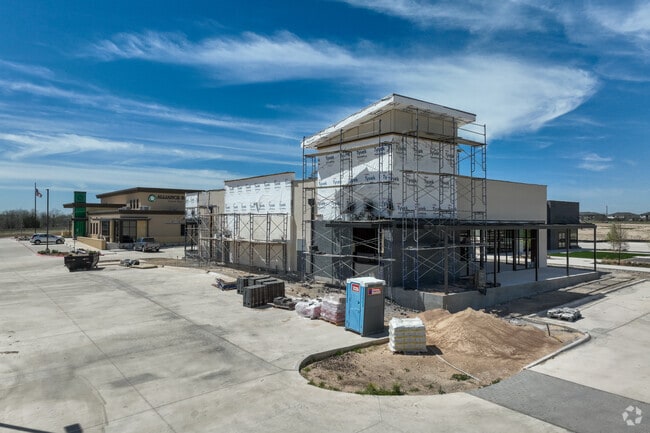
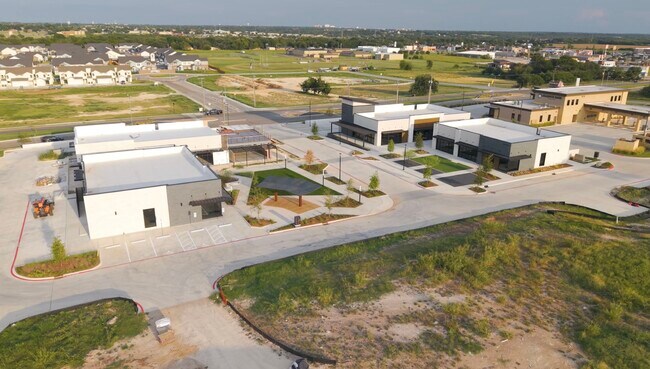
Property Record
7018 Crossroads Way, Temple, TX 76502
Current Lease Availabilities
Property Detail
7018 Crossroads Way
Killeen-Temple, TX
THE CROSSROAD DISTRICT PHASE II, BLOCK 003, LOT 0008, ACRES 1.017
516375
BELL
Commercialacreage
Texas
2025
8
2025
1.48 AC
020302
Temple
4,350 SF
Killeen/Temple/Fort Hood
NEARBY LISTINGS FOR SALE OR LEASE
DEMOGRAPHICS near 7018 Crossroads Way
1 mile
3 mile
5 mile
2025 Total Population
5,118
34,002
88,187
2030 Population
5,588
36,501
94,017
Pop Growth 2025-2030
+ 9.18%
+ 7.35%
+ 6.61%
Average Age
33
36
38
2025 Total Households
1,772
12,532
34,795
HH Growth 2025-2030
+ 9.26%
+ 7.29%
+ 6.64%
Median Household Inc
$93,891
$83,535
$72,208
Avg Household Size
2.90
2.70
2.40
2025 Avg HH Vehicles
2.00
2.00
2.00
Median Home Value
$280,987
$280,103
$268,048
Median Year Built
2011
2004
1991
Nearby Places
Map Layers
Map Styles
 Street
 Aerial
Transit
 Traffic
 Biking
Places
Listings with unknown addresses are not visible on the map
- Restaurants
- Banks
- Shops
- Fitness
- Groceries
PUBLIC TRANSPORTATION
COMMUTER RAIL
Temple (Texas Eagle - Amtrak)
Drive
Walk
Distance
Temple (Texas Eagle - Amtrak)
9 min
4.9 mi
AIRPORT
Killeen Municipal
Drive
Walk
Distance
Killeen Municipal
30 min
21.7 mi
Robert Gray AAF
Drive
Walk
Distance
Robert Gray AAF
50 min
35.6 mi
Freight Ports
Port of Houston
Drive
Walk
Distance
Port of Houston
235 min
185.5 mi
Nearby Properties
Address
Land Use
TOTAL SIZE
Lot Size
Zoning
Address
Land Use
TOTAL SIZE
Lot Size
Zoning
1 SF
14.43 AC
Address
Land Use
TOTAL SIZE
Lot Size
Zoning
109,343 SF
413.13 AC
LI
Address
Land Use
TOTAL SIZE
Lot Size
Zoning
92,815 SF
15.78 AC
Address
Land Use
TOTAL SIZE
Lot Size
Zoning
214,028 SF
14.37 AC
Address
Land Use
TOTAL SIZE
Lot Size
Zoning
230,116 SF
12.79 AC
Address
Land Use
TOTAL SIZE
Lot Size
Zoning
81,419 SF
100.28 AC
Address
Land Use
TOTAL SIZE
Lot Size
Zoning
188,072 SF
9.51 AC
C
Address
Land Use
TOTAL SIZE
Lot Size
Zoning
265,000 SF
15.41 AC
Address
Land Use
TOTAL SIZE
Lot Size
Zoning
168,754 SF
10.36 AC
LI
Address
Land Use
TOTAL SIZE
Lot Size
Zoning
41,630 SF
11.85 AC
Address
Land Use
TOTAL SIZE
Lot Size
Zoning
195,291 SF
36.30 AC
Address
Land Use
TOTAL SIZE
Lot Size
Zoning
71,931 SF
8.64 AC
Address
Land Use
TOTAL SIZE
Lot Size
Zoning
261,265 SF
17.50 AC
C
Address
Land Use
TOTAL SIZE
Lot Size
Zoning
206,897 SF
12.51 AC
COMB
Address
Land Use
TOTAL SIZE
Lot Size
Zoning
165,357 SF
33.03 AC
Address
Land Use
TOTAL SIZE
Lot Size
Zoning
57,121 SF
54.72 AC
Address
Land Use
TOTAL SIZE
Lot Size
Zoning
155,262 SF
10 AC
MF2
Address
Land Use
TOTAL SIZE
Lot Size
Zoning
176,542 SF
11.50 AC
COMB
Address
Land Use
TOTAL SIZE
Lot Size
Zoning
91,983 SF
13.18 AC
Address
Land Use
TOTAL SIZE
Lot Size
Zoning
147,052 SF
6.93 AC
MF2
Address
Land Use
TOTAL SIZE
Lot Size
Zoning
105,238 SF
12.33 AC
GR
Address
Land Use
TOTAL SIZE
Lot Size
Zoning
189,694 SF
20.78 AC
Address
Land Use
TOTAL SIZE
Lot Size
Zoning
216,450 SF
20.39 AC
Address
Land Use
TOTAL SIZE
Lot Size
Zoning
189,694 SF
20.70 AC
Address
Land Use
TOTAL SIZE
Lot Size
Zoning
213,344 SF
47.24 AC
Address
Land Use
TOTAL SIZE
Lot Size
Zoning
199,544 SF
9.91 AC
Address
Land Use
TOTAL SIZE
Lot Size
Zoning
65,754 SF
4.66 AC
Address
Land Use
TOTAL SIZE
Lot Size
Zoning
78,942 SF
15 AC
Address
Land Use
TOTAL SIZE
Lot Size
Zoning
2 SF
24.49 AC
Address
Land Use
TOTAL SIZE
Lot Size
Zoning
86,705 SF
4.79 AC
PD
The World's #1 Commercial Real Estate Marketplace
Connect with us
© 2026 CoStar Group
The information above has been obtained from sources believed reliable. While we do not doubt its accuracy we have not verified it and make no guarantee, warranty or representation about it. It is your responsibility to independently confirm its accuracy and completeness. Any projections, opinions, assumptions, or estimates used are for example only and do not represent the current or future performance of the property. The value of this transaction to you depends on tax and other factors which should be evaluated by your tax, financial, and legal advisors. You and your advisors should conduct a careful, independent investigation of the property to determine to your satisfaction the suitability of the property for your needs.