Property Record
702 N Midvale Blvd, Madison, WI 53705
NEARBY LISTINGS FOR SALE OR LEASE
Property Detail
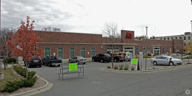
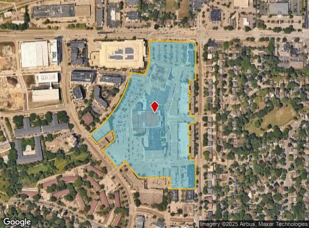
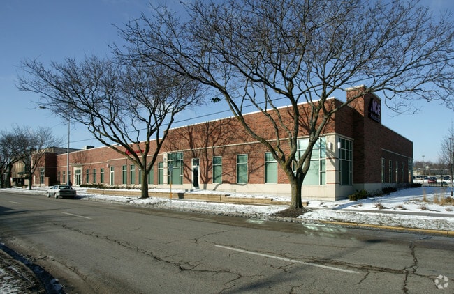
702 N Midvale Blvd
Madison, WI
Certified Survey Map No 12930 As
0709-201-2101-2
CERTIFIED SURVEY MAP NO 12930 AS RECORDED IN DANE COUNTY REGISTER OF DEEDS IN VO L 82 PAGE 160 OF CERTIFIED SURVEYS, LOT 1.
Commercialnec
Dane
X
Wisconsin
55025C0404G
82
2024
28.49 AC
2024
Near West Madison
000301
Milwaukee/Madison
226,593 SF
DEMOGRAPHICS near 702 N Midvale Blvd
1 Mile
3 Mile
5 Mile
2024 Total Population
14,867
98,599
225,283
2029 Population
15,357
101,487
232,678
Pop Growth 2024-2029
+ 3.30%
+ 2.93%
+ 3.28%
Average Age
39
35
36
2024 Total Households
7,345
40,612
100,362
HH Growth 2024-2029
+ 3.42%
+ 3.36%
+ 3.50%
Median Household Inc
$71,929
$60,110
$67,492
Avg Household Size
2.00
2.10
2.10
2024 Avg HH Vehicles
1.00
1.00
1.00
Median Home Value
$406,180
$397,615
$379,874
Median Year Built
1963
1970
1980
Nearby Places
Map Layers
Map Styles
 Street
 Aerial
- Restaurants
- Banks
- Shops
- Fitness
- Groceries
PUBLIC TRANSPORTATION
AIRPORT
Dane County Regional/Truax Field
DRIVE
WALK
Distance
Dane County Regional/Truax Field
19 min
8.8 mi
Freight Ports
Port Milwaukee
DRIVE
WALK
Distance
Port Milwaukee
105 min
83.3 mi
Nearby Properties
Address
Land Use
TOTAL SIZE
Lot Size
Zoning
Address
Land Use
TOTAL SIZE
Lot Size
Zoning
82,796 SF
9.26 AC
SE
Address
Land Use
TOTAL SIZE
Lot Size
Zoning
484,764 SF
1.62 AC
DC
Address
Land Use
TOTAL SIZE
Lot Size
Zoning
69,336 SF
26.90 AC
SE
Address
Land Use
TOTAL SIZE
Lot Size
Zoning
395,505 SF
0.99 AC
UMX
Address
Land Use
TOTAL SIZE
Lot Size
Zoning
466,963 SF
761.23 AC
PD
Address
Land Use
TOTAL SIZE
Lot Size
Zoning
291,526 SF
2.89 AC
PD
Address
Land Use
TOTAL SIZE
Lot Size
Zoning
56,000 SF
23.87 AC
SE
Address
Land Use
TOTAL SIZE
Lot Size
Zoning
460,603 SF
1.08 AC
PD
Address
Land Use
TOTAL SIZE
Lot Size
Zoning
349,680 SF
6.28 AC
TR-U2
Address
Land Use
TOTAL SIZE
Lot Size
Zoning
420,780 SF
10.14 AC
PD
Address
Land Use
TOTAL SIZE
Lot Size
Zoning
1.44 AC
TE
Address
Land Use
TOTAL SIZE
Lot Size
Zoning
230,268 SF
0.87 AC
UMX
Address
Land Use
TOTAL SIZE
Lot Size
Zoning
51,205 SF
9.32 AC
SE
Address
Land Use
TOTAL SIZE
Lot Size
Zoning
467,400 SF
6.17 AC
TR-U2
Address
Land Use
TOTAL SIZE
Lot Size
Zoning
183,407 SF
2.71 AC
PD
Address
Land Use
TOTAL SIZE
Lot Size
Zoning
2.91 AC
SE
Address
Land Use
TOTAL SIZE
Lot Size
Zoning
14,229 SF
0.50 AC
DC
Address
Land Use
TOTAL SIZE
Lot Size
Zoning
254,812 SF
0.64 AC
PD
Address
Land Use
TOTAL SIZE
Lot Size
Zoning
182,821 SF
1.19 AC
PD
Address
Land Use
TOTAL SIZE
Lot Size
Zoning
Address
Land Use
TOTAL SIZE
Lot Size
Zoning
234,075 SF
0.80 AC
UMX
Address
Land Use
TOTAL SIZE
Lot Size
Zoning
24,245 SF
2.23 AC
TSS
Address
Land Use
TOTAL SIZE
Lot Size
Zoning
2,454 SF
0.40 AC
PD
Address
Land Use
TOTAL SIZE
Lot Size
Zoning
209,268 SF
1.08 AC
PD
Address
Land Use
TOTAL SIZE
Lot Size
Zoning
237,225 SF
1.84 AC
PD
Address
Land Use
TOTAL SIZE
Lot Size
Zoning
3,085 SF
0.66 AC
UMX
Address
Land Use
TOTAL SIZE
Lot Size
Zoning
11,752 SF
0.58 AC
PD
Address
Land Use
TOTAL SIZE
Lot Size
Zoning
161,181 SF
8.50 AC
SR-V2
Address
Land Use
TOTAL SIZE
Lot Size
Zoning
222,406 SF
0.01 AC
PD
The World's #1 Commercial Real Estate Marketplace
Connect with us
© 2025 CoStar Group
The information above has been obtained from sources believed reliable. While we do not doubt its accuracy we have not verified it and make no guarantee, warranty or representation about it. It is your responsibility to independently confirm its accuracy and completeness. Any projections, opinions, assumptions, or estimates used are for example only and do not represent the current or future performance of the property. The value of this transaction to you depends on tax and other factors which should be evaluated by your tax, financial, and legal advisors. You and your advisors should conduct a careful, independent investigation of the property to determine to your satisfaction the suitability of the property for your needs.