Property Record
702 E Main St, Cobleskill, NY 12043
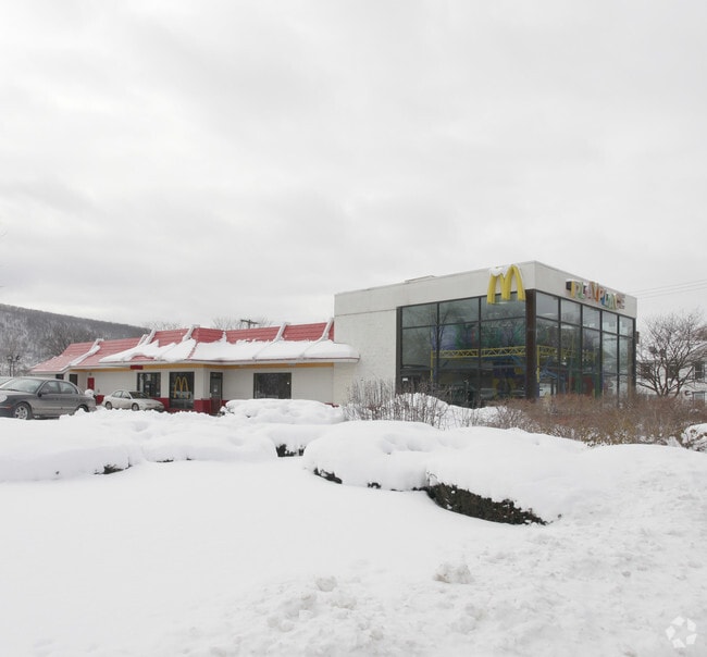

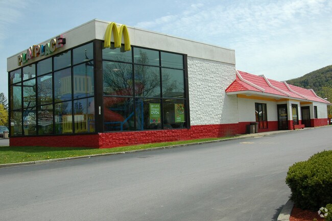
Property Detail
702 E Main St
432601-068-006-0004-016-000-0000
MACDONALD REST SEE ALSO 372/985
Restaurantdrivein
Schoharie
HB
New York
B and X Area of moderate flood hazard, usually the area between the limits of the 100-year and 500-year floods.
16.000
2025
0.80 AC
2025
Schoharie County
740200
Albany/Schenectady/Troy
3,512 SF
Albany-Schenectady-Troy, NY
NEARBY LISTINGS FOR SALE OR LEASE
DEMOGRAPHICS near 702 E Main St
1 mile
3 mile
5 mile
2025 Total Population
3,439
6,526
8,879
2030 Population
3,431
6,512
8,838
Pop Growth 2025-2030
(0.23%)
(0.21%)
(0.46%)
Average Age
43
40
41
2025 Total Households
1,643
2,440
3,398
HH Growth 2025-2030
(0.43%)
(0.37%)
(0.62%)
Median Household Inc
$57,557
$66,313
$70,243
Avg Household Size
2.00
2.10
2.20
2025 Avg HH Vehicles
2.00
2.00
2.00
Median Home Value
$178,291
$176,978
$181,608
Median Year Built
1969
1972
1973
Nearby Places
Map Layers
Map Styles
 Street
 Aerial
Transit
 Traffic
 Biking
Places
Listings with unknown addresses are not visible on the map
- Restaurants
- Banks
- Shops
- Fitness
- Groceries
PUBLIC TRANSPORTATION
AIRPORT
Albany International
Drive
Walk
Distance
Albany International
58 min
41.7 mi
Freight Ports
Albany, NY Port
Drive
Walk
Distance
Albany, NY Port
58 min
45.0 mi
Nearby Properties
Address
Land Use
TOTAL SIZE
Lot Size
Zoning
Address
Land Use
TOTAL SIZE
Lot Size
Zoning
35,584 SF
140.80 AC
HB
Address
Land Use
TOTAL SIZE
Lot Size
Zoning
280,000 SF
22.60 AC
RR
Address
Land Use
TOTAL SIZE
Lot Size
Zoning
59,672 SF
98.50 AC
RR
Address
Land Use
TOTAL SIZE
Lot Size
Zoning
97,728 SF
8.83 AC
R1
Address
Land Use
TOTAL SIZE
Lot Size
Zoning
4,668 SF
272.50 AC
Address
Land Use
TOTAL SIZE
Lot Size
Zoning
146,000 SF
15.79 AC
HB
Address
Land Use
TOTAL SIZE
Lot Size
Zoning
6,912 SF
25 AC
RM
Address
Land Use
TOTAL SIZE
Lot Size
Zoning
9,480 SF
1.70 AC
R3
Address
Land Use
TOTAL SIZE
Lot Size
Zoning
113,650 SF
15.08 AC
HB
Address
Land Use
TOTAL SIZE
Lot Size
Zoning
8,460 SF
12.27 AC
HB
Address
Land Use
TOTAL SIZE
Lot Size
Zoning
31,294 SF
8.40 AC
HB
Address
Land Use
TOTAL SIZE
Lot Size
Zoning
26,612 SF
5.08 AC
HB
Address
Land Use
TOTAL SIZE
Lot Size
Zoning
17,990 SF
4.73 AC
R1
Address
Land Use
TOTAL SIZE
Lot Size
Zoning
Address
Land Use
TOTAL SIZE
Lot Size
Zoning
15,086 SF
8.17 AC
RM
Address
Land Use
TOTAL SIZE
Lot Size
Zoning
Address
Land Use
TOTAL SIZE
Lot Size
Zoning
22,000 SF
8.60 AC
HB
Address
Land Use
TOTAL SIZE
Lot Size
Zoning
14,064 SF
3 AC
RM
Address
Land Use
TOTAL SIZE
Lot Size
Zoning
Address
Land Use
TOTAL SIZE
Lot Size
Zoning
6,128 SF
5.06 AC
RM
Address
Land Use
TOTAL SIZE
Lot Size
Zoning
17,676 SF
4.85 AC
RM
Address
Land Use
TOTAL SIZE
Lot Size
Zoning
14,673 SF
4.86 AC
GB
Address
Land Use
TOTAL SIZE
Lot Size
Zoning
33,078 SF
1.65 AC
R3
Address
Land Use
TOTAL SIZE
Lot Size
Zoning
4,048 SF
25.24 AC
PDD
Address
Land Use
TOTAL SIZE
Lot Size
Zoning
13,600 SF
1.45 AC
GB
Address
Land Use
TOTAL SIZE
Lot Size
Zoning
23,686 SF
3.50 AC
HB
Address
Land Use
TOTAL SIZE
Lot Size
Zoning
2,282 SF
1 AC
R3
Address
Land Use
TOTAL SIZE
Lot Size
Zoning
7,040 SF
5.40 AC
R3
Address
Land Use
TOTAL SIZE
Lot Size
Zoning
Address
Land Use
TOTAL SIZE
Lot Size
Zoning
32,400 SF
6.99 AC
HB
The World's #1 Commercial Real Estate Marketplace
Connect with us
© 2026 CoStar Group
The information above has been obtained from sources believed reliable. While we do not doubt its accuracy we have not verified it and make no guarantee, warranty or representation about it. It is your responsibility to independently confirm its accuracy and completeness. Any projections, opinions, assumptions, or estimates used are for example only and do not represent the current or future performance of the property. The value of this transaction to you depends on tax and other factors which should be evaluated by your tax, financial, and legal advisors. You and your advisors should conduct a careful, independent investigation of the property to determine to your satisfaction the suitability of the property for your needs.