Property Record
702 Hopewell Dr, Charleston, SC 29492

NEARBY LISTINGS FOR SALE OR LEASE
-
-
View all Charleston listings for sale on LoopNet.com
Property Detail
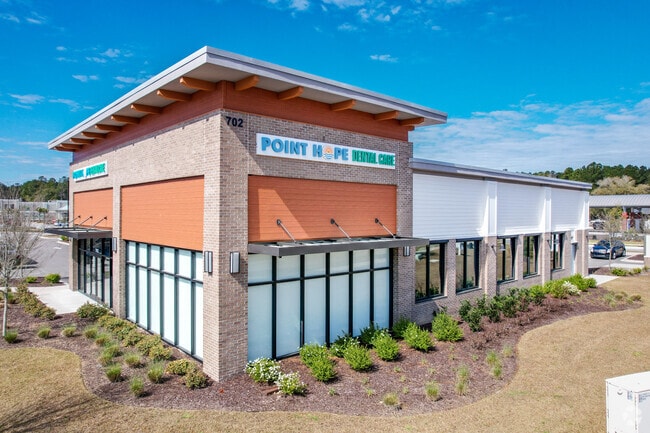
702 Hopewell Dr
262-00-00-045
Guggenheim-South
Commercialnec
PARCEL PH-D
X
Berkeley
45019C0340K
South Carolina
2025
1.70 AC
2025
Daniel Island
020404
Charleston/N Charleston
4,250 SF
Charleston-North Charleston, SC
DEMOGRAPHICS near 702 Hopewell Dr
1 Mile
3 Mile
5 Mile
2024 Total Population
1,995
9,891
38,639
2029 Population
2,403
11,396
43,851
Pop Growth 2024-2029
+ 20.45%
+ 15.22%
+ 13.49%
Average Age
37
39
41
2024 Total Households
813
3,749
14,951
HH Growth 2024-2029
+ 20.66%
+ 15.90%
+ 14.11%
Median Household Inc
$105,460
$122,930
$106,823
Avg Household Size
2.40
2.60
2.50
2024 Avg HH Vehicles
2.00
2.00
2.00
Median Home Value
$451,086
$469,719
$558,881
Median Year Built
2010
2007
2007
Nearby Places
Map Layers
Map Styles
 Street
 Aerial
- Restaurants
- Banks
- Shops
- Fitness
- Groceries
PUBLIC TRANSPORTATION
AIRPORT
Charleston AFB/International
DRIVE
WALK
Distance
Charleston AFB/International
27 min
16.8 mi
Freight Ports
Wando Welch Terminal
DRIVE
WALK
Distance
Wando Welch Terminal
18 min
11.2 mi
Nearby Properties
Address
Land Use
TOTAL SIZE
Lot Size
Zoning
Address
Land Use
TOTAL SIZE
Lot Size
Zoning
349,670 SF
21.61 AC
CHARLESTON
Address
Land Use
TOTAL SIZE
Lot Size
Zoning
626,148 SF
59.38 AC
CHARLESTON
Address
Land Use
TOTAL SIZE
Lot Size
Zoning
79,408 SF
3.11 AC
CHARLESTON
Address
Land Use
TOTAL SIZE
Lot Size
Zoning
278,800 SF
18.17 AC
CHARLESTON
Address
Land Use
TOTAL SIZE
Lot Size
Zoning
48,057 SF
8.50 AC
CHARLESTON
Address
Land Use
TOTAL SIZE
Lot Size
Zoning
351,000 SF
17.66 AC
CHARLESTON
Address
Land Use
TOTAL SIZE
Lot Size
Zoning
351,000 SF
27.58 AC
CHARLESTON
Address
Land Use
TOTAL SIZE
Lot Size
Zoning
300,000 SF
20.85 AC
CHARLESTON
Address
Land Use
TOTAL SIZE
Lot Size
Zoning
250,000 SF
28.97 AC
CHARLESTON
Address
Land Use
TOTAL SIZE
Lot Size
Zoning
3,929 SF
2.35 AC
CHARLESTON
Address
Land Use
TOTAL SIZE
Lot Size
Zoning
260,000 SF
14.33 AC
CHARLESTON
Address
Land Use
TOTAL SIZE
Lot Size
Zoning
92,361 SF
5.87 AC
BERKELEY C
Address
Land Use
TOTAL SIZE
Lot Size
Zoning
83,421 SF
3.66 AC
CHARLESTON
Address
Land Use
TOTAL SIZE
Lot Size
Zoning
190,175 SF
24.36 AC
CHARLESTON
Address
Land Use
TOTAL SIZE
Lot Size
Zoning
6,000 SF
4.35 AC
CHARLESTON
Address
Land Use
TOTAL SIZE
Lot Size
Zoning
200,000 SF
15.25 AC
CHARLESTON
Address
Land Use
TOTAL SIZE
Lot Size
Zoning
83,215 SF
1.98 AC
CHARLESTON
Address
Land Use
TOTAL SIZE
Lot Size
Zoning
112,000 SF
7.02 AC
CHARLESTON
Address
Land Use
TOTAL SIZE
Lot Size
Zoning
17,200 SF
48.82 AC
BERKELEY C
Address
Land Use
TOTAL SIZE
Lot Size
Zoning
1,680 SF
6.97 AC
BERKELEY C
Address
Land Use
TOTAL SIZE
Lot Size
Zoning
160.87 AC
CHARLESTON
Address
Land Use
TOTAL SIZE
Lot Size
Zoning
55,614 SF
4.56 AC
CHARLESTON
Address
Land Use
TOTAL SIZE
Lot Size
Zoning
19.46 AC
CHARLESTON
Address
Land Use
TOTAL SIZE
Lot Size
Zoning
50,400 SF
6.80 AC
CHARLESTON
Address
Land Use
TOTAL SIZE
Lot Size
Zoning
27,375 SF
16.07 AC
CHARLESTON
Address
Land Use
TOTAL SIZE
Lot Size
Zoning
19.50 AC
CHARLESTON
Address
Land Use
TOTAL SIZE
Lot Size
Zoning
8,440 SF
2.68 AC
CHARLESTON
Address
Land Use
TOTAL SIZE
Lot Size
Zoning
3,834 SF
2.07 AC
CHARLESTON
Address
Land Use
TOTAL SIZE
Lot Size
Zoning
10,140 SF
3.32 AC
BERKELEY C
The World's #1 Commercial Real Estate Marketplace
Connect with us
© 2025 CoStar Group
The information above has been obtained from sources believed reliable. While we do not doubt its accuracy we have not verified it and make no guarantee, warranty or representation about it. It is your responsibility to independently confirm its accuracy and completeness. Any projections, opinions, assumptions, or estimates used are for example only and do not represent the current or future performance of the property. The value of this transaction to you depends on tax and other factors which should be evaluated by your tax, financial, and legal advisors. You and your advisors should conduct a careful, independent investigation of the property to determine to your satisfaction the suitability of the property for your needs.