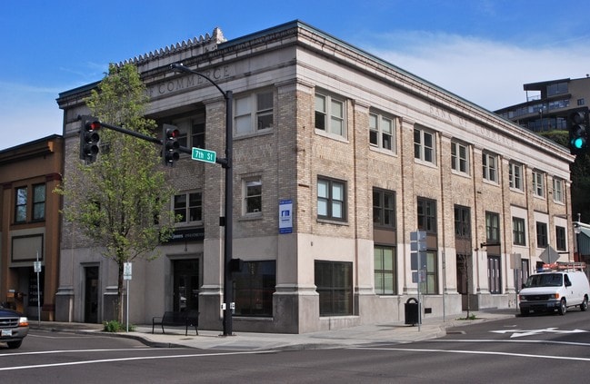
Property Record
702 Main St, Oregon City, OR 97045

Current Lease Availabilities
Property Detail
702 Main St
Portland-Vancouver-Hillsboro, OR-WA
SUBDIVISION OREGON CITY 2 BLOCK 24 PT LT 5
00572384
Clackamas
Commercialbuilding
Oregon
MUD
5
B and X Area of moderate flood hazard, usually the area between the limits of the 100-year and 500-year floods.
0.12 AC
2025
Oregon City
2025
Portland
022400
NEARBY LISTINGS FOR SALE OR LEASE
DEMOGRAPHICS near 702 Main St
1 mile
3 mile
5 mile
2025 Total Population
9,713
80,677
137,962
2030 Population
9,735
80,704
137,836
Pop Growth 2025-2030
+ 0.23%
+ 0.03%
(0.09%)
Average Age
41
42
43
2025 Total Households
3,790
30,459
52,935
HH Growth 2025-2030
+ 0.18%
(0.03%)
(0.16%)
Median Household Inc
$101,035
$103,090
$103,228
Avg Household Size
2.50
2.60
2.50
2025 Avg HH Vehicles
2.00
2.00
2.00
Median Home Value
$613,034
$637,783
$645,622
Median Year Built
1971
1982
1979
Nearby Places
Map Layers
Map Styles
 Street
 Aerial
Layers
 Traffic
 Biking
Places
Listings with unknown addresses are not visible on the map
- Restaurants
- Banks
- Shops
- Fitness
- Groceries
PUBLIC TRANSPORTATION
COMMUTER RAIL
Tualatin (Westside Express Service - Tri-County Metropolitan Transportation District of Oregon Rail (TriMet Rail))
Drive
Walk
Distance
Tualatin (Westside Express Service - Tri-County Metropolitan Transportation District of Oregon Rail (TriMet Rail))
12 min
8.3 mi
AIRPORT
Portland International
Drive
Walk
Distance
Portland International
24 min
18.9 mi
Freight Ports
Port of Portland
Drive
Walk
Distance
Port of Portland
1 min
14.0 mi
Nearby Properties
Address
Land Use
TOTAL SIZE
Lot Size
Zoning
Address
Land Use
TOTAL SIZE
Lot Size
Zoning
58 AC
MUE
Address
Land Use
TOTAL SIZE
Lot Size
Zoning
15.26 AC
GI
Address
Land Use
TOTAL SIZE
Lot Size
Zoning
9,233 SF
8.27 AC
MUE
Address
Land Use
TOTAL SIZE
Lot Size
Zoning
20.28 AC
R2
Address
Land Use
TOTAL SIZE
Lot Size
Zoning
3.11 AC
GC
Address
Land Use
TOTAL SIZE
Lot Size
Zoning
1,008 SF
10 AC
R3
Address
Land Use
TOTAL SIZE
Lot Size
Zoning
2,482 SF
5.14 AC
MR
Address
Land Use
TOTAL SIZE
Lot Size
Zoning
6 AC
OBC
Address
Land Use
TOTAL SIZE
Lot Size
Zoning
936 SF
10.25 AC
CI
Address
Land Use
TOTAL SIZE
Lot Size
Zoning
11 AC
MUD
Address
Land Use
TOTAL SIZE
Lot Size
Zoning
16.49 AC
MUD
Address
Land Use
TOTAL SIZE
Lot Size
Zoning
9.30 AC
C
Address
Land Use
TOTAL SIZE
Lot Size
Zoning
70.97 AC
OP
Address
Land Use
TOTAL SIZE
Lot Size
Zoning
15.29 AC
R2
Address
Land Use
TOTAL SIZE
Lot Size
Zoning
3.18 AC
C3
Address
Land Use
TOTAL SIZE
Lot Size
Zoning
8.27 AC
MR
Address
Land Use
TOTAL SIZE
Lot Size
Zoning
Address
Land Use
TOTAL SIZE
Lot Size
Zoning
9.21 AC
R3
Address
Land Use
TOTAL SIZE
Lot Size
Zoning
6 AC
OP
Address
Land Use
TOTAL SIZE
Lot Size
Zoning
980 SF
6.19 AC
GC
Address
Land Use
TOTAL SIZE
Lot Size
Zoning
Address
Land Use
TOTAL SIZE
Lot Size
Zoning
4 AC
MUE
Address
Land Use
TOTAL SIZE
Lot Size
Zoning
6.16 AC
GC
Address
Land Use
TOTAL SIZE
Lot Size
Zoning
1,202 SF
3 AC
OBC
Address
Land Use
TOTAL SIZE
Lot Size
Zoning
6.14 AC
R2.1
Address
Land Use
TOTAL SIZE
Lot Size
Zoning
1.67 AC
MUE
Address
Land Use
TOTAL SIZE
Lot Size
Zoning
4.56 AC
MR
Address
Land Use
TOTAL SIZE
Lot Size
Zoning
9.07 AC
GI
Address
Land Use
TOTAL SIZE
Lot Size
Zoning
0.94 AC
MUD
Address
Land Use
TOTAL SIZE
Lot Size
Zoning
4.12 AC
MUC2
The World's #1 Commercial Real Estate Marketplace
Connect with us
© 2026 CoStar Group
The information above has been obtained from sources believed reliable. While we do not doubt its accuracy we have not verified it and make no guarantee, warranty or representation about it. It is your responsibility to independently confirm its accuracy and completeness. Any projections, opinions, assumptions, or estimates used are for example only and do not represent the current or future performance of the property. The value of this transaction to you depends on tax and other factors which should be evaluated by your tax, financial, and legal advisors. You and your advisors should conduct a careful, independent investigation of the property to determine to your satisfaction the suitability of the property for your needs.