Property Record
702 Martin Adams Dr, Fort Stockton, TX 79735

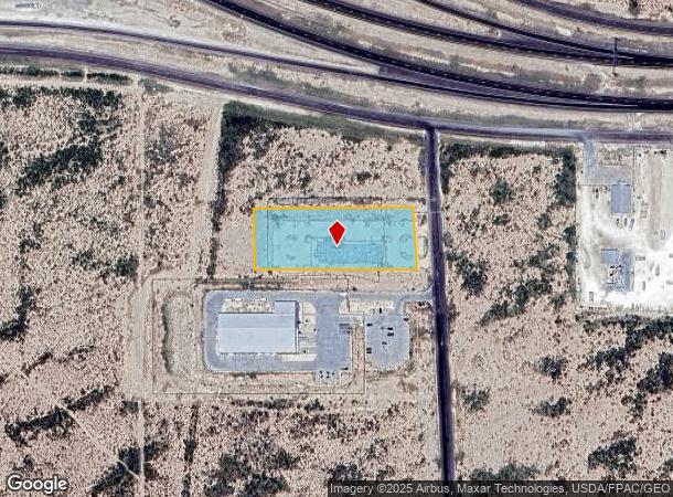
This Property Is For Sale
NEARBY LISTINGS FOR SALE OR LEASE
-
-
View all Fort Stockton listings for sale on LoopNet.com
Property Detail
702 Martin Adams Dr
Other Market Areas
PT 4 N FSIL LOT 16 F S INDUSTRIAL PARK (REPLAT OF LOT 1)
00800-11001-00123-000000
Pecos
Residentialacreage
Texas
2025
1,16
2025
2.10 AC
950300
Texas West Area
11,257 SF
DEMOGRAPHICS near 702 Martin Adams Dr
1 Mile
3 Mile
5 Mile
2024 Total Population
176
8,160
11,808
2029 Population
170
7,939
11,417
Pop Growth 2024-2029
(3.41%)
(2.71%)
(3.31%)
Average Age
38
38
38
2024 Total Households
59
2,797
4,066
HH Growth 2024-2029
(3.39%)
(3.07%)
(3.69%)
Median Household Inc
$99,999
$44,535
$52,996
Avg Household Size
3.00
2.70
2.70
2024 Avg HH Vehicles
2.00
2.00
2.00
Median Home Value
$103,125
$110,229
$119,835
Median Year Built
1990
1975
1976
Nearby Places
Map Layers
Map Styles
 Street
 Aerial
- Restaurants
- Banks
- Shops
- Fitness
- Groceries
Nearby Properties
Address
Land Use
TOTAL SIZE
Lot Size
Zoning
Address
Land Use
TOTAL SIZE
Lot Size
Zoning
236,285 SF
17.26 AC
Address
Land Use
TOTAL SIZE
Lot Size
Zoning
161,954 SF
3.60 AC
Address
Land Use
TOTAL SIZE
Lot Size
Zoning
Address
Land Use
TOTAL SIZE
Lot Size
Zoning
124,199 SF
3.60 AC
Address
Land Use
TOTAL SIZE
Lot Size
Zoning
29,338 SF
0.89 AC
Address
Land Use
TOTAL SIZE
Lot Size
Zoning
109,883 SF
60.58 AC
Address
Land Use
TOTAL SIZE
Lot Size
Zoning
13,774 SF
9.94 AC
Address
Land Use
TOTAL SIZE
Lot Size
Zoning
109,017 SF
1.47 AC
Address
Land Use
TOTAL SIZE
Lot Size
Zoning
276,502 SF
8.30 AC
Address
Land Use
TOTAL SIZE
Lot Size
Zoning
277,032 SF
10.91 AC
Address
Land Use
TOTAL SIZE
Lot Size
Zoning
58,971 SF
28.96 AC
Address
Land Use
TOTAL SIZE
Lot Size
Zoning
42,500 SF
1.77 AC
Address
Land Use
TOTAL SIZE
Lot Size
Zoning
42,933 SF
2.25 AC
Address
Land Use
TOTAL SIZE
Lot Size
Zoning
46,315 SF
0.01 AC
Address
Land Use
TOTAL SIZE
Lot Size
Zoning
14,434 SF
0.44 AC
Address
Land Use
TOTAL SIZE
Lot Size
Zoning
165,713 SF
2.41 AC
Address
Land Use
TOTAL SIZE
Lot Size
Zoning
65,606 SF
6.70 AC
Address
Land Use
TOTAL SIZE
Lot Size
Zoning
52,968 SF
4.65 AC
Address
Land Use
TOTAL SIZE
Lot Size
Zoning
24,668 SF
1.77 AC
Address
Land Use
TOTAL SIZE
Lot Size
Zoning
102,526 SF
7.30 AC
Address
Land Use
TOTAL SIZE
Lot Size
Zoning
56,491 SF
3.89 AC
Address
Land Use
TOTAL SIZE
Lot Size
Zoning
120,135 SF
1.48 AC
Address
Land Use
TOTAL SIZE
Lot Size
Zoning
77,120 SF
1.77 AC
Address
Land Use
TOTAL SIZE
Lot Size
Zoning
34,093 SF
5 AC
Address
Land Use
TOTAL SIZE
Lot Size
Zoning
94,236 SF
1.43 AC
Address
Land Use
TOTAL SIZE
Lot Size
Zoning
36,424 SF
1.55 AC
Address
Land Use
TOTAL SIZE
Lot Size
Zoning
22,709 SF
0.91 AC
Address
Land Use
TOTAL SIZE
Lot Size
Zoning
39,808 SF
1.82 AC
Address
Land Use
TOTAL SIZE
Lot Size
Zoning
43,224 SF
11.07 AC
The World's #1 Commercial Real Estate Marketplace
Connect with us
© 2025 CoStar Group
The information above has been obtained from sources believed reliable. While we do not doubt its accuracy we have not verified it and make no guarantee, warranty or representation about it. It is your responsibility to independently confirm its accuracy and completeness. Any projections, opinions, assumptions, or estimates used are for example only and do not represent the current or future performance of the property. The value of this transaction to you depends on tax and other factors which should be evaluated by your tax, financial, and legal advisors. You and your advisors should conduct a careful, independent investigation of the property to determine to your satisfaction the suitability of the property for your needs.