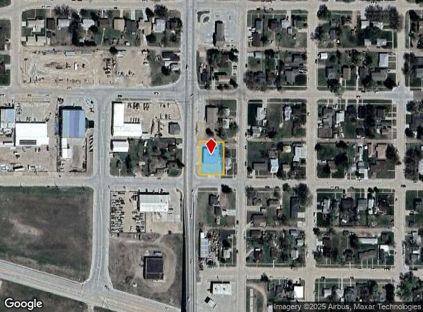
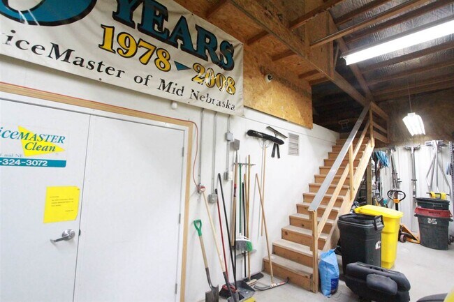
Property Record
702 N Adams St, Lexington, NE 68850

NEARBY LISTINGS FOR SALE OR LEASE
-
-
View all Lexington listings for sale on LoopNet.com
Property Detail
702 N Adams St
Lexington, NE
Mac Coll & Leflang's Second Add
24-0136276
00000672 LOTS 4 & 5 BLK 21 MAC COLL & LEFLANG'S SECOND ADDITION
Commercialnec
Dawson
X
Nebraska
31047C0463C
4,5
2024
0.33 AC
2025
I-80 Corridor
968500
Other Market Areas
3,840 SF
DEMOGRAPHICS near 702 N Adams St
1 Mile
3 Mile
5 Mile
2024 Total Population
9,786
11,504
11,935
2029 Population
9,720
11,425
11,842
Pop Growth 2024-2029
(0.67%)
(0.69%)
(0.78%)
Average Age
34
34
35
2024 Total Households
3,098
3,666
3,831
HH Growth 2024-2029
(0.68%)
(0.71%)
(0.78%)
Median Household Inc
$56,479
$57,769
$58,306
Avg Household Size
3.10
3.00
3.00
2024 Avg HH Vehicles
2.00
2.00
2.00
Median Home Value
$129,062
$135,598
$139,039
Median Year Built
1973
1973
1973
Nearby Places
Map Layers
Map Styles
 Street
 Aerial
- Restaurants
- Banks
- Shops
- Fitness
- Groceries
SALE & LEASE HISTORY
LISTING DATE
SALE/LEASE

Sep 20, 2021
For Sale
Nearby Properties
Address
Land Use
TOTAL SIZE
Lot Size
Zoning
Address
Land Use
TOTAL SIZE
Lot Size
Zoning
1,344 SF
128.24 AC
04-INDUSTR
Address
Land Use
TOTAL SIZE
Lot Size
Zoning
20,460 SF
1 AC
04-INDUSTR
Address
Land Use
TOTAL SIZE
Lot Size
Zoning
38,994 SF
4.86 AC
03-COMMERC
Address
Land Use
TOTAL SIZE
Lot Size
Zoning
112,374 SF
27.73 AC
03-COMMERC
Address
Land Use
TOTAL SIZE
Lot Size
Zoning
144,333 SF
35.44 AC
03-COMMERC
Address
Land Use
TOTAL SIZE
Lot Size
Zoning
7,143 SF
4.88 AC
02-MULTI-F
Address
Land Use
TOTAL SIZE
Lot Size
Zoning
284 AC
00
Address
Land Use
TOTAL SIZE
Lot Size
Zoning
69,010 SF
5.18 AC
00
Address
Land Use
TOTAL SIZE
Lot Size
Zoning
38,256 SF
10.07 AC
03-COMMERC
Address
Land Use
TOTAL SIZE
Lot Size
Zoning
7,804 SF
8.63 AC
03-COMMERC
Address
Land Use
TOTAL SIZE
Lot Size
Zoning
31,173 SF
2.24 AC
03-COMMERC
Address
Land Use
TOTAL SIZE
Lot Size
Zoning
11,074 SF
1.64 AC
02-MULTI-F
Address
Land Use
TOTAL SIZE
Lot Size
Zoning
7,344 SF
1.08 AC
03-COMMERC
Address
Land Use
TOTAL SIZE
Lot Size
Zoning
12,944 SF
0.76 AC
02-MULTI-F
Address
Land Use
TOTAL SIZE
Lot Size
Zoning
17,359 SF
1 AC
03-COMMERC
Address
Land Use
TOTAL SIZE
Lot Size
Zoning
18,700 SF
1.23 AC
03-COMMERC
Address
Land Use
TOTAL SIZE
Lot Size
Zoning
25,071 SF
6.93 AC
04-INDUSTR
Address
Land Use
TOTAL SIZE
Lot Size
Zoning
24,481 SF
0.52 AC
03-COMMERC
Address
Land Use
TOTAL SIZE
Lot Size
Zoning
10,000 SF
18.15 AC
03-COMMERC
Address
Land Use
TOTAL SIZE
Lot Size
Zoning
4,788 SF
2.11 AC
03-COMMERC
Address
Land Use
TOTAL SIZE
Lot Size
Zoning
17,920 SF
10.71 AC
03-COMMERC
Address
Land Use
TOTAL SIZE
Lot Size
Zoning
14,940 SF
16.85 AC
03-COMMERC
Address
Land Use
TOTAL SIZE
Lot Size
Zoning
11,550 SF
6.53 AC
03-COMMERC
Address
Land Use
TOTAL SIZE
Lot Size
Zoning
9,259 SF
2.89 AC
03-COMMERC
Address
Land Use
TOTAL SIZE
Lot Size
Zoning
5.50 AC
03-COMMERC
Address
Land Use
TOTAL SIZE
Lot Size
Zoning
12,074 SF
20.93 AC
03-COMMERC
Address
Land Use
TOTAL SIZE
Lot Size
Zoning
34,562 SF
2.11 AC
03-COMMERC
Address
Land Use
TOTAL SIZE
Lot Size
Zoning
3,360 SF
1.61 AC
03-COMMERC
Address
Land Use
TOTAL SIZE
Lot Size
Zoning
1,456 SF
4.14 AC
03-COMMERC
The World's #1 Commercial Real Estate Marketplace
Connect with us
© 2025 CoStar Group
The information above has been obtained from sources believed reliable. While we do not doubt its accuracy we have not verified it and make no guarantee, warranty or representation about it. It is your responsibility to independently confirm its accuracy and completeness. Any projections, opinions, assumptions, or estimates used are for example only and do not represent the current or future performance of the property. The value of this transaction to you depends on tax and other factors which should be evaluated by your tax, financial, and legal advisors. You and your advisors should conduct a careful, independent investigation of the property to determine to your satisfaction the suitability of the property for your needs.