Property Record
702 W Loop 289, Lubbock, TX 79416
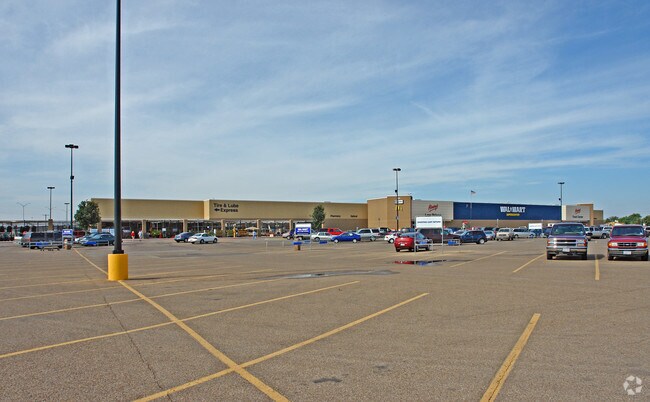

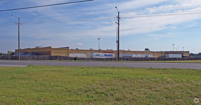
Property Detail
702 W Loop 289
R140046
WALMART TR A
Wholesaleoutletdiscountstore
Lubbock
AE The base floodplain where base flood elevations are provided. AE Zones are now used on new format FIRMs instead of A1-A30 Zones.
Texas
2024
34.16 AC
2025
North Outer Lubbock
000408
Lubbock
205,567 SF
Lubbock, TX
NEARBY LISTINGS FOR SALE OR LEASE
DEMOGRAPHICS near 702 W Loop 289
1 mile
3 mile
5 mile
2025 Total Population
13,562
70,596
160,692
2030 Population
14,056
73,810
167,193
Pop Growth 2025-2030
+ 3.64%
+ 4.55%
+ 4.05%
Average Age
34
35
35
2025 Total Households
5,497
29,579
64,673
HH Growth 2025-2030
+ 3.89%
+ 4.96%
+ 4.58%
Median Household Inc
$56,636
$54,058
$51,879
Avg Household Size
2.40
2.30
2.30
2025 Avg HH Vehicles
2.00
2.00
2.00
Median Home Value
$170,637
$187,696
$201,443
Median Year Built
1985
1987
1981
Nearby Places
Map Layers
Map Styles
 Street
 Aerial
Transit
 Traffic
 Biking
Places
Listings with unknown addresses are not visible on the map
- Restaurants
- Banks
- Shops
- Fitness
- Groceries
PUBLIC TRANSPORTATION
AIRPORT
Lubbock Preston Smith International
Drive
Walk
Distance
Lubbock Preston Smith International
27 min
15.3 mi
Freight Ports
Tulsa Port Of Catoosa
Drive
Walk
Distance
Tulsa Port Of Catoosa
512 min
474.1 mi
Nearby Properties
Address
Land Use
TOTAL SIZE
Lot Size
Zoning
Address
Land Use
TOTAL SIZE
Lot Size
Zoning
103,717 SF
25.26 AC
Address
Land Use
TOTAL SIZE
Lot Size
Zoning
380,785 SF
36.72 AC
Address
Land Use
TOTAL SIZE
Lot Size
Zoning
379,029 SF
29.43 AC
Address
Land Use
TOTAL SIZE
Lot Size
Zoning
409,380 SF
30.13 AC
Address
Land Use
TOTAL SIZE
Lot Size
Zoning
360,108 SF
18.63 AC
Address
Land Use
TOTAL SIZE
Lot Size
Zoning
244,983 SF
14.26 AC
Address
Land Use
TOTAL SIZE
Lot Size
Zoning
274,547 SF
18.92 AC
Address
Land Use
TOTAL SIZE
Lot Size
Zoning
473,857 SF
17.64 AC
Address
Land Use
TOTAL SIZE
Lot Size
Zoning
355,384 SF
19.63 AC
Address
Land Use
TOTAL SIZE
Lot Size
Zoning
244,834 SF
14.54 AC
Address
Land Use
TOTAL SIZE
Lot Size
Zoning
236,871 SF
6.77 AC
Address
Land Use
TOTAL SIZE
Lot Size
Zoning
122,976 SF
14.50 AC
Address
Land Use
TOTAL SIZE
Lot Size
Zoning
88,803 SF
7.23 AC
Address
Land Use
TOTAL SIZE
Lot Size
Zoning
106,894 SF
5.83 AC
Address
Land Use
TOTAL SIZE
Lot Size
Zoning
303,724 SF
17.32 AC
Address
Land Use
TOTAL SIZE
Lot Size
Zoning
207.36 AC
Address
Land Use
TOTAL SIZE
Lot Size
Zoning
102,209 SF
14 AC
Address
Land Use
TOTAL SIZE
Lot Size
Zoning
64,800 SF
0.94 AC
Address
Land Use
TOTAL SIZE
Lot Size
Zoning
153,416 SF
3.14 AC
Address
Land Use
TOTAL SIZE
Lot Size
Zoning
247,870 SF
11.48 AC
Address
Land Use
TOTAL SIZE
Lot Size
Zoning
176,412 SF
12.27 AC
Address
Land Use
TOTAL SIZE
Lot Size
Zoning
67,759 SF
6.37 AC
Address
Land Use
TOTAL SIZE
Lot Size
Zoning
207,374 SF
15.51 AC
Address
Land Use
TOTAL SIZE
Lot Size
Zoning
108,363 SF
11.35 AC
Address
Land Use
TOTAL SIZE
Lot Size
Zoning
143,905 SF
0.28 AC
Address
Land Use
TOTAL SIZE
Lot Size
Zoning
231,940 SF
7.67 AC
Address
Land Use
TOTAL SIZE
Lot Size
Zoning
169,556 SF
12 AC
Address
Land Use
TOTAL SIZE
Lot Size
Zoning
246,478 SF
13 AC
Address
Land Use
TOTAL SIZE
Lot Size
Zoning
156,495 SF
15.85 AC
Address
Land Use
TOTAL SIZE
Lot Size
Zoning
41,592 SF
13.72 AC
The World's #1 Commercial Real Estate Marketplace
Connect with us
© 2026 CoStar Group
The information above has been obtained from sources believed reliable. While we do not doubt its accuracy we have not verified it and make no guarantee, warranty or representation about it. It is your responsibility to independently confirm its accuracy and completeness. Any projections, opinions, assumptions, or estimates used are for example only and do not represent the current or future performance of the property. The value of this transaction to you depends on tax and other factors which should be evaluated by your tax, financial, and legal advisors. You and your advisors should conduct a careful, independent investigation of the property to determine to your satisfaction the suitability of the property for your needs.