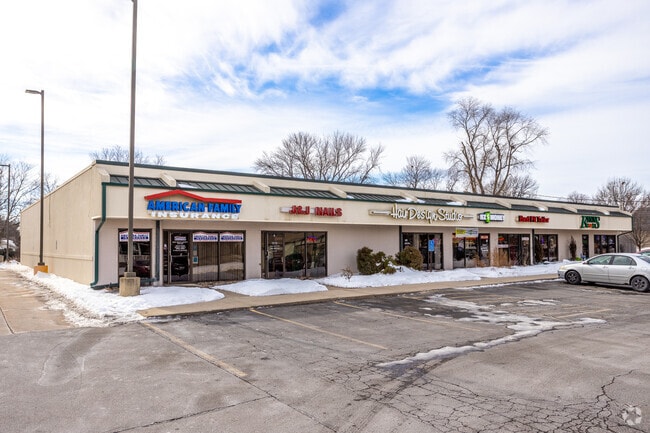
Property Record
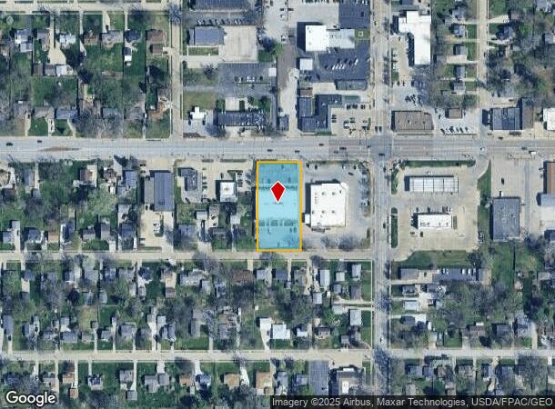
7020 Douglas Ave, Urbandale, IA 50322
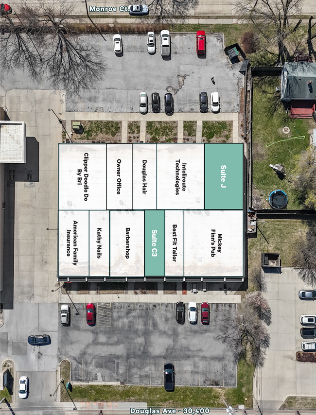
Current Lease Availabilities
NEARBY LISTINGS FOR SALE OR LEASE
Property Detail
7020 Douglas Ave
Des Moines-West Des Moines, IA
Maryland Acres
312-01883006000
-EX N 7F- LT 8 & -EX N 7F- W 14.78F LTS 9 & 12 & ALL LT 13 MARYLAND ACRES
Regionalshoppingcenterormallwithanchorstore
Polk
X
Iowa
19153C0189F
12
2024
0.91 AC
2025
Western Suburbs
010408
Des Moines
12,864 SF
DEMOGRAPHICS near 7020 Douglas Ave
1 Mile
3 Mile
5 Mile
2024 Total Population
12,452
82,852
190,353
2029 Population
12,814
85,317
197,210
Pop Growth 2024-2029
+ 2.91%
+ 2.98%
+ 3.60%
Average Age
40
40
39
2024 Total Households
5,225
35,561
79,849
HH Growth 2024-2029
+ 3.14%
+ 3.20%
+ 3.81%
Median Household Inc
$67,383
$73,383
$71,403
Avg Household Size
2.30
2.30
2.30
2024 Avg HH Vehicles
2.00
2.00
2.00
Median Home Value
$192,254
$220,376
$228,321
Median Year Built
1969
1969
1973
Nearby Places
- Restaurants
- Banks
- Shops
- Fitness
- Groceries
PUBLIC TRANSPORTATION
AIRPORT
Des Moines International
DRIVE
WALK
Distance
Des Moines International
19 min
9.1 mi
Freight Ports
Port Milwaukee
DRIVE
WALK
Distance
Port Milwaukee
419 min
376.4 mi
Nearby Properties
Address
Land Use
TOTAL SIZE
Lot Size
Zoning
Address
Land Use
TOTAL SIZE
Lot Size
Zoning
255,521 SF
60.90 AC
RE
Address
Land Use
TOTAL SIZE
Lot Size
Zoning
407,183 SF
17.02 AC
PUD
Address
Land Use
TOTAL SIZE
Lot Size
Zoning
415,320 SF
51.16 AC
PUD
Address
Land Use
TOTAL SIZE
Lot Size
Zoning
572,809 SF
42.13 AC
M-2
Address
Land Use
TOTAL SIZE
Lot Size
Zoning
133,256 SF
15.93 AC
Address
Land Use
TOTAL SIZE
Lot Size
Zoning
195,931 SF
13.66 AC
Address
Land Use
TOTAL SIZE
Lot Size
Zoning
307,734 SF
23.59 AC
R-3
Address
Land Use
TOTAL SIZE
Lot Size
Zoning
71,938 SF
8.23 AC
C-O
Address
Land Use
TOTAL SIZE
Lot Size
Zoning
235,620 SF
13.18 AC
RH
Address
Land Use
TOTAL SIZE
Lot Size
Zoning
101,592 SF
7.79 AC
PUD
Address
Land Use
TOTAL SIZE
Lot Size
Zoning
1,164,314 SF
57.72 AC
RC
Address
Land Use
TOTAL SIZE
Lot Size
Zoning
386,236 SF
9.62 AC
C-4
Address
Land Use
TOTAL SIZE
Lot Size
Zoning
117,272 SF
3.46 AC
R1-60
Address
Land Use
TOTAL SIZE
Lot Size
Zoning
141,377 SF
3.16 AC
Address
Land Use
TOTAL SIZE
Lot Size
Zoning
175,810 SF
19.36 AC
RC
Address
Land Use
TOTAL SIZE
Lot Size
Zoning
247,414 SF
15.83 AC
RH
Address
Land Use
TOTAL SIZE
Lot Size
Zoning
166,908 SF
8.03 AC
R-3
Address
Land Use
TOTAL SIZE
Lot Size
Zoning
168,556 SF
10.92 AC
RH
Address
Land Use
TOTAL SIZE
Lot Size
Zoning
188,453 SF
14.20 AC
R-3
Address
Land Use
TOTAL SIZE
Lot Size
Zoning
125,396 SF
12.89 AC
PUD
Address
Land Use
TOTAL SIZE
Lot Size
Zoning
146,025 SF
9.59 AC
PUD
Address
Land Use
TOTAL SIZE
Lot Size
Zoning
258,178 SF
5.95 AC
Address
Land Use
TOTAL SIZE
Lot Size
Zoning
91,985 SF
13.11 AC
PUD
Address
Land Use
TOTAL SIZE
Lot Size
Zoning
88,590 SF
11.22 AC
C-2
Address
Land Use
TOTAL SIZE
Lot Size
Zoning
264,656 SF
9.38 AC
RH
Address
Land Use
TOTAL SIZE
Lot Size
Zoning
223,876 SF
15.01 AC
Address
Land Use
TOTAL SIZE
Lot Size
Zoning
120,696 SF
5.40 AC
PUD
Address
Land Use
TOTAL SIZE
Lot Size
Zoning
143,831 SF
16.12 AC
PUD
Address
Land Use
TOTAL SIZE
Lot Size
Zoning
95,039 SF
4.52 AC
PUD
Address
Land Use
TOTAL SIZE
Lot Size
Zoning
120,808 SF
4.41 AC
PUD
The World's #1 Commercial Real Estate Marketplace
Connect with us
© 2025 CoStar Group
The information above has been obtained from sources believed reliable. While we do not doubt its accuracy we have not verified it and make no guarantee, warranty or representation about it. It is your responsibility to independently confirm its accuracy and completeness. Any projections, opinions, assumptions, or estimates used are for example only and do not represent the current or future performance of the property. The value of this transaction to you depends on tax and other factors which should be evaluated by your tax, financial, and legal advisors. You and your advisors should conduct a careful, independent investigation of the property to determine to your satisfaction the suitability of the property for your needs.