Property Record
7020 State Route 161, Plain City, OH 43064


NEARBY LISTINGS FOR SALE OR LEASE
Property Detail
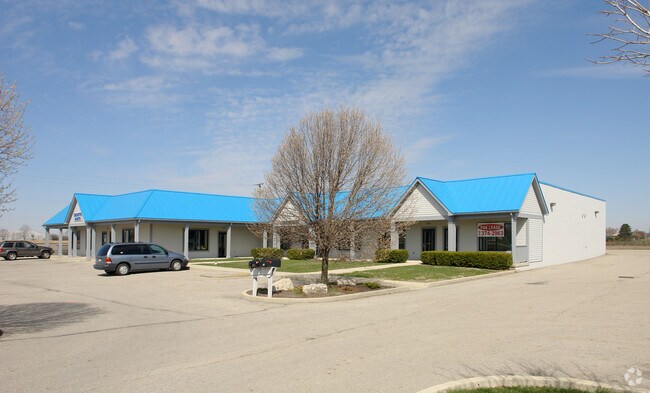
7020 State Route 161
15-0031018-1000
Virginia Military Survey #6748
Stripcommercialcenter
VMS 6748 OR 378 PG 869
X
Union
39097C0100D
Ohio
2024
1.64 AC
2024
Union County
050601
Columbus
12,920 SF
Columbus, OH
DEMOGRAPHICS near 7020 State Route 161
1 Mile
3 Mile
5 Mile
2024 Total Population
2,344
32,248
106,556
2029 Population
2,696
33,455
110,598
Pop Growth 2024-2029
+ 15.02%
+ 3.74%
+ 3.79%
Average Age
37
39
39
2024 Total Households
708
11,261
40,948
HH Growth 2024-2029
+ 14.97%
+ 3.29%
+ 3.16%
Median Household Inc
$185,555
$134,853
$113,497
Avg Household Size
3.20
2.80
2.60
2024 Avg HH Vehicles
2.00
2.00
2.00
Median Home Value
$450,458
$415,318
$394,448
Median Year Built
2007
1997
1997
Nearby Places
Map Layers
Map Styles
 Street
 Aerial
- Restaurants
- Banks
- Shops
- Fitness
- Groceries
PUBLIC TRANSPORTATION
AIRPORT
John Glenn Columbus International
DRIVE
WALK
Distance
John Glenn Columbus International
34 min
24.8 mi
Rickenbacker International
DRIVE
WALK
Distance
Rickenbacker International
41 min
30.2 mi
SALE & LEASE HISTORY
LISTING DATE
SALE/LEASE

Apr 10, 2024
For Lease
Nearby Properties
Address
Land Use
TOTAL SIZE
Lot Size
Zoning
Address
Land Use
TOTAL SIZE
Lot Size
Zoning
464,088 SF
45.57 AC
Address
Land Use
TOTAL SIZE
Lot Size
Zoning
768,498 SF
66.96 AC
Address
Land Use
TOTAL SIZE
Lot Size
Zoning
256,984 SF
10.49 AC
Address
Land Use
TOTAL SIZE
Lot Size
Zoning
297,024 SF
71.76 AC
Address
Land Use
TOTAL SIZE
Lot Size
Zoning
486,569 SF
96.85 AC
Address
Land Use
TOTAL SIZE
Lot Size
Zoning
Address
Land Use
TOTAL SIZE
Lot Size
Zoning
95,447 SF
58.80 AC
Address
Land Use
TOTAL SIZE
Lot Size
Zoning
129,283 SF
56.69 AC
Address
Land Use
TOTAL SIZE
Lot Size
Zoning
42,494 SF
15.07 AC
Address
Land Use
TOTAL SIZE
Lot Size
Zoning
143,277 SF
15.54 AC
Address
Land Use
TOTAL SIZE
Lot Size
Zoning
131,940 SF
34.46 AC
Address
Land Use
TOTAL SIZE
Lot Size
Zoning
103,881 SF
11.78 AC
Address
Land Use
TOTAL SIZE
Lot Size
Zoning
133,091 SF
15.01 AC
Address
Land Use
TOTAL SIZE
Lot Size
Zoning
59,144 SF
87.61 AC
Address
Land Use
TOTAL SIZE
Lot Size
Zoning
105,694 SF
14.51 AC
Address
Land Use
TOTAL SIZE
Lot Size
Zoning
134,901 SF
15.51 AC
Address
Land Use
TOTAL SIZE
Lot Size
Zoning
247,506 SF
14.97 AC
Address
Land Use
TOTAL SIZE
Lot Size
Zoning
57,876 SF
15.56 AC
Address
Land Use
TOTAL SIZE
Lot Size
Zoning
58,481 SF
26.99 AC
Address
Land Use
TOTAL SIZE
Lot Size
Zoning
25,737 SF
16.58 AC
Address
Land Use
TOTAL SIZE
Lot Size
Zoning
64,147 SF
28.90 AC
Address
Land Use
TOTAL SIZE
Lot Size
Zoning
168,576 SF
12.21 AC
Address
Land Use
TOTAL SIZE
Lot Size
Zoning
55,622 SF
8.98 AC
Address
Land Use
TOTAL SIZE
Lot Size
Zoning
130,839 SF
13.35 AC
Address
Land Use
TOTAL SIZE
Lot Size
Zoning
165,916 SF
11.15 AC
Address
Land Use
TOTAL SIZE
Lot Size
Zoning
50,238 SF
5 AC
Address
Land Use
TOTAL SIZE
Lot Size
Zoning
148,906 SF
13.46 AC
Address
Land Use
TOTAL SIZE
Lot Size
Zoning
44,648 SF
38.47 AC
Address
Land Use
TOTAL SIZE
Lot Size
Zoning
103,368 SF
13.48 AC
Address
Land Use
TOTAL SIZE
Lot Size
Zoning
190,783 SF
15.59 AC
The World's #1 Commercial Real Estate Marketplace
Connect with us
© 2026 CoStar Group
The information above has been obtained from sources believed reliable. While we do not doubt its accuracy we have not verified it and make no guarantee, warranty or representation about it. It is your responsibility to independently confirm its accuracy and completeness. Any projections, opinions, assumptions, or estimates used are for example only and do not represent the current or future performance of the property. The value of this transaction to you depends on tax and other factors which should be evaluated by your tax, financial, and legal advisors. You and your advisors should conduct a careful, independent investigation of the property to determine to your satisfaction the suitability of the property for your needs.