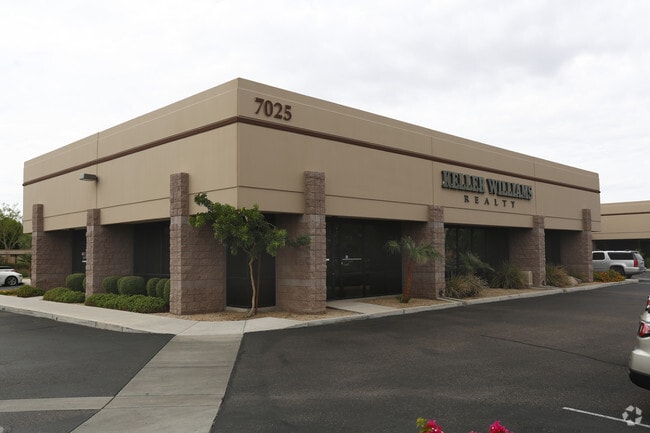
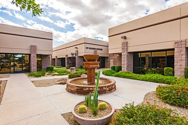
Property Record
7025 W Bell Rd, Glendale, AZ 85308


Property Detail
7025 W Bell Rd
200-52-022J
PT W2 NE4 SEC 1 DAF COM N4 COR SD SEC TH E 1078.40F TH S 01D 16M E 72.51F TO POB TH S 01D 16M E 246.77F TH S 88D 43M W 296.77F TH S 49D 37M W 56.45F TH W 349.73F TO BEG OF NON-TAN CUR CONC NWLY CTR BRS N 63D 36M W 530F TH SLY ALG ARC 95F TH S 36D 39M
Officebuilding
Maricopa
C-O
Arizona
C and X Area of minimal flood hazard, usually depicted on FIRMs as above the 500-year flood level.
4.15 AC
2025
Arrowhead
2025
Phoenix
071511
Phoenix-Mesa-Chandler, AZ
45,087 SF
NEARBY LISTINGS FOR SALE OR LEASE
DEMOGRAPHICS near 7025 W Bell Rd
1 mile
3 mile
5 mile
2025 Total Population
11,210
115,867
318,688
2030 Population
11,639
119,921
329,073
Pop Growth 2025-2030
+ 3.83%
+ 3.50%
+ 3.26%
Average Age
41
42
43
2025 Total Households
4,324
44,454
123,628
HH Growth 2025-2030
+ 3.84%
+ 3.60%
+ 3.39%
Median Household Inc
$94,549
$94,659
$83,967
Avg Household Size
2.50
2.50
2.50
2025 Avg HH Vehicles
2.00
2.00
2.00
Median Home Value
$469,047
$459,014
$415,392
Median Year Built
1990
1991
1987
Nearby Places
Map Layers
Map Styles
 Street
 Aerial
Layers
 Traffic
 Biking
Places
Listings with unknown addresses are not visible on the map
- Restaurants
- Banks
- Shops
- Fitness
- Groceries
PUBLIC TRANSPORTATION
AIRPORT
Phoenix Sky Harbor International
Drive
Walk
Distance
Phoenix Sky Harbor International
39 min
26.0 mi
Freight Ports
Port of San Diego
Drive
Walk
Distance
Port of San Diego
400 min
358.3 mi
SALE & LEASE HISTORY
LISTING DATE
SALE/LEASE

May 20, 2019
For Lease
Nearby Properties
Address
Land Use
TOTAL SIZE
Lot Size
Zoning
Address
Land Use
TOTAL SIZE
Lot Size
Zoning
81,100 SF
9.48 AC
PAD
Address
Land Use
TOTAL SIZE
Lot Size
Zoning
45,900 SF
11.09 AC
PAD
Address
Land Use
TOTAL SIZE
Lot Size
Zoning
1,019,640 SF
32.10 AC
GO
Address
Land Use
TOTAL SIZE
Lot Size
Zoning
1,360,424 SF
88.31 AC
C-BP
Address
Land Use
TOTAL SIZE
Lot Size
Zoning
7,916 SF
5.26 AC
C-C
Address
Land Use
TOTAL SIZE
Lot Size
Zoning
812,333 SF
31.75 AC
SR-30
Address
Land Use
TOTAL SIZE
Lot Size
Zoning
284,223 SF
10.02 AC
C-C
Address
Land Use
TOTAL SIZE
Lot Size
Zoning
708,928 SF
44.86 AC
Address
Land Use
TOTAL SIZE
Lot Size
Zoning
360,026 SF
74.94 AC
R-6
Address
Land Use
TOTAL SIZE
Lot Size
Zoning
238,942 SF
36.87 AC
R1-8
Address
Land Use
TOTAL SIZE
Lot Size
Zoning
0.47 AC
Address
Land Use
TOTAL SIZE
Lot Size
Zoning
19.95 AC
AG
Address
Land Use
TOTAL SIZE
Lot Size
Zoning
399,561 SF
16.30 AC
Address
Land Use
TOTAL SIZE
Lot Size
Zoning
401,879 SF
67.89 AC
Address
Land Use
TOTAL SIZE
Lot Size
Zoning
226,169 SF
20.48 AC
Address
Land Use
TOTAL SIZE
Lot Size
Zoning
348,803 SF
15.91 AC
PAD
Address
Land Use
TOTAL SIZE
Lot Size
Zoning
133,377 SF
17.52 AC
PAD
Address
Land Use
TOTAL SIZE
Lot Size
Zoning
240,863 SF
35.55 AC
Address
Land Use
TOTAL SIZE
Lot Size
Zoning
241,669 SF
12.78 AC
PAD
Address
Land Use
TOTAL SIZE
Lot Size
Zoning
280,356 SF
12.73 AC
PAD
Address
Land Use
TOTAL SIZE
Lot Size
Zoning
219,122 SF
33 AC
R-6
Address
Land Use
TOTAL SIZE
Lot Size
Zoning
440,494 SF
26.25 AC
PAD
Address
Land Use
TOTAL SIZE
Lot Size
Zoning
392,885 SF
17.67 AC
M-H
Address
Land Use
TOTAL SIZE
Lot Size
Zoning
126,781 SF
10.06 AC
C-C
Address
Land Use
TOTAL SIZE
Lot Size
Zoning
344,908 SF
20.69 AC
C-C
Address
Land Use
TOTAL SIZE
Lot Size
Zoning
375,604 SF
6.31 AC
M-M
Address
Land Use
TOTAL SIZE
Lot Size
Zoning
378,106 SF
19.18 AC
R-3
Address
Land Use
TOTAL SIZE
Lot Size
Zoning
126,814 SF
31.56 AC
R17
Address
Land Use
TOTAL SIZE
Lot Size
Zoning
244,979 SF
35.16 AC
C-BP
Address
Land Use
TOTAL SIZE
Lot Size
Zoning
200,658 SF
23.14 AC
C-BP
The World's #1 Commercial Real Estate Marketplace
Connect with us
© 2026 CoStar Group
The information above has been obtained from sources believed reliable. While we do not doubt its accuracy we have not verified it and make no guarantee, warranty or representation about it. It is your responsibility to independently confirm its accuracy and completeness. Any projections, opinions, assumptions, or estimates used are for example only and do not represent the current or future performance of the property. The value of this transaction to you depends on tax and other factors which should be evaluated by your tax, financial, and legal advisors. You and your advisors should conduct a careful, independent investigation of the property to determine to your satisfaction the suitability of the property for your needs.