Property Record
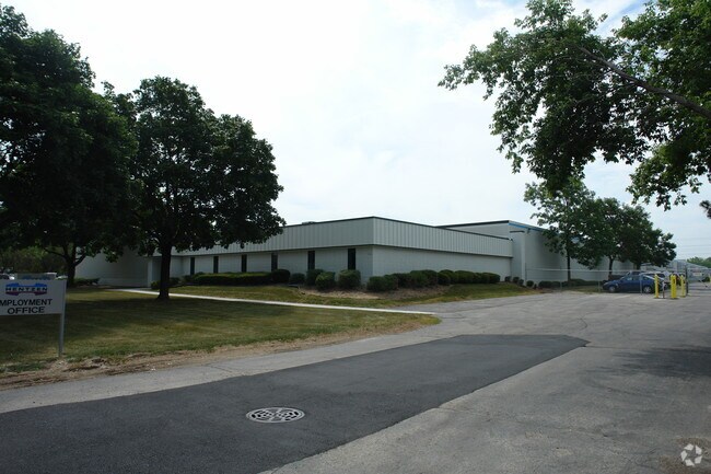
7029 W Mill Rd, Milwaukee, WI 53218


Property Detail
7029 W Mill Rd
154-9993-100-7
LANDS IN NW 1/4 SEC 27-8-21 COM 1657.27 E & 55 S OF NW COR SD 1/4 SEC-TH E 251.98-TH S 807.80-TH W 252.96-TH N 807.80 TO BEG BID #31
Industrialgeneral
MILWAUKEE
IL1
Wisconsin
B and X Area of moderate flood hazard, usually the area between the limits of the 100-year and 500-year floods.
4.68 AC
2024
Milwaukee NW
2024
Milwaukee/Madison
001800
Milwaukee-Waukesha, WI
69,980 SF
NEARBY LISTINGS FOR SALE OR LEASE
DEMOGRAPHICS near 7029 W Mill Rd
1 mile
3 mile
5 mile
2025 Total Population
15,301
121,052
279,896
2030 Population
15,320
121,562
280,873
Pop Growth 2025-2030
+ 0.12%
+ 0.42%
+ 0.35%
Average Age
34
36
38
2025 Total Households
5,269
45,822
111,570
HH Growth 2025-2030
+ 0.02%
+ 0.38%
+ 0.25%
Median Household Inc
$48,858
$52,052
$57,129
Avg Household Size
2.80
2.50
2.40
2025 Avg HH Vehicles
1.00
1.00
1.00
Median Home Value
$149,283
$157,642
$192,193
Median Year Built
1958
1959
1956
Nearby Places
Map Layers
Map Styles
 Street
 Aerial
Layers
 Traffic
 Biking
Places
Listings with unknown addresses are not visible on the map
- Restaurants
- Banks
- Shops
- Fitness
- Groceries
PUBLIC TRANSPORTATION
AIRPORT
General Mitchell International
Drive
Walk
Distance
General Mitchell International
34 min
18.1 mi
Freight Ports
Port Milwaukee
Drive
Walk
Distance
Port Milwaukee
26 min
14.0 mi
Nearby Properties
Address
Land Use
TOTAL SIZE
Lot Size
Zoning
Address
Land Use
TOTAL SIZE
Lot Size
Zoning
33.49 AC
TL
Address
Land Use
TOTAL SIZE
Lot Size
Zoning
145,218 SF
10.23 AC
Address
Land Use
TOTAL SIZE
Lot Size
Zoning
197,426 SF
26.34 AC
PD
Address
Land Use
TOTAL SIZE
Lot Size
Zoning
206,529 SF
7.88 AC
PD
Address
Land Use
TOTAL SIZE
Lot Size
Zoning
298,666 SF
5.09 AC
PD
Address
Land Use
TOTAL SIZE
Lot Size
Zoning
12.49 AC
TL
Address
Land Use
TOTAL SIZE
Lot Size
Zoning
104,365 SF
9.85 AC
PD
Address
Land Use
TOTAL SIZE
Lot Size
Zoning
66.42 AC
IL1
Address
Land Use
TOTAL SIZE
Lot Size
Zoning
17.84 AC
TL
Address
Land Use
TOTAL SIZE
Lot Size
Zoning
169,550 SF
12.04 AC
RB2
Address
Land Use
TOTAL SIZE
Lot Size
Zoning
18.54 AC
RS6
Address
Land Use
TOTAL SIZE
Lot Size
Zoning
17.91 AC
RS5
Address
Land Use
TOTAL SIZE
Lot Size
Zoning
297,894 SF
19.67 AC
IL1
Address
Land Use
TOTAL SIZE
Lot Size
Zoning
333,971 SF
16.93 AC
IL1
Address
Land Use
TOTAL SIZE
Lot Size
Zoning
166,245 SF
55 AC
PD
Address
Land Use
TOTAL SIZE
Lot Size
Zoning
28.12 AC
RM1
Address
Land Use
TOTAL SIZE
Lot Size
Zoning
116,862 SF
14.39 AC
RM1
Address
Land Use
TOTAL SIZE
Lot Size
Zoning
23.38 AC
RS6
Address
Land Use
TOTAL SIZE
Lot Size
Zoning
13.08 AC
Address
Land Use
TOTAL SIZE
Lot Size
Zoning
163,539 SF
7.17 AC
PUD
Address
Land Use
TOTAL SIZE
Lot Size
Zoning
49.03 AC
PK
Address
Land Use
TOTAL SIZE
Lot Size
Zoning
122,360 SF
PD
Address
Land Use
TOTAL SIZE
Lot Size
Zoning
88,259 SF
14.70 AC
PD
Address
Land Use
TOTAL SIZE
Lot Size
Zoning
9.94 AC
IL1
Address
Land Use
TOTAL SIZE
Lot Size
Zoning
92,303 SF
19.02 AC
PD
Address
Land Use
TOTAL SIZE
Lot Size
Zoning
73,748 SF
5.76 AC
PD
Address
Land Use
TOTAL SIZE
Lot Size
Zoning
90,360 SF
6.52 AC
LB1
Address
Land Use
TOTAL SIZE
Lot Size
Zoning
344,223 SF
26.39 AC
IL1
Address
Land Use
TOTAL SIZE
Lot Size
Zoning
157,000 SF
17.15 AC
PD
Address
Land Use
TOTAL SIZE
Lot Size
Zoning
75,221 SF
7.46 AC
RM1
The World's #1 Commercial Real Estate Marketplace
Connect with us
© 2026 CoStar Group
The information above has been obtained from sources believed reliable. While we do not doubt its accuracy we have not verified it and make no guarantee, warranty or representation about it. It is your responsibility to independently confirm its accuracy and completeness. Any projections, opinions, assumptions, or estimates used are for example only and do not represent the current or future performance of the property. The value of this transaction to you depends on tax and other factors which should be evaluated by your tax, financial, and legal advisors. You and your advisors should conduct a careful, independent investigation of the property to determine to your satisfaction the suitability of the property for your needs.