Property Record
703 E Folsom Blvd, Pocola, OK 74902

Property Detail
703 E Folsom Blvd
P120-05-09N-27E-0-014-00
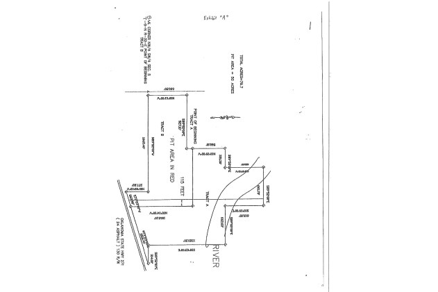
POCOLA TOWNSHIP ADD SEC 5 TWP 9N RNG 27E S1/2 SW SE NW & NE SW & E1/2 NE NW SW & S1/2 NW SW LESS W66 & E908.63 SE SW N HWY271
Warehouse
LE FLORE
C1
Oklahoma
2025
27e
2025
79.70 AC
040102
Le Flore County
6,030 SF
Fort Smith
NEARBY LISTINGS FOR SALE OR LEASE
-
-
View all Pocola listings for sale on LoopNet.com
DEMOGRAPHICS near 703 E Folsom Blvd
1 mile
3 mile
5 mile
2025 Total Population
477
4,096
23,221
2030 Population
496
4,199
23,477
Pop Growth 2025-2030
+ 3.98%
+ 2.51%
+ 1.10%
Average Age
41
41
41
2025 Total Households
192
1,634
9,432
HH Growth 2025-2030
+ 3.65%
+ 2.57%
+ 1.11%
Median Household Inc
$46,500
$57,958
$64,657
Avg Household Size
2.50
2.50
2.40
2025 Avg HH Vehicles
2.00
2.00
2.00
Median Home Value
$116,667
$166,032
$195,405
Median Year Built
1985
1985
1983
Nearby Places
Map Layers
Map Styles
 Street
 Aerial
Layers
 Traffic
 Biking
Places
Listings with unknown addresses are not visible on the map
- Restaurants
- Banks
- Shops
- Fitness
- Groceries
PUBLIC TRANSPORTATION
AIRPORT
Fort Smith Regional
Drive
Walk
Distance
Fort Smith Regional
17 min
9.8 mi
Freight Ports
Tulsa Port of Inola
Drive
Walk
Distance
Tulsa Port of Inola
138 min
113.3 mi
Nearby Properties
Address
Land Use
TOTAL SIZE
Lot Size
Zoning
Address
Land Use
TOTAL SIZE
Lot Size
Zoning
1,350 SF
5.07 AC
C1
Address
Land Use
TOTAL SIZE
Lot Size
Zoning
317,972 SF
36.19 AC
Address
Land Use
TOTAL SIZE
Lot Size
Zoning
48,070 SF
2.94 AC
Address
Land Use
TOTAL SIZE
Lot Size
Zoning
Address
Land Use
TOTAL SIZE
Lot Size
Zoning
3,600 SF
0.84 AC
Address
Land Use
TOTAL SIZE
Lot Size
Zoning
39,781 SF
8.88 AC
Address
Land Use
TOTAL SIZE
Lot Size
Zoning
1,700 SF
10.54 AC
C1
Address
Land Use
TOTAL SIZE
Lot Size
Zoning
9,360 SF
1.93 AC
Address
Land Use
TOTAL SIZE
Lot Size
Zoning
4,968 SF
1.25 AC
R1
Address
Land Use
TOTAL SIZE
Lot Size
Zoning
1,700 SF
1.25 AC
R1
Address
Land Use
TOTAL SIZE
Lot Size
Zoning
6,310 SF
2.65 AC
Address
Land Use
TOTAL SIZE
Lot Size
Zoning
4,960 SF
5.80 AC
C1
Address
Land Use
TOTAL SIZE
Lot Size
Zoning
15,000 SF
11.02 AC
Address
Land Use
TOTAL SIZE
Lot Size
Zoning
8,964 SF
31.12 AC
C2
Address
Land Use
TOTAL SIZE
Lot Size
Zoning
19,500 SF
1.98 AC
Address
Land Use
TOTAL SIZE
Lot Size
Zoning
37,500 SF
3 AC
Address
Land Use
TOTAL SIZE
Lot Size
Zoning
25,000 SF
3 AC
C1
Address
Land Use
TOTAL SIZE
Lot Size
Zoning
12,720 SF
2.87 AC
Address
Land Use
TOTAL SIZE
Lot Size
Zoning
22,660 SF
0.88 AC
C1
Address
Land Use
TOTAL SIZE
Lot Size
Zoning
3,000 SF
1.15 AC
Address
Land Use
TOTAL SIZE
Lot Size
Zoning
4,500 SF
7.50 AC
Address
Land Use
TOTAL SIZE
Lot Size
Zoning
6,190 SF
7.62 AC
Address
Land Use
TOTAL SIZE
Lot Size
Zoning
3,516 SF
1.05 AC
Address
Land Use
TOTAL SIZE
Lot Size
Zoning
2,016 SF
23.95 AC
C1
Address
Land Use
TOTAL SIZE
Lot Size
Zoning
3,937 SF
0.52 AC
Address
Land Use
TOTAL SIZE
Lot Size
Zoning
3,860 SF
0.49 AC
Address
Land Use
TOTAL SIZE
Lot Size
Zoning
3,860 SF
0.44 AC
The World's #1 Commercial Real Estate Marketplace
Connect with us
© 2026 CoStar Group
The information above has been obtained from sources believed reliable. While we do not doubt its accuracy we have not verified it and make no guarantee, warranty or representation about it. It is your responsibility to independently confirm its accuracy and completeness. Any projections, opinions, assumptions, or estimates used are for example only and do not represent the current or future performance of the property. The value of this transaction to you depends on tax and other factors which should be evaluated by your tax, financial, and legal advisors. You and your advisors should conduct a careful, independent investigation of the property to determine to your satisfaction the suitability of the property for your needs.