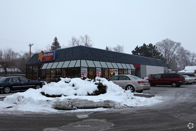
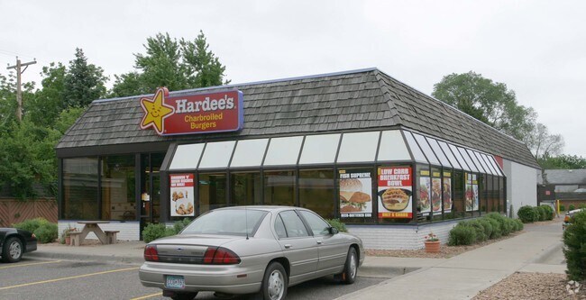
Property Record
703 E Main St, Anoka, MN 55303

Property Detail
703 E Main St
06-31-24-43-0072
S1/2 OF LOT 24 ANOKA SUBURBAN OUTLOTS, LOT 4 AUD SUB NO 17 & S 19.85 FT OF W 60 FT OF LOT 3 SD AUD SUB TOG/W S 14.85 FT OF W
Commercialacreage
Anoka
MSMU
Minnesota
B and X Area of moderate flood hazard, usually the area between the limits of the 100-year and 500-year floods.
24
2026
0.87 AC
2026
Coon Rapids
050504
Minneapolis/St Paul
4,448 SF
Minneapolis-St. Paul-Bloomington, MN-WI
NEARBY LISTINGS FOR SALE OR LEASE
DEMOGRAPHICS near 703 E Main St
1 mile
3 mile
5 mile
2025 Total Population
11,978
69,709
149,940
2030 Population
12,300
71,107
152,930
Pop Growth 2025-2030
+ 2.69%
+ 2.01%
+ 1.99%
Average Age
41
41
40
2025 Total Households
5,159
27,096
55,836
HH Growth 2025-2030
+ 2.79%
+ 2.13%
+ 2.10%
Median Household Inc
$69,176
$93,244
$100,476
Avg Household Size
2.20
2.50
2.60
2025 Avg HH Vehicles
2.00
2.00
2.00
Median Home Value
$326,761
$340,165
$348,956
Median Year Built
1973
1984
1987
Nearby Places
Map Layers
Map Styles
 Street
 Aerial
Layers
 Traffic
 Biking
Places
Listings with unknown addresses are not visible on the map
- Restaurants
- Banks
- Shops
- Fitness
- Groceries
PUBLIC TRANSPORTATION
COMMUTER RAIL
Anoka Station (Northstar Corridor - Northstar Commuter Rail)
Drive
Walk
Distance
Anoka Station (Northstar Corridor - Northstar Commuter Rail)
4 min
20 min
1.0 mi
Coon Rapids-Riverdale Station (Northstar Corridor - Northstar Commuter Rail)
Drive
Walk
Distance
Coon Rapids-Riverdale Station (Northstar Corridor - Northstar Commuter Rail)
5 min
2.1 mi
AIRPORT
Minneapolis-St Paul International/Wold-Chamberlain
Drive
Walk
Distance
Minneapolis-St Paul International/Wold-Chamberlain
47 min
35.2 mi
Nearby Properties
Address
Land Use
TOTAL SIZE
Lot Size
Zoning
Address
Land Use
TOTAL SIZE
Lot Size
Zoning
517,619 SF
3.85 AC
Address
Land Use
TOTAL SIZE
Lot Size
Zoning
468,099 SF
5.73 AC
MSMU
Address
Land Use
TOTAL SIZE
Lot Size
Zoning
412,914 SF
40 AC
Address
Land Use
TOTAL SIZE
Lot Size
Zoning
3.80 AC
Address
Land Use
TOTAL SIZE
Lot Size
Zoning
2,400 SF
72.45 AC
Address
Land Use
TOTAL SIZE
Lot Size
Zoning
319,826 SF
37.97 AC
Address
Land Use
TOTAL SIZE
Lot Size
Zoning
Address
Land Use
TOTAL SIZE
Lot Size
Zoning
5,110 SF
38.62 AC
Address
Land Use
TOTAL SIZE
Lot Size
Zoning
Address
Land Use
TOTAL SIZE
Lot Size
Zoning
122,816 SF
27.84 AC
Address
Land Use
TOTAL SIZE
Lot Size
Zoning
4.99 AC
Address
Land Use
TOTAL SIZE
Lot Size
Zoning
363,449 SF
82.99 AC
R-1
Address
Land Use
TOTAL SIZE
Lot Size
Zoning
225,748 SF
Address
Land Use
TOTAL SIZE
Lot Size
Zoning
382,508 SF
Address
Land Use
TOTAL SIZE
Lot Size
Zoning
129,060 SF
10.21 AC
Address
Land Use
TOTAL SIZE
Lot Size
Zoning
167 SF
4.73 AC
Address
Land Use
TOTAL SIZE
Lot Size
Zoning
343,297 SF
25.42 AC
M-1
Address
Land Use
TOTAL SIZE
Lot Size
Zoning
168,887 SF
7.01 AC
Address
Land Use
TOTAL SIZE
Lot Size
Zoning
159,335 SF
13.64 AC
Address
Land Use
TOTAL SIZE
Lot Size
Zoning
298,148 SF
17.70 AC
M-1
Address
Land Use
TOTAL SIZE
Lot Size
Zoning
114,281 SF
3.19 AC
PRD-4
Address
Land Use
TOTAL SIZE
Lot Size
Zoning
319,664 SF
19.62 AC
M-1
Address
Land Use
TOTAL SIZE
Lot Size
Zoning
436,117 SF
17.75 AC
M-1
Address
Land Use
TOTAL SIZE
Lot Size
Zoning
300,547 SF
19.21 AC
Address
Land Use
TOTAL SIZE
Lot Size
Zoning
Address
Land Use
TOTAL SIZE
Lot Size
Zoning
118,208 SF
Address
Land Use
TOTAL SIZE
Lot Size
Zoning
811,860 SF
Address
Land Use
TOTAL SIZE
Lot Size
Zoning
Address
Land Use
TOTAL SIZE
Lot Size
Zoning
155,849 SF
0.83 AC
Address
Land Use
TOTAL SIZE
Lot Size
Zoning
100 SF
5.42 AC
R-2
The World's #1 Commercial Real Estate Marketplace
Connect with us
© 2026 CoStar Group
The information above has been obtained from sources believed reliable. While we do not doubt its accuracy we have not verified it and make no guarantee, warranty or representation about it. It is your responsibility to independently confirm its accuracy and completeness. Any projections, opinions, assumptions, or estimates used are for example only and do not represent the current or future performance of the property. The value of this transaction to you depends on tax and other factors which should be evaluated by your tax, financial, and legal advisors. You and your advisors should conduct a careful, independent investigation of the property to determine to your satisfaction the suitability of the property for your needs.