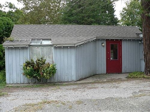
Property Record
703 Kent Rd, Gaylordsville, CT 06755

NEARBY LISTINGS FOR SALE OR LEASE
Property Detail
703 Kent Rd
Torrington, CT
Litchfield
NMIL-000075-000000-000021
Connecticut
Commercialnec
21
2025
4.77 AC
2025
New Milford/SW Litchfield
253500
Hartford
DEMOGRAPHICS near 703 Kent Rd
1 Mile
3 Mile
5 Mile
2024 Total Population
857
3,744
12,780
2029 Population
858
3,749
12,753
Pop Growth 2024-2029
+ 0.12%
+ 0.13%
(0.21%)
Average Age
45
44
44
2024 Total Households
339
1,435
4,906
HH Growth 2024-2029
0.00%
+ 0.14%
(0.22%)
Median Household Inc
$125,758
$112,908
$99,342
Avg Household Size
2.50
2.50
2.50
2024 Avg HH Vehicles
3.00
2.00
2.00
Median Home Value
$425,324
$435,209
$386,807
Median Year Built
1980
1977
1977
Nearby Places
Map Layers
Map Styles
 Street
 Aerial
- Restaurants
- Banks
- Shops
- Fitness
- Groceries
PUBLIC TRANSPORTATION
COMMUTER RAIL
Harlem Valley-Wingdale Station (Harlem Line - Metro-North Commuter Railroad Company (Metro-North))
DRIVE
WALK
Distance
Harlem Valley-Wingdale Station (Harlem Line - Metro-North Commuter Railroad Company (Metro-North))
10 min
6.7 mi
Appalachian Trail (Harlem - Metro-North Railroad)
DRIVE
WALK
Distance
Appalachian Trail (Harlem - Metro-North Railroad)
16 min
9.9 mi
Freight Ports
Port of New Haven
DRIVE
WALK
Distance
Port of New Haven
77 min
49.5 mi
Nearby Properties
Address
Land Use
TOTAL SIZE
Lot Size
Zoning
Address
Land Use
TOTAL SIZE
Lot Size
Zoning
Address
Land Use
TOTAL SIZE
Lot Size
Zoning
2,709 SF
172.34 AC
R80
Address
Land Use
TOTAL SIZE
Lot Size
Zoning
7,924 SF
8.55 AC
R80
Address
Land Use
TOTAL SIZE
Lot Size
Zoning
100.09 AC
Address
Land Use
TOTAL SIZE
Lot Size
Zoning
12,800 SF
35.01 AC
Address
Land Use
TOTAL SIZE
Lot Size
Zoning
143 AC
Address
Land Use
TOTAL SIZE
Lot Size
Zoning
10.02 AC
Address
Land Use
TOTAL SIZE
Lot Size
Zoning
1,404 SF
35.01 AC
Address
Land Use
TOTAL SIZE
Lot Size
Zoning
3,194 SF
11.03 AC
Address
Land Use
TOTAL SIZE
Lot Size
Zoning
168.50 AC
R80
Address
Land Use
TOTAL SIZE
Lot Size
Zoning
Address
Land Use
TOTAL SIZE
Lot Size
Zoning
3,411 SF
54 AC
Address
Land Use
TOTAL SIZE
Lot Size
Zoning
3,360 SF
581 AC
RC
Address
Land Use
TOTAL SIZE
Lot Size
Zoning
3,868 SF
49.90 AC
Address
Land Use
TOTAL SIZE
Lot Size
Zoning
4,228 SF
31.17 AC
Address
Land Use
TOTAL SIZE
Lot Size
Zoning
Address
Land Use
TOTAL SIZE
Lot Size
Zoning
8 AC
CO Y
Address
Land Use
TOTAL SIZE
Lot Size
Zoning
4,268 SF
4.30 AC
Address
Land Use
TOTAL SIZE
Lot Size
Zoning
1,522 SF
293.49 AC
Address
Land Use
TOTAL SIZE
Lot Size
Zoning
1,326 SF
12.10 AC
Address
Land Use
TOTAL SIZE
Lot Size
Zoning
3,188 SF
7.38 AC
Address
Land Use
TOTAL SIZE
Lot Size
Zoning
6,212 SF
100 AC
RU Y
Address
Land Use
TOTAL SIZE
Lot Size
Zoning
65.97 AC
Address
Land Use
TOTAL SIZE
Lot Size
Zoning
180.67 AC
R80/R4
Address
Land Use
TOTAL SIZE
Lot Size
Zoning
6.93 AC
R40
Address
Land Use
TOTAL SIZE
Lot Size
Zoning
6,963 SF
181 AC
RC Y
Address
Land Use
TOTAL SIZE
Lot Size
Zoning
1.89 AC
B2
Address
Land Use
TOTAL SIZE
Lot Size
Zoning
1.21 AC
R40
Address
Land Use
TOTAL SIZE
Lot Size
Zoning
22.12 AC
R80
Address
Land Use
TOTAL SIZE
Lot Size
Zoning
6.98 AC
The World's #1 Commercial Real Estate Marketplace
Connect with us
© 2025 CoStar Group
The information above has been obtained from sources believed reliable. While we do not doubt its accuracy we have not verified it and make no guarantee, warranty or representation about it. It is your responsibility to independently confirm its accuracy and completeness. Any projections, opinions, assumptions, or estimates used are for example only and do not represent the current or future performance of the property. The value of this transaction to you depends on tax and other factors which should be evaluated by your tax, financial, and legal advisors. You and your advisors should conduct a careful, independent investigation of the property to determine to your satisfaction the suitability of the property for your needs.