Property Record
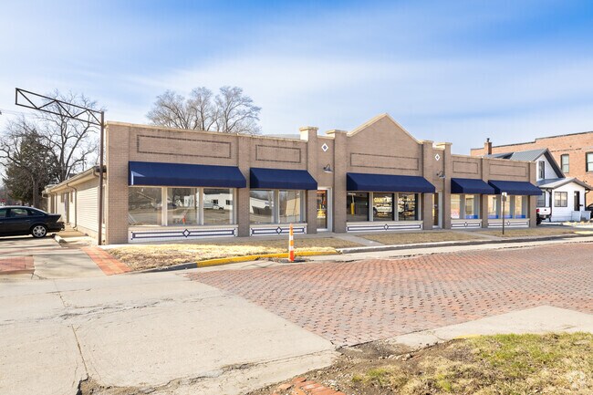
703 Main St, Adel, IA 50003


Property Detail
703 Main St
Des Moines-West Des Moines, IA
LOT 1 & E24 LOT 2 BLK 18 & N 1 ADJ TO LOT 1 & E24 LOT 2
11-29-455-004
DALLAS
Regionalshoppingcenterormallwithanchorstore
Iowa
B and X Area of moderate flood hazard, usually the area between the limits of the 100-year and 500-year floods.
1,2
2024
0.28 AC
2025
Outlying Dallas County
050700
Des Moines
11,000 SF
NEARBY LISTINGS FOR SALE OR LEASE
DEMOGRAPHICS near 703 Main St
1 mile
3 mile
5 mile
2025 Total Population
4,987
8,737
9,949
2030 Population
5,611
9,853
11,215
Pop Growth 2025-2030
+ 12.51%
+ 12.77%
+ 12.72%
Average Age
38
38
38
2025 Total Households
1,885
3,256
3,699
HH Growth 2025-2030
+ 12.84%
+ 13.11%
+ 13.06%
Median Household Inc
$87,271
$94,809
$96,514
Avg Household Size
2.60
2.70
2.70
2025 Avg HH Vehicles
2.00
2.00
2.00
Median Home Value
$340,985
$344,194
$344,318
Median Year Built
1990
1996
1995
Nearby Places
Map Layers
Map Styles
 Street
 Aerial
Layers
 Traffic
 Biking
Places
Listings with unknown addresses are not visible on the map
- Restaurants
- Banks
- Shops
- Fitness
- Groceries
PUBLIC TRANSPORTATION
AIRPORT
Des Moines International
Drive
Walk
Distance
Des Moines International
39 min
24.1 mi
SALE & LEASE HISTORY
LISTING DATE
SALE/LEASE

Mar 06, 2024
For Sale
Jun 23, 2024
For Lease
Jul 30, 2018
For Lease
Nearby Properties
Address
Land Use
TOTAL SIZE
Lot Size
Zoning
Address
Land Use
TOTAL SIZE
Lot Size
Zoning
0.92 AC
Address
Land Use
TOTAL SIZE
Lot Size
Zoning
Address
Land Use
TOTAL SIZE
Lot Size
Zoning
19.02 AC
Address
Land Use
TOTAL SIZE
Lot Size
Zoning
28,572 SF
1.70 AC
Address
Land Use
TOTAL SIZE
Lot Size
Zoning
8,262 SF
12.61 AC
Address
Land Use
TOTAL SIZE
Lot Size
Zoning
16 AC
Address
Land Use
TOTAL SIZE
Lot Size
Zoning
3.79 AC
Address
Land Use
TOTAL SIZE
Lot Size
Zoning
4,950 SF
2.66 AC
Address
Land Use
TOTAL SIZE
Lot Size
Zoning
99,602 SF
5.40 AC
Address
Land Use
TOTAL SIZE
Lot Size
Zoning
5,952 SF
8.62 AC
Address
Land Use
TOTAL SIZE
Lot Size
Zoning
3,029 SF
5.57 AC
Address
Land Use
TOTAL SIZE
Lot Size
Zoning
11,880 SF
5 AC
Address
Land Use
TOTAL SIZE
Lot Size
Zoning
2,820 SF
11.25 AC
Address
Land Use
TOTAL SIZE
Lot Size
Zoning
14,748 SF
6.75 AC
Address
Land Use
TOTAL SIZE
Lot Size
Zoning
4,775 SF
2.11 AC
Address
Land Use
TOTAL SIZE
Lot Size
Zoning
2,432 SF
20.33 AC
Address
Land Use
TOTAL SIZE
Lot Size
Zoning
16,679 SF
5.44 AC
Address
Land Use
TOTAL SIZE
Lot Size
Zoning
8,435 SF
0.42 AC
Address
Land Use
TOTAL SIZE
Lot Size
Zoning
19,078 SF
2.57 AC
Address
Land Use
TOTAL SIZE
Lot Size
Zoning
13,777 SF
13.48 AC
Address
Land Use
TOTAL SIZE
Lot Size
Zoning
22,297 SF
8.51 AC
Address
Land Use
TOTAL SIZE
Lot Size
Zoning
1.46 AC
Address
Land Use
TOTAL SIZE
Lot Size
Zoning
21,875 SF
3.11 AC
Address
Land Use
TOTAL SIZE
Lot Size
Zoning
5,643 SF
2.25 AC
Address
Land Use
TOTAL SIZE
Lot Size
Zoning
2,860 SF
7.50 AC
Address
Land Use
TOTAL SIZE
Lot Size
Zoning
24,000 SF
3.10 AC
Address
Land Use
TOTAL SIZE
Lot Size
Zoning
12,000 SF
3.50 AC
Address
Land Use
TOTAL SIZE
Lot Size
Zoning
4,930 SF
0.80 AC
Address
Land Use
TOTAL SIZE
Lot Size
Zoning
6,700 SF
0.68 AC
The World's #1 Commercial Real Estate Marketplace
Connect with us
© 2026 CoStar Group
The information above has been obtained from sources believed reliable. While we do not doubt its accuracy we have not verified it and make no guarantee, warranty or representation about it. It is your responsibility to independently confirm its accuracy and completeness. Any projections, opinions, assumptions, or estimates used are for example only and do not represent the current or future performance of the property. The value of this transaction to you depends on tax and other factors which should be evaluated by your tax, financial, and legal advisors. You and your advisors should conduct a careful, independent investigation of the property to determine to your satisfaction the suitability of the property for your needs.