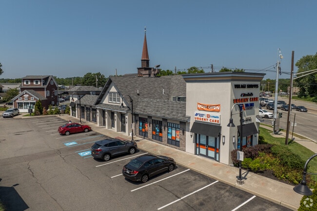
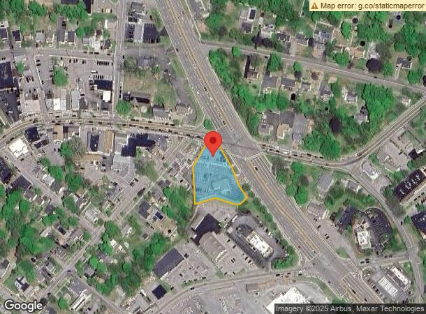
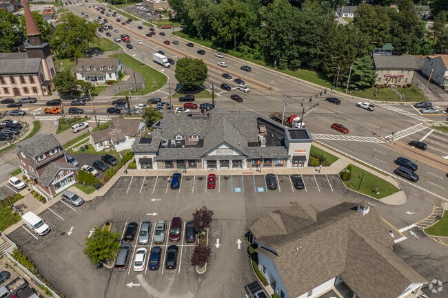
Property Record
701 Route 9 St, Fishkill, NY 12524
Current Lease Availabilities
NEARBY LISTINGS FOR SALE OR LEASE
Property Detail
701 Route 9 St
133001-6155-08-868954-0000
0.76 AC (D) 1915 0269 1596 0121
Restaurantbuilding
Dutchess
AE
New York
36027C0467E
868
2025
0.86 AC
2024
Fishkill
060400
Westchester/So Connecticut
8,047 SF
Dutchess County-Putnam County, NY
DEMOGRAPHICS near 701 Route 9 St
1 Mile
3 Mile
5 Mile
2024 Total Population
5,060
24,083
68,896
2029 Population
5,075
24,018
68,785
Pop Growth 2024-2029
+ 0.30%
(0.27%)
(0.16%)
Average Age
45
44
43
2024 Total Households
2,270
9,896
27,509
HH Growth 2024-2029
+ 0.31%
(0.29%)
(0.20%)
Median Household Inc
$88,439
$85,908
$92,117
Avg Household Size
2.20
2.30
2.40
2024 Avg HH Vehicles
2.00
2.00
2.00
Median Home Value
$374,755
$364,143
$374,512
Median Year Built
1981
1975
1972
Nearby Places
- Restaurants
- Banks
- Shops
- Fitness
- Groceries
PUBLIC TRANSPORTATION
COMMUTER RAIL
New Hamburg Station (Hudson Line - Metro-North Commuter Railroad Company (Metro-North))
DRIVE
WALK
Distance
New Hamburg Station (Hudson Line - Metro-North Commuter Railroad Company (Metro-North))
11 min
5.5 mi
Beacon Station (Hudson Line - Metro-North Commuter Railroad Company (Metro-North))
DRIVE
WALK
Distance
Beacon Station (Hudson Line - Metro-North Commuter Railroad Company (Metro-North))
10 min
5.6 mi
AIRPORT
New York Stewart International
DRIVE
WALK
Distance
New York Stewart International
24 min
14.1 mi
Westchester County
DRIVE
WALK
Distance
Westchester County
60 min
48.5 mi
Nearby Properties
Address
Land Use
TOTAL SIZE
Lot Size
Zoning
Address
Land Use
TOTAL SIZE
Lot Size
Zoning
1,240,333 SF
120.58 AC
PI
Address
Land Use
TOTAL SIZE
Lot Size
Zoning
137,278 SF
41.20 AC
R-50
Address
Land Use
TOTAL SIZE
Lot Size
Zoning
773,000 SF
6.80 AC
PI
Address
Land Use
TOTAL SIZE
Lot Size
Zoning
21,996 SF
17.36 AC
RMF5
Address
Land Use
TOTAL SIZE
Lot Size
Zoning
56,704 SF
5.03 AC
PSC
Address
Land Use
TOTAL SIZE
Lot Size
Zoning
123,536 SF
18.10 AC
GB
Address
Land Use
TOTAL SIZE
Lot Size
Zoning
118,800 SF
8.46 AC
PI
Address
Land Use
TOTAL SIZE
Lot Size
Zoning
28,362 SF
1,116.34 AC
R4A
Address
Land Use
TOTAL SIZE
Lot Size
Zoning
248,686 SF
0.01 AC
PSC
Address
Land Use
TOTAL SIZE
Lot Size
Zoning
206,064 SF
31.72 AC
PI
Address
Land Use
TOTAL SIZE
Lot Size
Zoning
6.30 AC
PSC
Address
Land Use
TOTAL SIZE
Lot Size
Zoning
99,569 SF
16.10 AC
PSC
Address
Land Use
TOTAL SIZE
Lot Size
Zoning
105,500 SF
8.50 AC
RB
Address
Land Use
TOTAL SIZE
Lot Size
Zoning
466.77 AC
R40
Address
Land Use
TOTAL SIZE
Lot Size
Zoning
72,222 SF
7.62 AC
PSC
Address
Land Use
TOTAL SIZE
Lot Size
Zoning
27,472 SF
0.67 AC
LI
Address
Land Use
TOTAL SIZE
Lot Size
Zoning
32,347 SF
17.10 AC
R20
Address
Land Use
TOTAL SIZE
Lot Size
Zoning
133,362 SF
18.85 AC
PSC
Address
Land Use
TOTAL SIZE
Lot Size
Zoning
38,699 SF
3.09 AC
GB
Address
Land Use
TOTAL SIZE
Lot Size
Zoning
117,740 SF
6.34 AC
PSC
Address
Land Use
TOTAL SIZE
Lot Size
Zoning
8,960 SF
6.28 AC
PSC
Address
Land Use
TOTAL SIZE
Lot Size
Zoning
49.90 AC
GB
Address
Land Use
TOTAL SIZE
Lot Size
Zoning
45,720 SF
13.68 AC
RMF5
Address
Land Use
TOTAL SIZE
Lot Size
Zoning
52,988 SF
3.80 AC
LHCSB
Address
Land Use
TOTAL SIZE
Lot Size
Zoning
47,968 SF
5.19 AC
GB
Address
Land Use
TOTAL SIZE
Lot Size
Zoning
54,595 SF
11 AC
R15
Address
Land Use
TOTAL SIZE
Lot Size
Zoning
132,874 SF
13.49 AC
GB
Address
Land Use
TOTAL SIZE
Lot Size
Zoning
56,824 SF
10 AC
RMF5
Address
Land Use
TOTAL SIZE
Lot Size
Zoning
26,128 SF
3.43 AC
PI
Address
Land Use
TOTAL SIZE
Lot Size
Zoning
109,900 SF
11.17 AC
PB
The World's #1 Commercial Real Estate Marketplace
Connect with us
© 2025 CoStar Group
The information above has been obtained from sources believed reliable. While we do not doubt its accuracy we have not verified it and make no guarantee, warranty or representation about it. It is your responsibility to independently confirm its accuracy and completeness. Any projections, opinions, assumptions, or estimates used are for example only and do not represent the current or future performance of the property. The value of this transaction to you depends on tax and other factors which should be evaluated by your tax, financial, and legal advisors. You and your advisors should conduct a careful, independent investigation of the property to determine to your satisfaction the suitability of the property for your needs.