Property Record
703 School St, Dalton, GA 30720
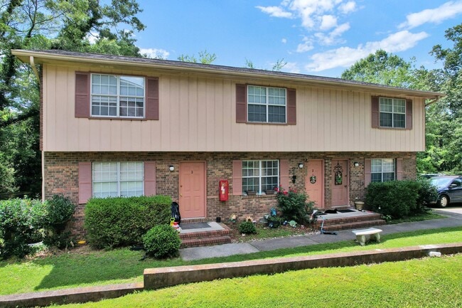
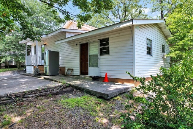
This Property Is For Sale
NEARBY LISTINGS FOR SALE OR LEASE
Property Detail
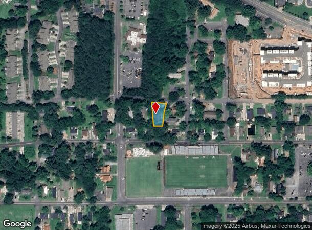
703 School St
Dalton, GA
Blk Map 41
12-220-19-008
Whitfield
Triplex
Georgia
X
0.27 AC
13213C0100D
Georgia Northwest
3,224 SF
Other Market Areas
DEMOGRAPHICS near 703 School St
1 Mile
3 Mile
5 Mile
2024 Total Population
9,121
40,310
67,477
2029 Population
9,433
41,643
69,706
Pop Growth 2024-2029
+ 3.42%
+ 3.31%
+ 3.30%
Average Age
39
38
38
2024 Total Households
3,306
14,153
23,448
HH Growth 2024-2029
+ 3.60%
+ 3.46%
+ 3.39%
Median Household Inc
$65,307
$59,927
$59,560
Avg Household Size
2.60
2.70
2.80
2024 Avg HH Vehicles
2.00
2.00
2.00
Median Home Value
$272,554
$233,513
$235,234
Median Year Built
1978
1982
1984
Nearby Places
Map Layers
Map Styles
 Street
 Aerial
- Restaurants
- Banks
- Shops
- Fitness
- Groceries
PUBLIC TRANSPORTATION
AIRPORT
Lovell Field
DRIVE
WALK
Distance
Lovell Field
41 min
27.6 mi
Nearby Properties
Address
Land Use
TOTAL SIZE
Lot Size
Zoning
Address
Land Use
TOTAL SIZE
Lot Size
Zoning
34,320 SF
13.50 AC
Address
Land Use
TOTAL SIZE
Lot Size
Zoning
54,546 SF
128.30 AC
Address
Land Use
TOTAL SIZE
Lot Size
Zoning
500,075 SF
11.48 AC
Address
Land Use
TOTAL SIZE
Lot Size
Zoning
39,664 SF
27.50 AC
Address
Land Use
TOTAL SIZE
Lot Size
Zoning
784,920 SF
56.60 AC
Address
Land Use
TOTAL SIZE
Lot Size
Zoning
123,430 SF
51.17 AC
Address
Land Use
TOTAL SIZE
Lot Size
Zoning
346,476 SF
31.41 AC
Address
Land Use
TOTAL SIZE
Lot Size
Zoning
1,183,067 SF
48.97 AC
Address
Land Use
TOTAL SIZE
Lot Size
Zoning
133,712 SF
14.93 AC
R7
Address
Land Use
TOTAL SIZE
Lot Size
Zoning
195,990 SF
60.25 AC
Address
Land Use
TOTAL SIZE
Lot Size
Zoning
664,020 SF
28.75 AC
M-2
Address
Land Use
TOTAL SIZE
Lot Size
Zoning
68,465 SF
0.71 AC
Address
Land Use
TOTAL SIZE
Lot Size
Zoning
100,084 SF
1.47 AC
Address
Land Use
TOTAL SIZE
Lot Size
Zoning
1,188,135 SF
106.61 AC
M2
Address
Land Use
TOTAL SIZE
Lot Size
Zoning
115,979 SF
10.60 AC
C2
Address
Land Use
TOTAL SIZE
Lot Size
Zoning
125,756 SF
7 AC
Address
Land Use
TOTAL SIZE
Lot Size
Zoning
160,386 SF
14.21 AC
Address
Land Use
TOTAL SIZE
Lot Size
Zoning
150,771 SF
12.66 AC
Address
Land Use
TOTAL SIZE
Lot Size
Zoning
6,650 SF
22.70 AC
Address
Land Use
TOTAL SIZE
Lot Size
Zoning
158,128 SF
13.71 AC
Address
Land Use
TOTAL SIZE
Lot Size
Zoning
391,865 SF
17.51 AC
Address
Land Use
TOTAL SIZE
Lot Size
Zoning
219,744 SF
12.74 AC
Address
Land Use
TOTAL SIZE
Lot Size
Zoning
8,208 SF
11.86 AC
Address
Land Use
TOTAL SIZE
Lot Size
Zoning
18,016 SF
27.65 AC
Address
Land Use
TOTAL SIZE
Lot Size
Zoning
38,016 SF
18 AC
Address
Land Use
TOTAL SIZE
Lot Size
Zoning
55,020 SF
7.02 AC
Address
Land Use
TOTAL SIZE
Lot Size
Zoning
184,000 SF
29.32 AC
Address
Land Use
TOTAL SIZE
Lot Size
Zoning
211,512 SF
3.60 AC
M2
Address
Land Use
TOTAL SIZE
Lot Size
Zoning
39,191 SF
1.93 AC
Address
Land Use
TOTAL SIZE
Lot Size
Zoning
31,376 SF
9.64 AC
The World's #1 Commercial Real Estate Marketplace
Connect with us
© 2026 CoStar Group
The information above has been obtained from sources believed reliable. While we do not doubt its accuracy we have not verified it and make no guarantee, warranty or representation about it. It is your responsibility to independently confirm its accuracy and completeness. Any projections, opinions, assumptions, or estimates used are for example only and do not represent the current or future performance of the property. The value of this transaction to you depends on tax and other factors which should be evaluated by your tax, financial, and legal advisors. You and your advisors should conduct a careful, independent investigation of the property to determine to your satisfaction the suitability of the property for your needs.