Property Record
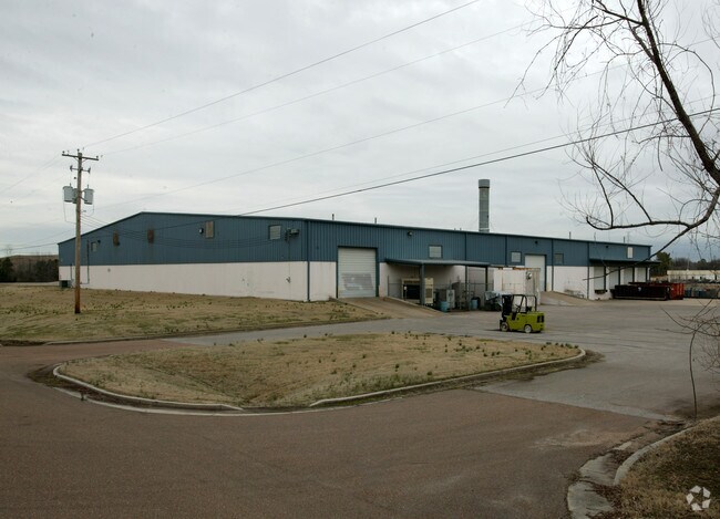
7030 Ryburn Dr, Millington, TN 38053


NEARBY LISTINGS FOR SALE OR LEASE
Property Detail
7030 Ryburn Dr
Memphis, TN-MS-AR
Industrial Dev Brd Resub Of 109Ac Tract
M0-125-0-0549
524.81FT SW OF MILLINGTON INDUSTRIAL PKWY
Warehouse
Shelby
X
Tennessee
47157C0155F
1
2024
5.99 AC
2025
Northwest
020221
Memphis
43,240 SF
DEMOGRAPHICS near 7030 Ryburn Dr
1 Mile
3 Mile
5 Mile
2024 Total Population
500
11,248
23,037
2029 Population
491
11,035
22,668
Pop Growth 2024-2029
(1.80%)
(1.89%)
(1.60%)
Average Age
45
41
39
2024 Total Households
185
4,443
8,714
HH Growth 2024-2029
(1.62%)
(2.00%)
(1.72%)
Median Household Inc
$65,500
$56,768
$50,586
Avg Household Size
2.60
2.50
2.60
2024 Avg HH Vehicles
2.00
2.00
2.00
Median Home Value
$223,913
$197,645
$198,805
Median Year Built
1977
1976
1978
Nearby Places
Map Layers
Map Styles
 Street
 Aerial
- Restaurants
- Banks
- Shops
- Fitness
- Groceries
PUBLIC TRANSPORTATION
AIRPORT
Memphis International
DRIVE
WALK
Distance
Memphis International
38 min
23.9 mi
Nearby Properties
Address
Land Use
TOTAL SIZE
Lot Size
Zoning
Address
Land Use
TOTAL SIZE
Lot Size
Zoning
625,426 SF
38.85 AC
M-2
Address
Land Use
TOTAL SIZE
Lot Size
Zoning
22,232 SF
10.55 AC
R-4
Address
Land Use
TOTAL SIZE
Lot Size
Zoning
75,401 SF
309.54 AC
IH
Address
Land Use
TOTAL SIZE
Lot Size
Zoning
17,690 SF
30.89 AC
CA
Address
Land Use
TOTAL SIZE
Lot Size
Zoning
148,903 SF
13.81 AC
P-C
Address
Land Use
TOTAL SIZE
Lot Size
Zoning
23,730 SF
342.10 AC
IH
Address
Land Use
TOTAL SIZE
Lot Size
Zoning
76,055 SF
30.92 AC
M-1
Address
Land Use
TOTAL SIZE
Lot Size
Zoning
63,815 SF
30 AC
IH
Address
Land Use
TOTAL SIZE
Lot Size
Zoning
73,893 SF
3.88 AC
B-2
Address
Land Use
TOTAL SIZE
Lot Size
Zoning
47,152 SF
7.82 AC
R-4
Address
Land Use
TOTAL SIZE
Lot Size
Zoning
1,970 SF
143.36 AC
R-4
Address
Land Use
TOTAL SIZE
Lot Size
Zoning
107.61 AC
M-2
Address
Land Use
TOTAL SIZE
Lot Size
Zoning
24 AC
R-4
Address
Land Use
TOTAL SIZE
Lot Size
Zoning
27.21 AC
R-1
Address
Land Use
TOTAL SIZE
Lot Size
Zoning
39,912 SF
31.16 AC
IH
Address
Land Use
TOTAL SIZE
Lot Size
Zoning
10,793 SF
1.30 AC
B-2
Address
Land Use
TOTAL SIZE
Lot Size
Zoning
9.44 AC
R-1
Address
Land Use
TOTAL SIZE
Lot Size
Zoning
3,634 SF
0.99 AC
B-2
Address
Land Use
TOTAL SIZE
Lot Size
Zoning
14,376 SF
1.81 AC
B-2
Address
Land Use
TOTAL SIZE
Lot Size
Zoning
65,468 SF
7.01 AC
R-4
Address
Land Use
TOTAL SIZE
Lot Size
Zoning
5,425 SF
1.36 AC
B-2
Address
Land Use
TOTAL SIZE
Lot Size
Zoning
3,045 SF
3.01 AC
B-2
Address
Land Use
TOTAL SIZE
Lot Size
Zoning
32,020 SF
10.38 AC
B-2
Address
Land Use
TOTAL SIZE
Lot Size
Zoning
59,559 SF
4.94 AC
B-2
Address
Land Use
TOTAL SIZE
Lot Size
Zoning
5,030 SF
10 AC
R-4
Address
Land Use
TOTAL SIZE
Lot Size
Zoning
2,550 SF
0.93 AC
B-2
Address
Land Use
TOTAL SIZE
Lot Size
Zoning
29,104 SF
5.37 AC
R-4
Address
Land Use
TOTAL SIZE
Lot Size
Zoning
15,838 SF
566.44 AC
M-3
Address
Land Use
TOTAL SIZE
Lot Size
Zoning
145,100 SF
25.50 AC
IH
Address
Land Use
TOTAL SIZE
Lot Size
Zoning
26,688 SF
2.37 AC
CA
The World's #1 Commercial Real Estate Marketplace
Connect with us
© 2026 CoStar Group
The information above has been obtained from sources believed reliable. While we do not doubt its accuracy we have not verified it and make no guarantee, warranty or representation about it. It is your responsibility to independently confirm its accuracy and completeness. Any projections, opinions, assumptions, or estimates used are for example only and do not represent the current or future performance of the property. The value of this transaction to you depends on tax and other factors which should be evaluated by your tax, financial, and legal advisors. You and your advisors should conduct a careful, independent investigation of the property to determine to your satisfaction the suitability of the property for your needs.