Property Record
7035 Navarre Pkwy, Navarre, FL 32566
NEARBY LISTINGS FOR SALE OR LEASE
Property Detail
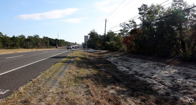
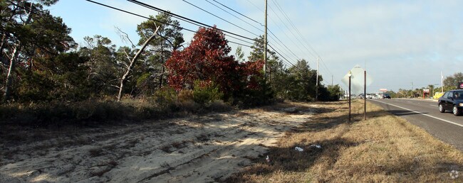
7035 Navarre Pkwy
23-2S-27-0000-02801-0000
THAT PORT OF THE FOLLOWING TWO LEGALS LYING IN SEC 23 DES AS: E 79.20 FT OF W 1729.30 FT OF SECTIONS 23 & 26-2S-27 LYING S OF US HWY 98 DESCRIBED AS FOLL OWS: COM SW CORN OF SEC 23 SAID CORN ALSO BEING NW CORN OF SEC 26 THN S89*0234E ALNG COMMON SEC
Commercialacreage
Santa Rosa
AE
Florida
12113C0568H
11.85 AC
2024
Navarre
2025
Pensacola
010824
Pensacola-Ferry Pass-Brent, FL
DEMOGRAPHICS near 7035 Navarre Pkwy
1 Mile
3 Mile
5 Mile
2024 Total Population
4,596
28,127
52,253
2029 Population
5,255
32,497
60,683
Pop Growth 2024-2029
+ 14.34%
+ 15.54%
+ 16.13%
Average Age
39
40
40
2024 Total Households
1,709
10,536
19,850
HH Growth 2024-2029
+ 14.75%
+ 16.04%
+ 16.71%
Median Household Inc
$99,376
$95,117
$92,773
Avg Household Size
2.70
2.60
2.60
2024 Avg HH Vehicles
2.00
2.00
2.00
Median Home Value
$292,192
$318,266
$320,338
Median Year Built
2002
2003
2002
Nearby Places
Map Layers
Map Styles
 Street
 Aerial
- Restaurants
- Banks
- Shops
- Fitness
- Groceries
PUBLIC TRANSPORTATION
AIRPORT
Pensacola International
DRIVE
WALK
Distance
Pensacola International
46 min
26.2 mi
Eglin AFB/Destin-Ft Walton Beach
DRIVE
WALK
Distance
Eglin AFB/Destin-Ft Walton Beach
58 min
30.2 mi
Freight Ports
Port of Mobile
DRIVE
WALK
Distance
Port of Mobile
99 min
82.1 mi
Nearby Properties
Address
Land Use
TOTAL SIZE
Lot Size
Zoning
Address
Land Use
TOTAL SIZE
Lot Size
Zoning
1.03 AC
NONE
Address
Land Use
TOTAL SIZE
Lot Size
Zoning
344,974 SF
16.11 AC
R3
Address
Land Use
TOTAL SIZE
Lot Size
Zoning
375,552 SF
10.62 AC
PBD
Address
Land Use
TOTAL SIZE
Lot Size
Zoning
242,842 SF
14.77 AC
PBD
Address
Land Use
TOTAL SIZE
Lot Size
Zoning
241,693 SF
14.28 AC
PBD
Address
Land Use
TOTAL SIZE
Lot Size
Zoning
161,438 SF
5.64 AC
HCD
Address
Land Use
TOTAL SIZE
Lot Size
Zoning
68,134 SF
21.16 AC
R1
Address
Land Use
TOTAL SIZE
Lot Size
Zoning
116,452 SF
4.55 AC
HCD
Address
Land Use
TOTAL SIZE
Lot Size
Zoning
65,936 SF
1.86 AC
PBD
Address
Land Use
TOTAL SIZE
Lot Size
Zoning
51,677 SF
17.79 AC
PBD
Address
Land Use
TOTAL SIZE
Lot Size
Zoning
68,334 SF
4.45 AC
HCD
Address
Land Use
TOTAL SIZE
Lot Size
Zoning
85,562 SF
36.21 AC
PBD
Address
Land Use
TOTAL SIZE
Lot Size
Zoning
19,350 SF
9.10 AC
HCD
Address
Land Use
TOTAL SIZE
Lot Size
Zoning
60,854 SF
7.07 AC
HCD
Address
Land Use
TOTAL SIZE
Lot Size
Zoning
48,198 SF
1.76 AC
PBD
Address
Land Use
TOTAL SIZE
Lot Size
Zoning
130,030 SF
36.74 AC
R1A
Address
Land Use
TOTAL SIZE
Lot Size
Zoning
39,373 SF
185.18 AC
R1
Address
Land Use
TOTAL SIZE
Lot Size
Zoning
36,749 SF
2.75 AC
HCD
Address
Land Use
TOTAL SIZE
Lot Size
Zoning
24,180 SF
4.07 AC
HCD
Address
Land Use
TOTAL SIZE
Lot Size
Zoning
18,054 SF
1.47 AC
HCD
Address
Land Use
TOTAL SIZE
Lot Size
Zoning
40,963 SF
8.36 AC
HCD
Address
Land Use
TOTAL SIZE
Lot Size
Zoning
10,506 SF
0.67 AC
PBD
Address
Land Use
TOTAL SIZE
Lot Size
Zoning
41.24 AC
R1
Address
Land Use
TOTAL SIZE
Lot Size
Zoning
20,150 SF
4.02 AC
HCD
Address
Land Use
TOTAL SIZE
Lot Size
Zoning
17,056 SF
4.17 AC
HCD
The World's #1 Commercial Real Estate Marketplace
Connect with us
© 2025 CoStar Group
The information above has been obtained from sources believed reliable. While we do not doubt its accuracy we have not verified it and make no guarantee, warranty or representation about it. It is your responsibility to independently confirm its accuracy and completeness. Any projections, opinions, assumptions, or estimates used are for example only and do not represent the current or future performance of the property. The value of this transaction to you depends on tax and other factors which should be evaluated by your tax, financial, and legal advisors. You and your advisors should conduct a careful, independent investigation of the property to determine to your satisfaction the suitability of the property for your needs.