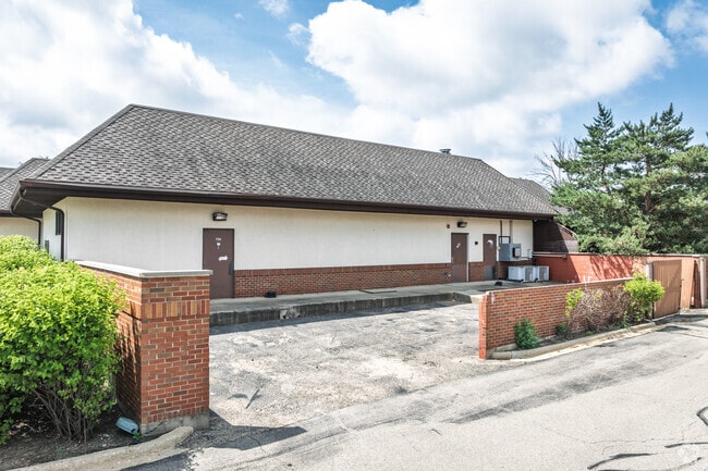
Property Record
720 W Euclid Ave, Palatine, IL 60074

Current Lease Availabilities
NEARBY LISTINGS FOR SALE OR LEASE
Property Detail
720 W Euclid Ave
Chicago-Naperville-Elgin, IL-IN-WI
Assessors Sub
02-27-301-006-0000
(ASSESSORS) SUB OF SEC 27-42-10
Regionalshoppingcenterormallwithanchorstore
Cook
X
Illinois
17031C0183J
5
2023
15.22 AC
2024
Schaumburg Area
803605
Chicago
138,363 SF
DEMOGRAPHICS near 720 W Euclid Ave
1 Mile
3 Mile
5 Mile
2024 Total Population
11,308
79,410
246,024
2029 Population
10,957
77,065
238,934
Pop Growth 2024-2029
(3.10%)
(2.95%)
(2.88%)
Average Age
41
41
41
2024 Total Households
4,170
32,119
95,134
HH Growth 2024-2029
(3.41%)
(3.23%)
(3.17%)
Median Household Inc
$129,831
$101,399
$95,935
Avg Household Size
2.70
2.40
2.50
2024 Avg HH Vehicles
2.00
2.00
2.00
Median Home Value
$454,685
$337,629
$342,300
Median Year Built
1980
1975
1975
Nearby Places
Map Layers
Map Styles
 Street
 Aerial
- Restaurants
- Banks
- Shops
- Fitness
- Groceries
PUBLIC TRANSPORTATION
COMMUTER RAIL
Palatine Station (Union Pacific Northwest Line - Northeast Illinois Regional Commuter Railroad (Metra))
DRIVE
WALK
Distance
Palatine Station (Union Pacific Northwest Line - Northeast Illinois Regional Commuter Railroad (Metra))
6 min
2.6 mi
Arlington Park Station (Union Pacific Northwest Line - Northeast Illinois Regional Commuter Railroad (Metra))
DRIVE
WALK
Distance
Arlington Park Station (Union Pacific Northwest Line - Northeast Illinois Regional Commuter Railroad (Metra))
7 min
3.6 mi
AIRPORT
Chicago O'Hare International
DRIVE
WALK
Distance
Chicago O'Hare International
24 min
16.3 mi
Chicago Midway International
DRIVE
WALK
Distance
Chicago Midway International
46 min
32.3 mi
Freight Ports
Port Milwaukee
DRIVE
WALK
Distance
Port Milwaukee
95 min
77.4 mi
Nearby Properties
Address
Land Use
TOTAL SIZE
Lot Size
Zoning
Address
Land Use
TOTAL SIZE
Lot Size
Zoning
800,552 SF
38.86 AC
Address
Land Use
TOTAL SIZE
Lot Size
Zoning
Address
Land Use
TOTAL SIZE
Lot Size
Zoning
Address
Land Use
TOTAL SIZE
Lot Size
Zoning
961,890 SF
42.21 AC
Address
Land Use
TOTAL SIZE
Lot Size
Zoning
369,303 SF
29.96 AC
Address
Land Use
TOTAL SIZE
Lot Size
Zoning
787,336 SF
Address
Land Use
TOTAL SIZE
Lot Size
Zoning
Address
Land Use
TOTAL SIZE
Lot Size
Zoning
427,761 SF
30.41 AC
Address
Land Use
TOTAL SIZE
Lot Size
Zoning
388,080 SF
12.64 AC
Address
Land Use
TOTAL SIZE
Lot Size
Zoning
298,493 SF
9.76 AC
Address
Land Use
TOTAL SIZE
Lot Size
Zoning
449,131 SF
28.93 AC
Address
Land Use
TOTAL SIZE
Lot Size
Zoning
14,099 SF
2.01 AC
Address
Land Use
TOTAL SIZE
Lot Size
Zoning
239,700 SF
Address
Land Use
TOTAL SIZE
Lot Size
Zoning
490,458 SF
13.52 AC
Address
Land Use
TOTAL SIZE
Lot Size
Zoning
544,744 SF
14.87 AC
Address
Land Use
TOTAL SIZE
Lot Size
Zoning
117,825 SF
4.49 AC
Address
Land Use
TOTAL SIZE
Lot Size
Zoning
375,417 SF
13.35 AC
Address
Land Use
TOTAL SIZE
Lot Size
Zoning
Address
Land Use
TOTAL SIZE
Lot Size
Zoning
29.21 AC
Address
Land Use
TOTAL SIZE
Lot Size
Zoning
161,514 SF
11.17 AC
Address
Land Use
TOTAL SIZE
Lot Size
Zoning
150,452 SF
15.26 AC
Address
Land Use
TOTAL SIZE
Lot Size
Zoning
212,192 SF
7.05 AC
Address
Land Use
TOTAL SIZE
Lot Size
Zoning
148,220 SF
Address
Land Use
TOTAL SIZE
Lot Size
Zoning
45,259 SF
2.33 AC
Address
Land Use
TOTAL SIZE
Lot Size
Zoning
28,913 SF
6.63 AC
Address
Land Use
TOTAL SIZE
Lot Size
Zoning
93,333 SF
22.45 AC
Address
Land Use
TOTAL SIZE
Lot Size
Zoning
Address
Land Use
TOTAL SIZE
Lot Size
Zoning
0.99 AC
Address
Land Use
TOTAL SIZE
Lot Size
Zoning
392,258 SF
12.51 AC
Address
Land Use
TOTAL SIZE
Lot Size
Zoning
287,328 SF
13.57 AC
The World's #1 Commercial Real Estate Marketplace
Connect with us
© 2025 CoStar Group
The information above has been obtained from sources believed reliable. While we do not doubt its accuracy we have not verified it and make no guarantee, warranty or representation about it. It is your responsibility to independently confirm its accuracy and completeness. Any projections, opinions, assumptions, or estimates used are for example only and do not represent the current or future performance of the property. The value of this transaction to you depends on tax and other factors which should be evaluated by your tax, financial, and legal advisors. You and your advisors should conduct a careful, independent investigation of the property to determine to your satisfaction the suitability of the property for your needs.