Property Record
7040 Archibald Ave, Rancho Cucamonga, CA 91701
NEARBY LISTINGS FOR SALE OR LEASE
-
-
View all Rancho Cucamonga listings for sale on LoopNet.com
Property Detail
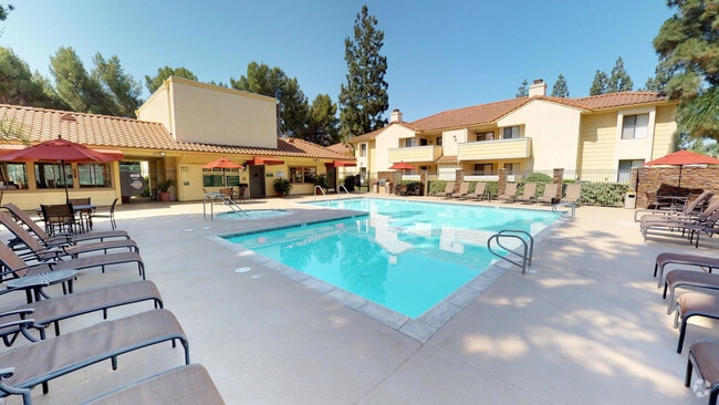
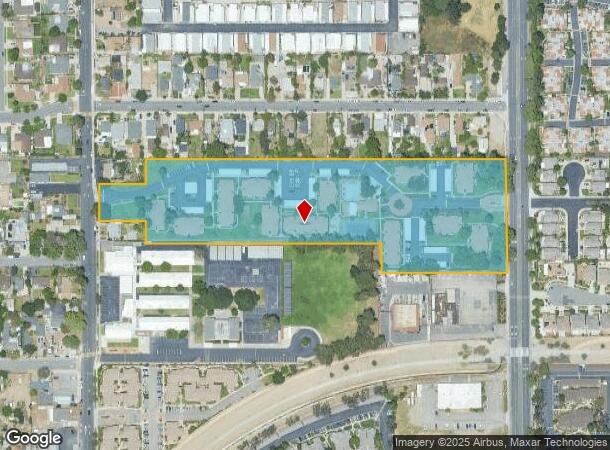
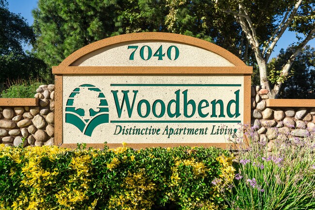
7040 Archibald Ave
Riverside-San Bernardino-Ontario, CA
Cucamonga Homestead Association
0202-141-11
CUCAMONGA HOMESTEAD ASSN LOT 4 BLK 8 EX COM AT SE COR LOT 4 TH N 0 DEG 24 MIN 26 SECONDS W ALG E LI SD LOT 4 1.11 FT TO S LI P E R R CO R/W TH WLY ALG SD S LI TO S LI SD LOT 4 TH ELY ALG SD S LI TO POB AND EX COM AT SE COR SD LOT 4 TH N 89 DEG 58 MIN
Apartment
San Bernardino
X
California
06071C7890J
4
2024
8.55 AC
2025
Rancho Cucamonga
002023
Inland Empire (California)
99,144 SF
DEMOGRAPHICS near 7040 Archibald Ave
1 Mile
3 Mile
5 Mile
2024 Total Population
21,891
142,801
299,271
2029 Population
22,170
144,765
303,692
Pop Growth 2024-2029
+ 1.27%
+ 1.38%
+ 1.48%
Average Age
42
39
38
2024 Total Households
8,122
49,358
98,824
HH Growth 2024-2029
+ 1.27%
+ 1.40%
+ 1.54%
Median Household Inc
$78,991
$97,362
$94,745
Avg Household Size
2.60
2.80
2.90
2024 Avg HH Vehicles
2.00
2.00
2.00
Median Home Value
$603,668
$648,295
$655,826
Median Year Built
1979
1983
1983
Nearby Places
Map Layers
Map Styles
 Street
 Aerial
- Restaurants
- Banks
- Shops
- Fitness
- Groceries
PUBLIC TRANSPORTATION
COMMUTER RAIL
Rancho Cucamonga (San Bernardino Line - Southern California Regional Rail Authority (Metrolink))
DRIVE
WALK
Distance
Rancho Cucamonga (San Bernardino Line - Southern California Regional Rail Authority (Metrolink))
9 min
5.0 mi
Upland (San Bernardino Line - Southern California Regional Rail Authority (Metrolink))
DRIVE
WALK
Distance
Upland (San Bernardino Line - Southern California Regional Rail Authority (Metrolink))
10 min
5.1 mi
AIRPORT
Ontario International
DRIVE
WALK
Distance
Ontario International
10 min
5.3 mi
Freight Ports
Port of Long Beach
DRIVE
WALK
Distance
Port of Long Beach
70 min
57.0 mi
Nearby Properties
Address
Land Use
TOTAL SIZE
Lot Size
Zoning
Address
Land Use
TOTAL SIZE
Lot Size
Zoning
376,610 SF
25.22 AC
Address
Land Use
TOTAL SIZE
Lot Size
Zoning
293,860 SF
16.10 AC
Address
Land Use
TOTAL SIZE
Lot Size
Zoning
190,724 SF
10.69 AC
Address
Land Use
TOTAL SIZE
Lot Size
Zoning
468,682 SF
19.40 AC
Address
Land Use
TOTAL SIZE
Lot Size
Zoning
174,092 SF
4.42 AC
Address
Land Use
TOTAL SIZE
Lot Size
Zoning
251,645 SF
4.50 AC
Address
Land Use
TOTAL SIZE
Lot Size
Zoning
340,104 SF
8.95 AC
Address
Land Use
TOTAL SIZE
Lot Size
Zoning
249,672 SF
13.80 AC
Address
Land Use
TOTAL SIZE
Lot Size
Zoning
405,970 SF
19.23 AC
Address
Land Use
TOTAL SIZE
Lot Size
Zoning
139,059 SF
20.83 AC
Address
Land Use
TOTAL SIZE
Lot Size
Zoning
122,563 SF
5.76 AC
Address
Land Use
TOTAL SIZE
Lot Size
Zoning
225,727 SF
7.18 AC
Address
Land Use
TOTAL SIZE
Lot Size
Zoning
354,616 SF
20.07 AC
Address
Land Use
TOTAL SIZE
Lot Size
Zoning
131,190 SF
6.71 AC
Address
Land Use
TOTAL SIZE
Lot Size
Zoning
468,410 SF
22.71 AC
Address
Land Use
TOTAL SIZE
Lot Size
Zoning
443,300 SF
23.06 AC
Address
Land Use
TOTAL SIZE
Lot Size
Zoning
127,559 SF
5.63 AC
Address
Land Use
TOTAL SIZE
Lot Size
Zoning
324,131 SF
19.81 AC
Address
Land Use
TOTAL SIZE
Lot Size
Zoning
161,555 SF
8.25 AC
Address
Land Use
TOTAL SIZE
Lot Size
Zoning
95,240 SF
8.42 AC
Address
Land Use
TOTAL SIZE
Lot Size
Zoning
99,345 SF
5.15 AC
Address
Land Use
TOTAL SIZE
Lot Size
Zoning
63,862 SF
4.77 AC
Address
Land Use
TOTAL SIZE
Lot Size
Zoning
171,446 SF
10.88 AC
Address
Land Use
TOTAL SIZE
Lot Size
Zoning
133,847 SF
7.52 AC
Address
Land Use
TOTAL SIZE
Lot Size
Zoning
102,516 SF
4.88 AC
Address
Land Use
TOTAL SIZE
Lot Size
Zoning
79,319 SF
4.47 AC
Address
Land Use
TOTAL SIZE
Lot Size
Zoning
54,166 SF
4.60 AC
Address
Land Use
TOTAL SIZE
Lot Size
Zoning
110,442 SF
4.60 AC
Address
Land Use
TOTAL SIZE
Lot Size
Zoning
54,444 SF
4.71 AC
Address
Land Use
TOTAL SIZE
Lot Size
Zoning
175,624 SF
8.20 AC
The World's #1 Commercial Real Estate Marketplace
Connect with us
© 2026 CoStar Group
The information above has been obtained from sources believed reliable. While we do not doubt its accuracy we have not verified it and make no guarantee, warranty or representation about it. It is your responsibility to independently confirm its accuracy and completeness. Any projections, opinions, assumptions, or estimates used are for example only and do not represent the current or future performance of the property. The value of this transaction to you depends on tax and other factors which should be evaluated by your tax, financial, and legal advisors. You and your advisors should conduct a careful, independent investigation of the property to determine to your satisfaction the suitability of the property for your needs.