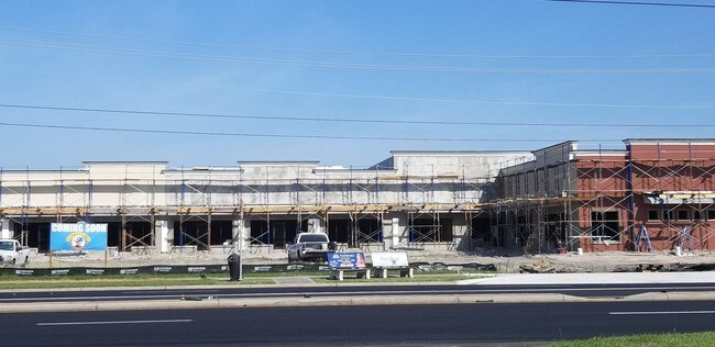
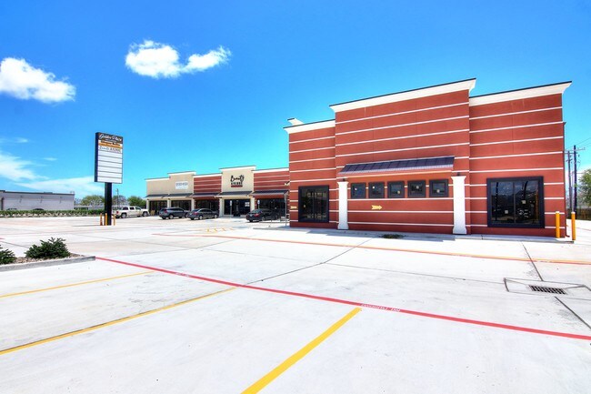
Property Record
7042 S Staples St, Corpus Christi, TX 78413

Property Detail
7042 S Staples St
370869
CORSICA TRACT LT 1R BLK 1
Commercialnec
NUECES
B1
Texas
B and X Area of moderate flood hazard, usually the area between the limits of the 100-year and 500-year floods.
1r
2024
1.31 AC
2025
South Side
005415
Corpus Christi
11,916 SF
Corpus Christi, TX
NEARBY LISTINGS FOR SALE OR LEASE
DEMOGRAPHICS near 7042 S Staples St
1 mile
3 mile
5 mile
2025 Total Population
19,780
98,588
163,437
2030 Population
19,672
97,819
161,362
Pop Growth 2025-2030
(0.55%)
(0.78%)
(1.27%)
Average Age
37
38
38
2025 Total Households
7,208
37,214
61,779
HH Growth 2025-2030
(0.76%)
(0.99%)
(1.47%)
Median Household Inc
$85,834
$77,074
$72,927
Avg Household Size
2.60
2.60
2.60
2025 Avg HH Vehicles
2.00
2.00
2.00
Median Home Value
$271,174
$257,774
$234,946
Median Year Built
1996
1991
1983
Nearby Places
Map Layers
Map Styles
 Street
 Aerial
Transit
 Traffic
 Biking
Places
Listings with unknown addresses are not visible on the map
- Restaurants
- Banks
- Shops
- Fitness
- Groceries
PUBLIC TRANSPORTATION
AIRPORT
Corpus Christi International
Drive
Walk
Distance
Corpus Christi International
22 min
14.0 mi
Freight Ports
Port of Corpus Christi
Drive
Walk
Distance
Port of Corpus Christi
17 min
10.8 mi
SALE & LEASE HISTORY
LISTING DATE
SALE/LEASE

Nov 06, 2019
For Lease
May 17, 2018
For Lease
Nearby Properties
Address
Land Use
TOTAL SIZE
Lot Size
Zoning
Address
Land Use
TOTAL SIZE
Lot Size
Zoning
248,852 SF
50.64 AC
Address
Land Use
TOTAL SIZE
Lot Size
Zoning
747,956 SF
39.67 AC
B-4
Address
Land Use
TOTAL SIZE
Lot Size
Zoning
380,000 SF
71.08 AC
Address
Land Use
TOTAL SIZE
Lot Size
Zoning
97,505 SF
29.76 AC
B-4
Address
Land Use
TOTAL SIZE
Lot Size
Zoning
273,740 SF
16.74 AC
A1
Address
Land Use
TOTAL SIZE
Lot Size
Zoning
245,114 SF
16.86 AC
Address
Land Use
TOTAL SIZE
Lot Size
Zoning
212,125 SF
16.55 AC
Address
Land Use
TOTAL SIZE
Lot Size
Zoning
111,464 SF
18.63 AC
R1C
Address
Land Use
TOTAL SIZE
Lot Size
Zoning
196,076 SF
13.25 AC
Address
Land Use
TOTAL SIZE
Lot Size
Zoning
96,495 SF
6.63 AC
AB
Address
Land Use
TOTAL SIZE
Lot Size
Zoning
96,546 SF
19.99 AC
Address
Land Use
TOTAL SIZE
Lot Size
Zoning
124,257 SF
7.63 AC
Address
Land Use
TOTAL SIZE
Lot Size
Zoning
97,799 SF
8.35 AC
Address
Land Use
TOTAL SIZE
Lot Size
Zoning
88,260 SF
5 AC
Address
Land Use
TOTAL SIZE
Lot Size
Zoning
108,420 SF
20 AC
R1B
Address
Land Use
TOTAL SIZE
Lot Size
Zoning
126,787 SF
13.58 AC
R1B
Address
Land Use
TOTAL SIZE
Lot Size
Zoning
79,107 SF
9.54 AC
R1B
Address
Land Use
TOTAL SIZE
Lot Size
Zoning
9,202 SF
126.97 AC
R1B
Address
Land Use
TOTAL SIZE
Lot Size
Zoning
124,511 SF
10.74 AC
B-3
Address
Land Use
TOTAL SIZE
Lot Size
Zoning
192,450 SF
6.45 AC
Address
Land Use
TOTAL SIZE
Lot Size
Zoning
81,798 SF
23.13 AC
A2
Address
Land Use
TOTAL SIZE
Lot Size
Zoning
71,556 SF
4.11 AC
R1B
Address
Land Use
TOTAL SIZE
Lot Size
Zoning
68,535 SF
10.88 AC
V
Address
Land Use
TOTAL SIZE
Lot Size
Zoning
66,412 SF
4.10 AC
I-2
Address
Land Use
TOTAL SIZE
Lot Size
Zoning
174,134 SF
19.26 AC
B4
Address
Land Use
TOTAL SIZE
Lot Size
Zoning
83,945 SF
13.34 AC
R2
Address
Land Use
TOTAL SIZE
Lot Size
Zoning
72,436 SF
7.55 AC
B1
Address
Land Use
TOTAL SIZE
Lot Size
Zoning
89,100 SF
11.45 AC
R1B
Address
Land Use
TOTAL SIZE
Lot Size
Zoning
170,667 SF
13.42 AC
IV
Address
Land Use
TOTAL SIZE
Lot Size
Zoning
72,555 SF
10 AC
R1C
The World's #1 Commercial Real Estate Marketplace
Connect with us
© 2026 CoStar Group
The information above has been obtained from sources believed reliable. While we do not doubt its accuracy we have not verified it and make no guarantee, warranty or representation about it. It is your responsibility to independently confirm its accuracy and completeness. Any projections, opinions, assumptions, or estimates used are for example only and do not represent the current or future performance of the property. The value of this transaction to you depends on tax and other factors which should be evaluated by your tax, financial, and legal advisors. You and your advisors should conduct a careful, independent investigation of the property to determine to your satisfaction the suitability of the property for your needs.