Property Record
7049 Ulmerton Rd, Largo, FL 33771

NEARBY LISTINGS FOR SALE OR LEASE
-
-
View all Largo listings for sale on LoopNet.com
Property Detail
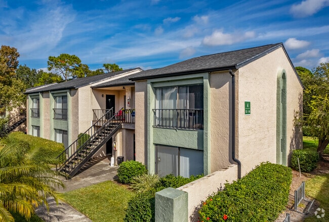
7049 Ulmerton Rd
Tampa-St. Petersburg-Clearwater, FL
Pinellas Groves
06-30-16-70938-400-0801
CITRUS GROVES ACRES, E.L. ROGERS PART OF LOT 4 DESC FROM NE COR OF SD LOT 4 TH S00D50 49E 157.24FT FOR POB TH S00D5049E 28.77FT TH N86D5033W 37.17FT TH N03D0927E 7.16FT TH CUR LT RAD 76.21FT ARC 28.49FT CB N47D1347E 28.32FT TH N88D4519E 15.51FT TO PO
Commercialacreage
Pinellas
X
Florida
12103C0138H
4
2024
16.07 AC
2025
Inner Central Peninsula
025417
Tampa/St Petersburg
252,641 SF
DEMOGRAPHICS near 7049 Ulmerton Rd
1 Mile
3 Mile
5 Mile
2024 Total Population
16,169
85,246
246,082
2029 Population
16,347
85,480
247,647
Pop Growth 2024-2029
+ 1.10%
+ 0.27%
+ 0.64%
Average Age
46
46
46
2024 Total Households
7,581
39,265
112,077
HH Growth 2024-2029
+ 1.07%
+ 0.14%
+ 0.58%
Median Household Inc
$55,343
$56,375
$57,334
Avg Household Size
2.00
2.10
2.10
2024 Avg HH Vehicles
2.00
2.00
2.00
Median Home Value
$99,405
$209,093
$227,066
Median Year Built
1982
1979
1976
Nearby Places
Map Layers
Map Styles
 Street
 Aerial
- Restaurants
- Banks
- Shops
- Fitness
- Groceries
PUBLIC TRANSPORTATION
AIRPORT
St Pete-Clearwater International
DRIVE
WALK
Distance
St Pete-Clearwater International
16 min
6.1 mi
Tampa International
DRIVE
WALK
Distance
Tampa International
29 min
17.6 mi
Freight Ports
Port of Tampa Bay
DRIVE
WALK
Distance
Port of Tampa Bay
38 min
23.0 mi
Nearby Properties
Address
Land Use
TOTAL SIZE
Lot Size
Zoning
Address
Land Use
TOTAL SIZE
Lot Size
Zoning
795,890 SF
69.11 AC
M1
Address
Land Use
TOTAL SIZE
Lot Size
Zoning
130,544 SF
1,313.50 AC
PCAIRPOR
Address
Land Use
TOTAL SIZE
Lot Size
Zoning
367,411 SF
16.12 AC
Address
Land Use
TOTAL SIZE
Lot Size
Zoning
382,389 SF
13.62 AC
Address
Land Use
TOTAL SIZE
Lot Size
Zoning
333,425 SF
33.66 AC
Address
Land Use
TOTAL SIZE
Lot Size
Zoning
337,954 SF
21 AC
R3
Address
Land Use
TOTAL SIZE
Lot Size
Zoning
588,657 SF
33 AC
Address
Land Use
TOTAL SIZE
Lot Size
Zoning
402,681 SF
18.40 AC
Address
Land Use
TOTAL SIZE
Lot Size
Zoning
364,675 SF
66.40 AC
AE
Address
Land Use
TOTAL SIZE
Lot Size
Zoning
384,124 SF
25.78 AC
C3
Address
Land Use
TOTAL SIZE
Lot Size
Zoning
446,556 SF
14.95 AC
M1
Address
Land Use
TOTAL SIZE
Lot Size
Zoning
396,822 SF
36.20 AC
RPD5
Address
Land Use
TOTAL SIZE
Lot Size
Zoning
362,618 SF
40.19 AC
R6
Address
Land Use
TOTAL SIZE
Lot Size
Zoning
266,396 SF
23.18 AC
Address
Land Use
TOTAL SIZE
Lot Size
Zoning
294,478 SF
44.79 AC
M1
Address
Land Use
TOTAL SIZE
Lot Size
Zoning
352,158 SF
47.45 AC
Address
Land Use
TOTAL SIZE
Lot Size
Zoning
160,014 SF
7.77 AC
Address
Land Use
TOTAL SIZE
Lot Size
Zoning
244,655 SF
16.84 AC
AE
Address
Land Use
TOTAL SIZE
Lot Size
Zoning
582,271 SF
17.14 AC
Address
Land Use
TOTAL SIZE
Lot Size
Zoning
225,515 SF
26.82 AC
Address
Land Use
TOTAL SIZE
Lot Size
Zoning
241,547 SF
9.27 AC
Address
Land Use
TOTAL SIZE
Lot Size
Zoning
249,699 SF
15 AC
Address
Land Use
TOTAL SIZE
Lot Size
Zoning
280,129 SF
Address
Land Use
TOTAL SIZE
Lot Size
Zoning
296,868 SF
20.99 AC
Address
Land Use
TOTAL SIZE
Lot Size
Zoning
319,725 SF
9.14 AC
Address
Land Use
TOTAL SIZE
Lot Size
Zoning
261,486 SF
30.21 AC
RPD20
Address
Land Use
TOTAL SIZE
Lot Size
Zoning
222,575 SF
15.03 AC
R3
Address
Land Use
TOTAL SIZE
Lot Size
Zoning
176,716 SF
14.20 AC
Address
Land Use
TOTAL SIZE
Lot Size
Zoning
194,610 SF
36.55 AC
R3
Address
Land Use
TOTAL SIZE
Lot Size
Zoning
174,082 SF
17.08 AC
C2
The World's #1 Commercial Real Estate Marketplace
Connect with us
© 2026 CoStar Group
The information above has been obtained from sources believed reliable. While we do not doubt its accuracy we have not verified it and make no guarantee, warranty or representation about it. It is your responsibility to independently confirm its accuracy and completeness. Any projections, opinions, assumptions, or estimates used are for example only and do not represent the current or future performance of the property. The value of this transaction to you depends on tax and other factors which should be evaluated by your tax, financial, and legal advisors. You and your advisors should conduct a careful, independent investigation of the property to determine to your satisfaction the suitability of the property for your needs.