Property Record
705 Canterbury Rd, Kings Mountain, NC 28086


Save to a Folder
{{folder.Name}}
{{folder.ListingIds.length}} Properties
{{folder.ListingIds.length}} Property
Create a New Folder
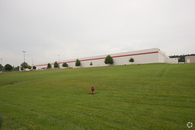
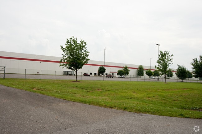
Property Detail
705 Canterbury Rd
154313
CANTERBURY ROAD PLAT BOOK 093 PAGE 046
Distributionwarehouseregional
GASTON
STOR2
North Carolina
AE The base floodplain where base flood elevations are provided. AE Zones are now used on new format FIRMs instead of A1-A30 Zones.
35.38 AC
2025
Gaston County
2025
Charlotte
031706
Charlotte-Concord-Gastonia, NC-SC
469,498 SF
NEARBY LISTINGS FOR SALE OR LEASE
DEMOGRAPHICS near 705 Canterbury Rd
1 mile
3 mile
5 mile
2025 Total Population
541
11,734
35,751
2030 Population
568
12,163
37,316
Pop Growth 2025-2030
+ 4.99%
+ 3.66%
+ 4.38%
Average Age
43
40
41
2025 Total Households
214
4,759
14,165
HH Growth 2025-2030
+ 5.14%
+ 3.76%
+ 4.53%
Median Household Inc
$48,269
$54,182
$61,514
Avg Household Size
2.40
2.40
2.50
2025 Avg HH Vehicles
2.00
2.00
2.00
Median Home Value
$246,428
$214,866
$224,085
Median Year Built
1976
1975
1977
Nearby Places
Map Layers
Map Styles
 Street
 Aerial
Layers
 Traffic
 Biking
Places
Listings with unknown addresses are not visible on the map
- Restaurants
- Banks
- Shops
- Fitness
- Groceries
PUBLIC TRANSPORTATION
AIRPORT
Charlotte/Douglas International
Drive
Walk
Distance
Charlotte/Douglas International
43 min
27.1 mi
Freight Ports
North Charleston Terminal
Drive
Walk
Distance
North Charleston Terminal
247 min
208.2 mi
Nearby Properties
Address
Land Use
TOTAL SIZE
Lot Size
Zoning
Address
Land Use
TOTAL SIZE
Lot Size
Zoning
163 AC
Address
Land Use
TOTAL SIZE
Lot Size
Zoning
536,116 SF
45.22 AC
HI
Address
Land Use
TOTAL SIZE
Lot Size
Zoning
12,183 SF
78.45 AC
INDS3
Address
Land Use
TOTAL SIZE
Lot Size
Zoning
Address
Land Use
TOTAL SIZE
Lot Size
Zoning
1,200 SF
487.79 AC
I2
Address
Land Use
TOTAL SIZE
Lot Size
Zoning
12.52 AC
RO
Address
Land Use
TOTAL SIZE
Lot Size
Zoning
300,993 SF
19.39 AC
HI
Address
Land Use
TOTAL SIZE
Lot Size
Zoning
1,276 SF
3,547.93 AC
Address
Land Use
TOTAL SIZE
Lot Size
Zoning
32.87 AC
Address
Land Use
TOTAL SIZE
Lot Size
Zoning
135,000 SF
20.43 AC
HI
Address
Land Use
TOTAL SIZE
Lot Size
Zoning
175,610 SF
25.84 AC
LI
Address
Land Use
TOTAL SIZE
Lot Size
Zoning
32,880 SF
2.88 AC
R08
Address
Land Use
TOTAL SIZE
Lot Size
Zoning
44,094 SF
2.67 AC
HI
Address
Land Use
TOTAL SIZE
Lot Size
Zoning
4,935 SF
13.07 AC
LI
Address
Land Use
TOTAL SIZE
Lot Size
Zoning
7,000 SF
536.04 AC
HI
Address
Land Use
TOTAL SIZE
Lot Size
Zoning
149,927 SF
5 AC
LI
Address
Land Use
TOTAL SIZE
Lot Size
Zoning
111,034 SF
39.75 AC
OFF01
Address
Land Use
TOTAL SIZE
Lot Size
Zoning
9,968 SF
18.38 AC
PUB01
Address
Land Use
TOTAL SIZE
Lot Size
Zoning
32,926 SF
4.40 AC
RO
Address
Land Use
TOTAL SIZE
Lot Size
Zoning
1,500 SF
10.02 AC
INDS1
Address
Land Use
TOTAL SIZE
Lot Size
Zoning
100,225 SF
10.48 AC
HI
Address
Land Use
TOTAL SIZE
Lot Size
Zoning
11,920 SF
3.10 AC
GB
Address
Land Use
TOTAL SIZE
Lot Size
Zoning
42,045 SF
5 AC
GB
Address
Land Use
TOTAL SIZE
Lot Size
Zoning
233,000 SF
20.87 AC
INDS2
Address
Land Use
TOTAL SIZE
Lot Size
Zoning
2,700 SF
21.20 AC
GB
Address
Land Use
TOTAL SIZE
Lot Size
Zoning
5,291 SF
4 AC
RO
Address
Land Use
TOTAL SIZE
Lot Size
Zoning
187,920 SF
14.51 AC
LI
Address
Land Use
TOTAL SIZE
Lot Size
Zoning
48,324 SF
14.91 AC
LI
Address
Land Use
TOTAL SIZE
Lot Size
Zoning
22,012 SF
7.35 AC
LI
The World's #1 Commercial Real Estate Marketplace
Connect with us
© 2026 CoStar Group
The information above has been obtained from sources believed reliable. While we do not doubt its accuracy we have not verified it and make no guarantee, warranty or representation about it. It is your responsibility to independently confirm its accuracy and completeness. Any projections, opinions, assumptions, or estimates used are for example only and do not represent the current or future performance of the property. The value of this transaction to you depends on tax and other factors which should be evaluated by your tax, financial, and legal advisors. You and your advisors should conduct a careful, independent investigation of the property to determine to your satisfaction the suitability of the property for your needs.