Property Record
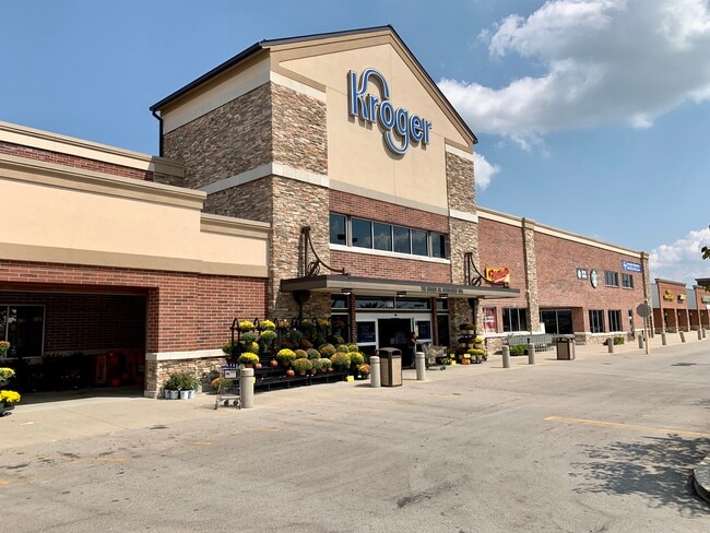
705 E Main St, Lebanon, KY 40033

Property Detail
705 E Main St
064-013-01A
705 E MAIN ST
Commercialnec
Marion
B and X Area of moderate flood hazard, usually the area between the limits of the 100-year and 500-year floods.
Kentucky
2025
4.30 AC
2025
Kentucky East Area
970200
Other Market Areas
38,340 SF
NEARBY LISTINGS FOR SALE OR LEASE
DEMOGRAPHICS near 705 E Main St
1 mile
3 mile
5 mile
2025 Total Population
1,801
7,970
10,434
2030 Population
1,800
7,987
10,461
Pop Growth 2025-2030
(0.06%)
+ 0.21%
+ 0.26%
Average Age
40
40
40
2025 Total Households
767
3,220
4,155
HH Growth 2025-2030
0.00%
+ 0.16%
+ 0.24%
Median Household Inc
$39,917
$47,583
$49,211
Avg Household Size
2.30
2.30
2.40
2025 Avg HH Vehicles
2.00
2.00
2.00
Median Home Value
$165,898
$174,782
$179,044
Median Year Built
1972
1975
1977
Nearby Places
Map Layers
Map Styles
 Street
 Aerial
Layers
 Traffic
 Biking
Places
Listings with unknown addresses are not visible on the map
- Restaurants
- Banks
- Shops
- Fitness
- Groceries
SALE & LEASE HISTORY
LISTING DATE
SALE/LEASE

Jun 02, 2020
For Sale
Nearby Properties
Address
Land Use
TOTAL SIZE
Lot Size
Zoning
Address
Land Use
TOTAL SIZE
Lot Size
Zoning
1,800 SF
244.13 AC
Address
Land Use
TOTAL SIZE
Lot Size
Zoning
34,800 SF
1.78 AC
Address
Land Use
TOTAL SIZE
Lot Size
Zoning
3,612 SF
64.61 AC
Address
Land Use
TOTAL SIZE
Lot Size
Zoning
105,533 SF
11.71 AC
Address
Land Use
TOTAL SIZE
Lot Size
Zoning
50,000 SF
58.71 AC
Address
Land Use
TOTAL SIZE
Lot Size
Zoning
18.50 AC
Address
Land Use
TOTAL SIZE
Lot Size
Zoning
217.78 AC
Address
Land Use
TOTAL SIZE
Lot Size
Zoning
31.14 AC
Address
Land Use
TOTAL SIZE
Lot Size
Zoning
37.94 AC
Address
Land Use
TOTAL SIZE
Lot Size
Zoning
28.98 AC
Address
Land Use
TOTAL SIZE
Lot Size
Zoning
33,750 SF
4.25 AC
Address
Land Use
TOTAL SIZE
Lot Size
Zoning
47.36 AC
Address
Land Use
TOTAL SIZE
Lot Size
Zoning
15,855 SF
9.01 AC
Address
Land Use
TOTAL SIZE
Lot Size
Zoning
26.69 AC
Address
Land Use
TOTAL SIZE
Lot Size
Zoning
17.57 AC
Address
Land Use
TOTAL SIZE
Lot Size
Zoning
14,820 SF
2.06 AC
Address
Land Use
TOTAL SIZE
Lot Size
Zoning
9.75 AC
Address
Land Use
TOTAL SIZE
Lot Size
Zoning
17.02 AC
Address
Land Use
TOTAL SIZE
Lot Size
Zoning
5,988 SF
8.93 AC
Address
Land Use
TOTAL SIZE
Lot Size
Zoning
5,988 SF
0.78 AC
Address
Land Use
TOTAL SIZE
Lot Size
Zoning
5,988 SF
1.18 AC
Address
Land Use
TOTAL SIZE
Lot Size
Zoning
5,988 SF
4.88 AC
Address
Land Use
TOTAL SIZE
Lot Size
Zoning
5,988 SF
0.30 AC
Address
Land Use
TOTAL SIZE
Lot Size
Zoning
5,988 SF
3.12 AC
Address
Land Use
TOTAL SIZE
Lot Size
Zoning
5,988 SF
3 AC
Address
Land Use
TOTAL SIZE
Lot Size
Zoning
5,988 SF
13 AC
Address
Land Use
TOTAL SIZE
Lot Size
Zoning
5,988 SF
0.17 AC
Address
Land Use
TOTAL SIZE
Lot Size
Zoning
5,988 SF
0.17 AC
Address
Land Use
TOTAL SIZE
Lot Size
Zoning
6.82 AC
Address
Land Use
TOTAL SIZE
Lot Size
Zoning
11.65 AC
The World's #1 Commercial Real Estate Marketplace
Connect with us
© 2026 CoStar Group
The information above has been obtained from sources believed reliable. While we do not doubt its accuracy we have not verified it and make no guarantee, warranty or representation about it. It is your responsibility to independently confirm its accuracy and completeness. Any projections, opinions, assumptions, or estimates used are for example only and do not represent the current or future performance of the property. The value of this transaction to you depends on tax and other factors which should be evaluated by your tax, financial, and legal advisors. You and your advisors should conduct a careful, independent investigation of the property to determine to your satisfaction the suitability of the property for your needs.