Property Record
705 E Us Highway 74 E, Rockingham, NC 28379
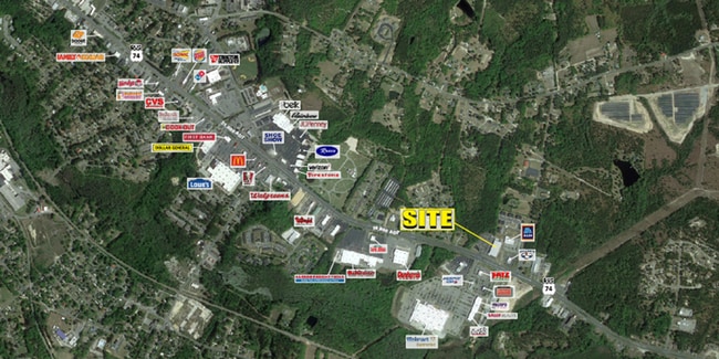
Property Detail
705 E Us Highway 74 E
Rockingham, NC
RICHMOND
747202-95-7304
North Carolina
Commercialnec
5.03 AC
B3
North Carolina Southeast Area
B and X Area of moderate flood hazard, usually the area between the limits of the 100-year and 500-year floods.
Other Market Areas
NEARBY LISTINGS FOR SALE OR LEASE
DEMOGRAPHICS near 705 E Us Highway 74 E
1 mile
3 mile
5 mile
2025 Total Population
1,773
19,799
30,296
2030 Population
1,725
19,672
29,998
Pop Growth 2025-2030
(2.71%)
(0.64%)
(0.98%)
Average Age
40
40
41
2025 Total Households
822
8,252
12,510
HH Growth 2025-2030
(3.04%)
(0.74%)
(1.03%)
Median Household Inc
$21,504
$37,200
$40,812
Avg Household Size
2.10
2.30
2.40
2025 Avg HH Vehicles
1.00
2.00
2.00
Median Home Value
$88,437
$127,057
$130,895
Median Year Built
1978
1972
1974
Nearby Places
Map Layers
Map Styles
 Street
 Aerial
Layers
 Traffic
 Biking
Places
Listings with unknown addresses are not visible on the map
- Restaurants
- Banks
- Shops
- Fitness
- Groceries
PUBLIC TRANSPORTATION
COMMUTER RAIL
Drive
Walk
Distance
7 min
3.4 mi
SALE & LEASE HISTORY
LISTING DATE
SALE/LEASE

Feb 14, 2020
For Sale
Feb 14, 2020
For Lease
Nearby Properties
Address
Land Use
TOTAL SIZE
Lot Size
Zoning
Address
Land Use
TOTAL SIZE
Lot Size
Zoning
43.38 AC
HI
Address
Land Use
TOTAL SIZE
Lot Size
Zoning
187,379 SF
43.43 AC
Address
Land Use
TOTAL SIZE
Lot Size
Zoning
131,657 SF
18.83 AC
Address
Land Use
TOTAL SIZE
Lot Size
Zoning
5,120 SF
15.36 AC
Address
Land Use
TOTAL SIZE
Lot Size
Zoning
66,923 SF
26.15 AC
Address
Land Use
TOTAL SIZE
Lot Size
Zoning
11,435 SF
2.04 AC
Address
Land Use
TOTAL SIZE
Lot Size
Zoning
25,854 SF
12.76 AC
I2
Address
Land Use
TOTAL SIZE
Lot Size
Zoning
20,240 SF
2.85 AC
Address
Land Use
TOTAL SIZE
Lot Size
Zoning
13,057 SF
1.78 AC
Address
Land Use
TOTAL SIZE
Lot Size
Zoning
156,574 SF
27.74 AC
B3
Address
Land Use
TOTAL SIZE
Lot Size
Zoning
20,280 SF
5.49 AC
Address
Land Use
TOTAL SIZE
Lot Size
Zoning
32,284 SF
7.82 AC
B3
Address
Land Use
TOTAL SIZE
Lot Size
Zoning
7,260 SF
10.85 AC
Address
Land Use
TOTAL SIZE
Lot Size
Zoning
42,140 SF
5.69 AC
Address
Land Use
TOTAL SIZE
Lot Size
Zoning
17,086 SF
4.92 AC
Address
Land Use
TOTAL SIZE
Lot Size
Zoning
15,903 SF
1.25 AC
Address
Land Use
TOTAL SIZE
Lot Size
Zoning
27,152 SF
8.21 AC
Address
Land Use
TOTAL SIZE
Lot Size
Zoning
Address
Land Use
TOTAL SIZE
Lot Size
Zoning
93,600 SF
7.47 AC
HI
Address
Land Use
TOTAL SIZE
Lot Size
Zoning
62,360 SF
10.16 AC
Address
Land Use
TOTAL SIZE
Lot Size
Zoning
11,572 SF
1.67 AC
Address
Land Use
TOTAL SIZE
Lot Size
Zoning
13,200 SF
7.59 AC
Address
Land Use
TOTAL SIZE
Lot Size
Zoning
17,061 SF
3.13 AC
R12
Address
Land Use
TOTAL SIZE
Lot Size
Zoning
7,566 SF
9.40 AC
Address
Land Use
TOTAL SIZE
Lot Size
Zoning
6,603 SF
2.45 AC
Address
Land Use
TOTAL SIZE
Lot Size
Zoning
4,940 SF
5.99 AC
Address
Land Use
TOTAL SIZE
Lot Size
Zoning
15,000 SF
2.49 AC
B3
Address
Land Use
TOTAL SIZE
Lot Size
Zoning
7,325 SF
1.78 AC
Address
Land Use
TOTAL SIZE
Lot Size
Zoning
7,176 SF
13.54 AC
The World's #1 Commercial Real Estate Marketplace
Connect with us
© 2026 CoStar Group
The information above has been obtained from sources believed reliable. While we do not doubt its accuracy we have not verified it and make no guarantee, warranty or representation about it. It is your responsibility to independently confirm its accuracy and completeness. Any projections, opinions, assumptions, or estimates used are for example only and do not represent the current or future performance of the property. The value of this transaction to you depends on tax and other factors which should be evaluated by your tax, financial, and legal advisors. You and your advisors should conduct a careful, independent investigation of the property to determine to your satisfaction the suitability of the property for your needs.