Property Record
705 E Whitmore Ave, Modesto, CA 95358


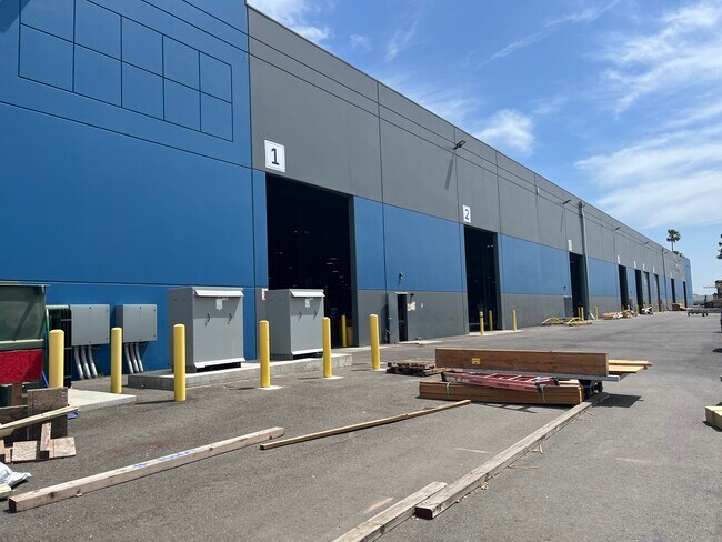
Property Detail
705 E Whitmore Ave
086-14-32
STANISLAUS
Heavyindustrial
California
MODM2
17.34 AC
2025
Modesto
2025
Stockton/Modesto
002506
Modesto, CA
194,384 SF
NEARBY LISTINGS FOR SALE OR LEASE
DEMOGRAPHICS near 705 E Whitmore Ave
1 mile
3 mile
5 mile
2024 Total Population
11,784
99,373
182,366
2029 Population
11,874
100,028
183,392
Pop Growth 2024-2029
+ 0.76%
+ 0.66%
+ 0.56%
Average Age
34
35
36
2024 Total Households
3,072
26,894
54,932
HH Growth 2024-2029
+ 0.81%
+ 0.70%
+ 0.58%
Median Household Inc
$77,229
$69,013
$74,573
Avg Household Size
3.70
3.60
3.20
2024 Avg HH Vehicles
2.00
2.00
2.00
Median Home Value
$441,234
$400,568
$417,259
Median Year Built
1995
1978
1974
Nearby Places
Map Layers
Map Styles
 Street
 Aerial
Transit
 Traffic
 Biking
Places
Listings with unknown addresses are not visible on the map
- Restaurants
- Banks
- Shops
- Fitness
- Groceries
PUBLIC TRANSPORTATION
AIRPORT
Stockton Metro
Drive
Walk
Distance
Stockton Metro
39 min
28.7 mi
Freight Ports
Port of Stockton
Drive
Walk
Distance
Port of Stockton
48 min
37.2 mi
SALE & LEASE HISTORY
LISTING DATE
SALE/LEASE

Jun 13, 2023
For Lease
Nearby Properties
Address
Land Use
TOTAL SIZE
Lot Size
Zoning
Address
Land Use
TOTAL SIZE
Lot Size
Zoning
817,526 SF
17.31 AC
Address
Land Use
TOTAL SIZE
Lot Size
Zoning
373,574 SF
23 AC
Address
Land Use
TOTAL SIZE
Lot Size
Zoning
877,788 SF
103.22 AC
MI
Address
Land Use
TOTAL SIZE
Lot Size
Zoning
726,299 SF
38.86 AC
M2
Address
Land Use
TOTAL SIZE
Lot Size
Zoning
774,633 SF
39.18 AC
MODM2
Address
Land Use
TOTAL SIZE
Lot Size
Zoning
153,937 SF
7.87 AC
Address
Land Use
TOTAL SIZE
Lot Size
Zoning
1,897,790 SF
92.04 AC
M2
Address
Land Use
TOTAL SIZE
Lot Size
Zoning
151,288 SF
6.50 AC
Address
Land Use
TOTAL SIZE
Lot Size
Zoning
77,382 SF
2.60 AC
Address
Land Use
TOTAL SIZE
Lot Size
Zoning
697,000 SF
37.82 AC
MODM2
Address
Land Use
TOTAL SIZE
Lot Size
Zoning
775,280 SF
30.42 AC
COUM
Address
Land Use
TOTAL SIZE
Lot Size
Zoning
186,058 SF
14.35 AC
CERRC
Address
Land Use
TOTAL SIZE
Lot Size
Zoning
204,801 SF
12.99 AC
M2
Address
Land Use
TOTAL SIZE
Lot Size
Zoning
206,271 SF
6.94 AC
Address
Land Use
TOTAL SIZE
Lot Size
Zoning
256,014 SF
19.38 AC
Address
Land Use
TOTAL SIZE
Lot Size
Zoning
326,176 SF
14.92 AC
MODM2
Address
Land Use
TOTAL SIZE
Lot Size
Zoning
255,404 SF
17.49 AC
Address
Land Use
TOTAL SIZE
Lot Size
Zoning
447,488 SF
22.67 AC
Address
Land Use
TOTAL SIZE
Lot Size
Zoning
71,572 SF
5.35 AC
Address
Land Use
TOTAL SIZE
Lot Size
Zoning
362,384 SF
19.43 AC
Address
Land Use
TOTAL SIZE
Lot Size
Zoning
61,640 SF
5.39 AC
Address
Land Use
TOTAL SIZE
Lot Size
Zoning
174,524 SF
11.61 AC
M
Address
Land Use
TOTAL SIZE
Lot Size
Zoning
73,290 SF
6 AC
MODPD
Address
Land Use
TOTAL SIZE
Lot Size
Zoning
156,414 SF
6.57 AC
Address
Land Use
TOTAL SIZE
Lot Size
Zoning
392,796 SF
25.89 AC
COUM
Address
Land Use
TOTAL SIZE
Lot Size
Zoning
172,380 SF
11.92 AC
M2
Address
Land Use
TOTAL SIZE
Lot Size
Zoning
171,244 SF
5.18 AC
Address
Land Use
TOTAL SIZE
Lot Size
Zoning
102,489 SF
10.27 AC
C2
Address
Land Use
TOTAL SIZE
Lot Size
Zoning
664,240 SF
21.49 AC
The World's #1 Commercial Real Estate Marketplace
Connect with us
© 2026 CoStar Group
The information above has been obtained from sources believed reliable. While we do not doubt its accuracy we have not verified it and make no guarantee, warranty or representation about it. It is your responsibility to independently confirm its accuracy and completeness. Any projections, opinions, assumptions, or estimates used are for example only and do not represent the current or future performance of the property. The value of this transaction to you depends on tax and other factors which should be evaluated by your tax, financial, and legal advisors. You and your advisors should conduct a careful, independent investigation of the property to determine to your satisfaction the suitability of the property for your needs.