Property Record
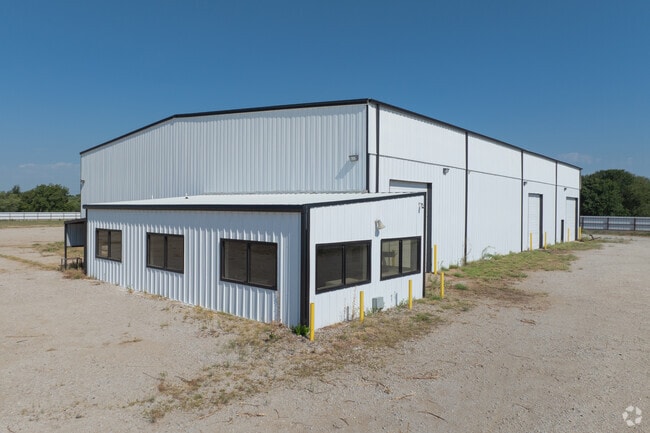
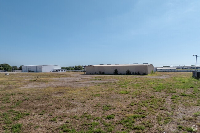
705 Industrial Loop, Breckenridge, TX 76424

Property Detail
705 Industrial Loop
R12056
BLK: 3 & 4 SUBD: INDUSTRIAL PARK TRACT: W/84.115 X 94 OF 4, & .765 OF 3
Industrialgeneral
Stephens
2025
Texas
2025
10.01 AC
950300
Breckenridge
11,280 SF
Other Market Areas
NEARBY LISTINGS FOR SALE OR LEASE
-
-
View all Breckenridge listings for lease on LoopNet.com
DEMOGRAPHICS near 705 Industrial Loop
1 mile
3 mile
5 mile
2025 Total Population
1,883
5,880
6,589
2030 Population
1,912
5,901
6,611
Pop Growth 2025-2030
+ 1.54%
+ 0.36%
+ 0.33%
Average Age
38
39
40
2025 Total Households
710
2,289
2,557
HH Growth 2025-2030
+ 2.11%
+ 0.79%
+ 0.74%
Median Household Inc
$53,010
$48,270
$49,211
Avg Household Size
2.60
2.50
2.50
2025 Avg HH Vehicles
2.00
2.00
2.00
Median Home Value
$69,009
$79,511
$86,505
Median Year Built
1960
1965
1967
Nearby Places
Map Layers
Map Styles
 Street
 Aerial
Transit
 Traffic
 Biking
Places
Listings with unknown addresses are not visible on the map
- Restaurants
- Banks
- Shops
- Fitness
- Groceries
SALE & LEASE HISTORY
LISTING DATE
SALE/LEASE

Jun 27, 2023
For Lease
Jun 26, 2023
For Sale
Feb 29, 2024
For Lease
Feb 29, 2024
For Sale
Nearby Properties
Address
Land Use
TOTAL SIZE
Lot Size
Zoning
Address
Land Use
TOTAL SIZE
Lot Size
Zoning
24,856 SF
1.38 AC
Address
Land Use
TOTAL SIZE
Lot Size
Zoning
143,468 SF
25.39 AC
Address
Land Use
TOTAL SIZE
Lot Size
Zoning
30,043 SF
4.71 AC
Address
Land Use
TOTAL SIZE
Lot Size
Zoning
26,254 SF
0.71 AC
Address
Land Use
TOTAL SIZE
Lot Size
Zoning
95,713 SF
11.48 AC
Address
Land Use
TOTAL SIZE
Lot Size
Zoning
35,548 SF
7 AC
Address
Land Use
TOTAL SIZE
Lot Size
Zoning
29,977 SF
1.49 AC
Address
Land Use
TOTAL SIZE
Lot Size
Zoning
51,108 SF
6.33 AC
Address
Land Use
TOTAL SIZE
Lot Size
Zoning
19,120 SF
3.94 AC
Address
Land Use
TOTAL SIZE
Lot Size
Zoning
43,904 SF
0.34 AC
Address
Land Use
TOTAL SIZE
Lot Size
Zoning
14,897 SF
0.34 AC
Address
Land Use
TOTAL SIZE
Lot Size
Zoning
29,540 SF
1.94 AC
Address
Land Use
TOTAL SIZE
Lot Size
Zoning
65,430 SF
6.49 AC
Address
Land Use
TOTAL SIZE
Lot Size
Zoning
12,016 SF
1.03 AC
Address
Land Use
TOTAL SIZE
Lot Size
Zoning
11,521 SF
0.62 AC
Address
Land Use
TOTAL SIZE
Lot Size
Zoning
35,640 SF
5 AC
Address
Land Use
TOTAL SIZE
Lot Size
Zoning
9,481 SF
1.03 AC
Address
Land Use
TOTAL SIZE
Lot Size
Zoning
13,100 SF
1.12 AC
Address
Land Use
TOTAL SIZE
Lot Size
Zoning
25,330 SF
5.37 AC
Address
Land Use
TOTAL SIZE
Lot Size
Zoning
18,322 SF
3.69 AC
Address
Land Use
TOTAL SIZE
Lot Size
Zoning
Address
Land Use
TOTAL SIZE
Lot Size
Zoning
38,744 SF
2.59 AC
Address
Land Use
TOTAL SIZE
Lot Size
Zoning
15,050 SF
2.07 AC
Address
Land Use
TOTAL SIZE
Lot Size
Zoning
87,025 SF
8.78 AC
Address
Land Use
TOTAL SIZE
Lot Size
Zoning
16,100 SF
3.40 AC
Address
Land Use
TOTAL SIZE
Lot Size
Zoning
Address
Land Use
TOTAL SIZE
Lot Size
Zoning
9,800 SF
5.32 AC
Address
Land Use
TOTAL SIZE
Lot Size
Zoning
33,465 SF
0.48 AC
Address
Land Use
TOTAL SIZE
Lot Size
Zoning
10,377 SF
4.62 AC
Address
Land Use
TOTAL SIZE
Lot Size
Zoning
7,360 SF
1 AC
The World's #1 Commercial Real Estate Marketplace
Connect with us
© 2026 CoStar Group
The information above has been obtained from sources believed reliable. While we do not doubt its accuracy we have not verified it and make no guarantee, warranty or representation about it. It is your responsibility to independently confirm its accuracy and completeness. Any projections, opinions, assumptions, or estimates used are for example only and do not represent the current or future performance of the property. The value of this transaction to you depends on tax and other factors which should be evaluated by your tax, financial, and legal advisors. You and your advisors should conduct a careful, independent investigation of the property to determine to your satisfaction the suitability of the property for your needs.