Property Record
705 Parsons Rd, Traverse City, MI 49686


Save to a Folder
{{folder.Name}}
{{folder.ListingIds.length}} Properties
{{folder.ListingIds.length}} Property
Create a New Folder
Property Detail
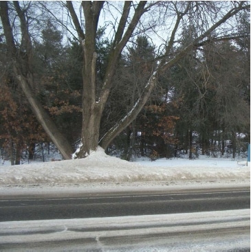
705 Parsons Rd
51-112-014-15
PRT OF E OF SEC 12 COM AT E COR TH N8956'20!! W 664.5 FT TO POB TH N0007'16!!W 214.98 FT TH S8952'44
Lightindustrial
Grand Traverse
B and X Area of moderate flood hazard, usually the area between the limits of the 100-year and 500-year floods.
Michigan
2025
1.70 AC
2026
Michigan Northwest Area
551100
Other Market Areas
12,350 SF
Traverse City, MI
NEARBY LISTINGS FOR SALE OR LEASE
DEMOGRAPHICS near 705 Parsons Rd
1 mile
3 mile
5 mile
2025 Total Population
2,939
24,410
43,971
2030 Population
2,917
24,302
43,698
Pop Growth 2025-2030
(0.75%)
(0.44%)
(0.62%)
Average Age
42
44
44
2025 Total Households
1,331
11,467
19,901
HH Growth 2025-2030
(0.75%)
(0.45%)
(0.61%)
Median Household Inc
$79,602
$69,188
$78,486
Avg Household Size
2.00
2.00
2.10
2025 Avg HH Vehicles
2.00
2.00
2.00
Median Home Value
$333,864
$336,664
$357,291
Median Year Built
1965
1977
1982
Nearby Places
Map Layers
Map Styles
 Street
 Aerial
Layers
 Traffic
 Biking
Places
Listings with unknown addresses are not visible on the map
- Restaurants
- Banks
- Shops
- Fitness
- Groceries
PUBLIC TRANSPORTATION
AIRPORT
Cherry Capital
Drive
Walk
Distance
Cherry Capital
4 min
1.0 mi
Nearby Properties
Address
Land Use
TOTAL SIZE
Lot Size
Zoning
Address
Land Use
TOTAL SIZE
Lot Size
Zoning
3,682 SF
9.21 AC
Address
Land Use
TOTAL SIZE
Lot Size
Zoning
Address
Land Use
TOTAL SIZE
Lot Size
Zoning
54,254 SF
4.83 AC
Address
Land Use
TOTAL SIZE
Lot Size
Zoning
53,806 SF
77.29 AC
Address
Land Use
TOTAL SIZE
Lot Size
Zoning
5,308 SF
27.64 AC
Address
Land Use
TOTAL SIZE
Lot Size
Zoning
40,791 SF
1.53 AC
Address
Land Use
TOTAL SIZE
Lot Size
Zoning
78,739 SF
0.84 AC
Address
Land Use
TOTAL SIZE
Lot Size
Zoning
41,084 SF
22.79 AC
Address
Land Use
TOTAL SIZE
Lot Size
Zoning
103,000 SF
4.77 AC
Address
Land Use
TOTAL SIZE
Lot Size
Zoning
123,544 SF
3.93 AC
Address
Land Use
TOTAL SIZE
Lot Size
Zoning
57,780 SF
1.77 AC
Address
Land Use
TOTAL SIZE
Lot Size
Zoning
25,208 SF
15.01 AC
Address
Land Use
TOTAL SIZE
Lot Size
Zoning
71,389 SF
0.65 AC
Address
Land Use
TOTAL SIZE
Lot Size
Zoning
77,000 SF
1.71 AC
Address
Land Use
TOTAL SIZE
Lot Size
Zoning
59,000 SF
46.12 AC
Address
Land Use
TOTAL SIZE
Lot Size
Zoning
88,964 SF
0.86 AC
Address
Land Use
TOTAL SIZE
Lot Size
Zoning
99,848 SF
0.99 AC
Address
Land Use
TOTAL SIZE
Lot Size
Zoning
81,900 SF
870.88 AC
Address
Land Use
TOTAL SIZE
Lot Size
Zoning
6,354 SF
97.88 AC
Address
Land Use
TOTAL SIZE
Lot Size
Zoning
39,988 SF
0.88 AC
Address
Land Use
TOTAL SIZE
Lot Size
Zoning
33,184 SF
0.76 AC
Address
Land Use
TOTAL SIZE
Lot Size
Zoning
18,558 SF
0.42 AC
Address
Land Use
TOTAL SIZE
Lot Size
Zoning
Address
Land Use
TOTAL SIZE
Lot Size
Zoning
Address
Land Use
TOTAL SIZE
Lot Size
Zoning
70,134 SF
1.37 AC
Address
Land Use
TOTAL SIZE
Lot Size
Zoning
74,411 SF
28.31 AC
Address
Land Use
TOTAL SIZE
Lot Size
Zoning
139,710 SF
8.04 AC
Address
Land Use
TOTAL SIZE
Lot Size
Zoning
Address
Land Use
TOTAL SIZE
Lot Size
Zoning
4,524 SF
1.13 AC
Address
Land Use
TOTAL SIZE
Lot Size
Zoning
The World's #1 Commercial Real Estate Marketplace
Connect with us
© 2026 CoStar Group
The information above has been obtained from sources believed reliable. While we do not doubt its accuracy we have not verified it and make no guarantee, warranty or representation about it. It is your responsibility to independently confirm its accuracy and completeness. Any projections, opinions, assumptions, or estimates used are for example only and do not represent the current or future performance of the property. The value of this transaction to you depends on tax and other factors which should be evaluated by your tax, financial, and legal advisors. You and your advisors should conduct a careful, independent investigation of the property to determine to your satisfaction the suitability of the property for your needs.