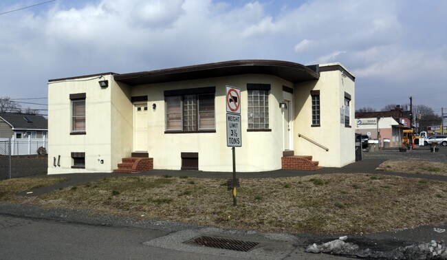
Property Record
705 State Rd, Croydon, PA 19021

Save to a Folder
{{folder.Name}}
{{folder.ListingIds.length}} Properties
{{folder.ListingIds.length}} Property
Create a New Folder
Property Detail
705 State Rd
05-011-081
CROYDON HTS SEC H LOTS #3 3-34 50X125
Officebuilding
Bucks
C
Pennsylvania
B and X Area of moderate flood hazard, usually the area between the limits of the 100-year and 500-year floods.
3
2025
0.14 AC
2026
Lower Bucks County
100302
Philadelphia
932 SF
Philadelphia-Camden-Wilmington, PA-NJ-DE-MD
NEARBY LISTINGS FOR SALE OR LEASE
DEMOGRAPHICS near 705 State Rd
1 mile
3 mile
5 mile
2025 Total Population
7,897
86,416
252,905
2030 Population
7,943
87,939
255,042
Pop Growth 2025-2030
+ 0.58%
+ 1.76%
+ 0.84%
Average Age
42
41
42
2025 Total Households
2,845
33,529
96,249
HH Growth 2025-2030
+ 0.53%
+ 1.84%
+ 0.81%
Median Household Inc
$73,520
$75,316
$84,209
Avg Household Size
2.70
2.50
2.50
2025 Avg HH Vehicles
2.00
2.00
2.00
Median Home Value
$279,367
$305,896
$306,738
Median Year Built
1955
1968
1966
Nearby Places
Map Layers
Map Styles
 Street
 Aerial
Layers
 Traffic
 Biking
Places
Listings with unknown addresses are not visible on the map
- Restaurants
- Banks
- Shops
- Fitness
- Groceries
PUBLIC TRANSPORTATION
TRANSIT/SUBWAY
Croydon (R7 - Southeastern Pennsylvania Transportation Authority Regional Rail (SEPTA Regional Rail))
Drive
Walk
Distance
Croydon (R7 - Southeastern Pennsylvania Transportation Authority Regional Rail (SEPTA Regional Rail))
2 min
12 min
0.6 mi
COMMUTER RAIL
Croydon (R7 - Southeastern Pennsylvania Transportation Authority Regional Rail (SEPTA Regional Rail))
Drive
Walk
Distance
Croydon (R7 - Southeastern Pennsylvania Transportation Authority Regional Rail (SEPTA Regional Rail))
2 min
12 min
0.6 mi
Eddington (R7 - Southeastern Pennsylvania Transportation Authority Regional Rail (SEPTA Regional Rail))
Drive
Walk
Distance
Eddington (R7 - Southeastern Pennsylvania Transportation Authority Regional Rail (SEPTA Regional Rail))
4 min
2.0 mi
AIRPORT
Trenton Mercer
Drive
Walk
Distance
Trenton Mercer
30 min
17.1 mi
Philadelphia International
Drive
Walk
Distance
Philadelphia International
43 min
28.2 mi
Freight Ports
Port of Philadelphia
Drive
Walk
Distance
Port of Philadelphia
23 min
14.5 mi
SALE & LEASE HISTORY
LISTING DATE
SALE/LEASE

Nov 10, 2017
For Lease
May 21, 2021
For Lease
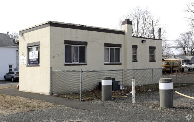
Nearby Properties
Address
Land Use
TOTAL SIZE
Lot Size
Zoning
Address
Land Use
TOTAL SIZE
Lot Size
Zoning
39.18 AC
Address
Land Use
TOTAL SIZE
Lot Size
Zoning
22,688 SF
32.55 AC
BLI1
Address
Land Use
TOTAL SIZE
Lot Size
Zoning
32.72 AC
Address
Land Use
TOTAL SIZE
Lot Size
Zoning
Address
Land Use
TOTAL SIZE
Lot Size
Zoning
376 SF
32.32 AC
B-3
Address
Land Use
TOTAL SIZE
Lot Size
Zoning
136,315 SF
11.38 AC
CA1
Address
Land Use
TOTAL SIZE
Lot Size
Zoning
253,500 SF
24.28 AC
BLI1
Address
Land Use
TOTAL SIZE
Lot Size
Zoning
1,325 SF
18.73 AC
Address
Land Use
TOTAL SIZE
Lot Size
Zoning
9.65 AC
Address
Land Use
TOTAL SIZE
Lot Size
Zoning
372,324 SF
17 AC
Address
Land Use
TOTAL SIZE
Lot Size
Zoning
11 AC
TRN
Address
Land Use
TOTAL SIZE
Lot Size
Zoning
15.09 AC
I-1
Address
Land Use
TOTAL SIZE
Lot Size
Zoning
10.73 AC
BLI1
Address
Land Use
TOTAL SIZE
Lot Size
Zoning
208,036 SF
28.81 AC
Address
Land Use
TOTAL SIZE
Lot Size
Zoning
16.16 AC
Address
Land Use
TOTAL SIZE
Lot Size
Zoning
Address
Land Use
TOTAL SIZE
Lot Size
Zoning
16,918 SF
13.56 AC
B-3
Address
Land Use
TOTAL SIZE
Lot Size
Zoning
287,866 SF
47.54 AC
I-1
Address
Land Use
TOTAL SIZE
Lot Size
Zoning
20.65 AC
Address
Land Use
TOTAL SIZE
Lot Size
Zoning
1,997 SF
2.17 AC
Address
Land Use
TOTAL SIZE
Lot Size
Zoning
3.74 AC
Address
Land Use
TOTAL SIZE
Lot Size
Zoning
8.60 AC
R-1
Address
Land Use
TOTAL SIZE
Lot Size
Zoning
2.43 AC
W-1
Address
Land Use
TOTAL SIZE
Lot Size
Zoning
242 AC
OS-1
Address
Land Use
TOTAL SIZE
Lot Size
Zoning
8.40 AC
Address
Land Use
TOTAL SIZE
Lot Size
Zoning
4.01 AC
Address
Land Use
TOTAL SIZE
Lot Size
Zoning
120 SF
10.50 AC
B-3
Address
Land Use
TOTAL SIZE
Lot Size
Zoning
9.15 AC
B2
Address
Land Use
TOTAL SIZE
Lot Size
Zoning
8.93 AC
B1
Address
Land Use
TOTAL SIZE
Lot Size
Zoning
21,000 SF
3.42 AC
CA1
The World's #1 Commercial Real Estate Marketplace
Connect with us
© 2026 CoStar Group
The information above has been obtained from sources believed reliable. While we do not doubt its accuracy we have not verified it and make no guarantee, warranty or representation about it. It is your responsibility to independently confirm its accuracy and completeness. Any projections, opinions, assumptions, or estimates used are for example only and do not represent the current or future performance of the property. The value of this transaction to you depends on tax and other factors which should be evaluated by your tax, financial, and legal advisors. You and your advisors should conduct a careful, independent investigation of the property to determine to your satisfaction the suitability of the property for your needs.