Property Record
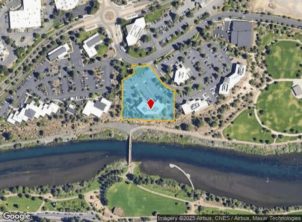
705 Sw Bonnett Way, Bend, OR 97702


NEARBY LISTINGS FOR SALE OR LEASE
Property Detail
705 Sw Bonnett Way
Bend-Redmond, OR
Mill Point Riverbend Pud
208781
MILL POINT RIVERBEND PUD LOT 1
Commercialnec
Deschutes
X
Oregon
41017C0662E
1
2025
1.81 AC
2025
Deschutes County
001402
Portland
20,110 SF
DEMOGRAPHICS near 705 Sw Bonnett Way
1 Mile
3 Mile
5 Mile
2024 Total Population
10,042
73,893
112,660
2029 Population
11,450
82,652
125,695
Pop Growth 2024-2029
+ 14.02%
+ 11.85%
+ 11.57%
Average Age
42
41
41
2024 Total Households
4,308
30,787
46,086
HH Growth 2024-2029
+ 14.21%
+ 11.98%
+ 11.72%
Median Household Inc
$85,645
$83,836
$85,024
Avg Household Size
2.20
2.30
2.40
2024 Avg HH Vehicles
2.00
2.00
2.00
Median Home Value
$732,929
$660,605
$632,133
Median Year Built
1998
1999
1999
Nearby Places
Map Layers
Map Styles
 Street
 Aerial
- Restaurants
- Banks
- Shops
- Fitness
- Groceries
PUBLIC TRANSPORTATION
AIRPORT
Roberts Field
DRIVE
WALK
Distance
Roberts Field
29 min
18.5 mi
SALE & LEASE HISTORY
LISTING DATE
SALE/LEASE

Oct 17, 2018
For Lease
May 09, 2019
For Lease
Jun 28, 2017
For Lease
Aug 21, 2023
For Lease
Nearby Properties
Address
Land Use
TOTAL SIZE
Lot Size
Zoning
Address
Land Use
TOTAL SIZE
Lot Size
Zoning
3.74 AC
MR
Address
Land Use
TOTAL SIZE
Lot Size
Zoning
25,574 SF
3.74 AC
MR
Address
Land Use
TOTAL SIZE
Lot Size
Zoning
27,863 SF
4.23 AC
MU
Address
Land Use
TOTAL SIZE
Lot Size
Zoning
318,598 SF
9.77 AC
RS
Address
Land Use
TOTAL SIZE
Lot Size
Zoning
166,371 SF
2.52 AC
MU
Address
Land Use
TOTAL SIZE
Lot Size
Zoning
199,892 SF
19.16 AC
CG
Address
Land Use
TOTAL SIZE
Lot Size
Zoning
1.04 AC
CB
Address
Land Use
TOTAL SIZE
Lot Size
Zoning
201,575 SF
1.04 AC
CB
Address
Land Use
TOTAL SIZE
Lot Size
Zoning
165,048 SF
4.68 AC
RM
Address
Land Use
TOTAL SIZE
Lot Size
Zoning
1,248 SF
5.04 AC
RM
Address
Land Use
TOTAL SIZE
Lot Size
Zoning
129,449 SF
2.91 AC
MR
Address
Land Use
TOTAL SIZE
Lot Size
Zoning
229,286 SF
17.96 AC
CG
Address
Land Use
TOTAL SIZE
Lot Size
Zoning
70,294 SF
17.96 AC
CG
Address
Land Use
TOTAL SIZE
Lot Size
Zoning
24.36 AC
IG
Address
Land Use
TOTAL SIZE
Lot Size
Zoning
24.36 AC
Address
Land Use
TOTAL SIZE
Lot Size
Zoning
46,317 SF
5.67 AC
RM
Address
Land Use
TOTAL SIZE
Lot Size
Zoning
170,218 SF
13.27 AC
RS
Address
Land Use
TOTAL SIZE
Lot Size
Zoning
49,923 SF
18.42 AC
PF
Address
Land Use
TOTAL SIZE
Lot Size
Zoning
172,121 SF
3.92 AC
RH
Address
Land Use
TOTAL SIZE
Lot Size
Zoning
132,020 SF
12.11 AC
CG
Address
Land Use
TOTAL SIZE
Lot Size
Zoning
21.41 AC
MU
Address
Land Use
TOTAL SIZE
Lot Size
Zoning
2.17 AC
Address
Land Use
TOTAL SIZE
Lot Size
Zoning
88,619 SF
2.17 AC
ME
Address
Land Use
TOTAL SIZE
Lot Size
Zoning
7,920 SF
8.62 AC
RH
Address
Land Use
TOTAL SIZE
Lot Size
Zoning
105,069 SF
4.97 AC
RS
Address
Land Use
TOTAL SIZE
Lot Size
Zoning
164,959 SF
9.30 AC
CG
Address
Land Use
TOTAL SIZE
Lot Size
Zoning
164,959 SF
9.30 AC
CG
Address
Land Use
TOTAL SIZE
Lot Size
Zoning
7.73 AC
MR
Address
Land Use
TOTAL SIZE
Lot Size
Zoning
7.73 AC
MR
The World's #1 Commercial Real Estate Marketplace
Connect with us
© 2025 CoStar Group
The information above has been obtained from sources believed reliable. While we do not doubt its accuracy we have not verified it and make no guarantee, warranty or representation about it. It is your responsibility to independently confirm its accuracy and completeness. Any projections, opinions, assumptions, or estimates used are for example only and do not represent the current or future performance of the property. The value of this transaction to you depends on tax and other factors which should be evaluated by your tax, financial, and legal advisors. You and your advisors should conduct a careful, independent investigation of the property to determine to your satisfaction the suitability of the property for your needs.