Property Record
705 W Baptist Rd, Colorado Springs, CO 80921
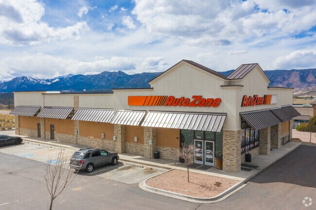


Property Detail
705 W Baptist Rd
Colorado Springs, CO
LOT 5A MONUMENT RIDGE REPLAT NO 4
71362-01-008
EL PASO
Commercialbuilding
Colorado
PUD
5a
2024
1.02 AC
2025
Northeast
007203
Colorado Springs
7,392 SF
NEARBY LISTINGS FOR SALE OR LEASE
DEMOGRAPHICS near 705 W Baptist Rd
1 mile
3 mile
5 mile
2025 Total Population
5,327
30,371
58,922
2030 Population
5,518
31,381
60,736
Pop Growth 2025-2030
+ 3.59%
+ 3.33%
+ 3.08%
Average Age
40
41
41
2025 Total Households
1,844
10,734
20,950
HH Growth 2025-2030
+ 3.90%
+ 3.57%
+ 3.36%
Median Household Inc
$164,675
$147,760
$147,840
Avg Household Size
2.90
2.80
2.80
2025 Avg HH Vehicles
2.00
2.00
2.00
Median Home Value
$707,571
$720,398
$746,750
Median Year Built
2006
2003
2003
Nearby Places
Map Layers
Map Styles
 Street
 Aerial
Layers
 Traffic
 Biking
Places
Listings with unknown addresses are not visible on the map
- Restaurants
- Banks
- Shops
- Fitness
- Groceries
PUBLIC TRANSPORTATION
AIRPORT
City of Colorado Springs Municipal
Drive
Walk
Distance
City of Colorado Springs Municipal
37 min
24.1 mi
Nearby Properties
Address
Land Use
TOTAL SIZE
Lot Size
Zoning
Address
Land Use
TOTAL SIZE
Lot Size
Zoning
136,906 SF
25.22 AC
PRD-4
Address
Land Use
TOTAL SIZE
Lot Size
Zoning
112,266 SF
0.24 AC
RR3
Address
Land Use
TOTAL SIZE
Lot Size
Zoning
57,619 SF
3.26 AC
SFD-2
Address
Land Use
TOTAL SIZE
Lot Size
Zoning
10,000 SF
23.39 AC
PUD
Address
Land Use
TOTAL SIZE
Lot Size
Zoning
45,186 SF
8.91 AC
PUD
Address
Land Use
TOTAL SIZE
Lot Size
Zoning
22,970 SF
5.45 AC
PUD
Address
Land Use
TOTAL SIZE
Lot Size
Zoning
49,258 SF
3.68 AC
PUD
Address
Land Use
TOTAL SIZE
Lot Size
Zoning
154,703 SF
14.29 AC
BP HR
Address
Land Use
TOTAL SIZE
Lot Size
Zoning
53,026 SF
17.20 AC
RR-5
Address
Land Use
TOTAL SIZE
Lot Size
Zoning
355,799 SF
10.51 AC
PDZ HR
Address
Land Use
TOTAL SIZE
Lot Size
Zoning
23,378 SF
3.34 AC
PUD
Address
Land Use
TOTAL SIZE
Lot Size
Zoning
20,752 SF
1.27 AC
BP HR
Address
Land Use
TOTAL SIZE
Lot Size
Zoning
222,850 SF
20.55 AC
PUD
Address
Land Use
TOTAL SIZE
Lot Size
Zoning
21,695 SF
1.17 AC
BP
Address
Land Use
TOTAL SIZE
Lot Size
Zoning
347,470 SF
15.42 AC
PDZ HR
Address
Land Use
TOTAL SIZE
Lot Size
Zoning
51,034 SF
11.01 AC
PDZ HR
Address
Land Use
TOTAL SIZE
Lot Size
Zoning
119,596 SF
19.25 AC
PDZ HR
Address
Land Use
TOTAL SIZE
Lot Size
Zoning
98,428 SF
16.92 AC
PUD
Address
Land Use
TOTAL SIZE
Lot Size
Zoning
150,335 SF
28 AC
LI
Address
Land Use
TOTAL SIZE
Lot Size
Zoning
13.14 AC
PUD
Address
Land Use
TOTAL SIZE
Lot Size
Zoning
86,779 SF
10.62 AC
PCD
Address
Land Use
TOTAL SIZE
Lot Size
Zoning
12,167 SF
1.40 AC
DB
Address
Land Use
TOTAL SIZE
Lot Size
Zoning
272.98 AC
RR-5
Address
Land Use
TOTAL SIZE
Lot Size
Zoning
17,655 SF
7.01 AC
R-4
Address
Land Use
TOTAL SIZE
Lot Size
Zoning
14,684 SF
5 AC
RS-20000
Address
Land Use
TOTAL SIZE
Lot Size
Zoning
16,235 SF
6.08 AC
RR-5
Address
Land Use
TOTAL SIZE
Lot Size
Zoning
9.62 AC
PID
Address
Land Use
TOTAL SIZE
Lot Size
Zoning
16,230 SF
2.81 AC
Address
Land Use
TOTAL SIZE
Lot Size
Zoning
222,866 SF
14.40 AC
RM-30
Address
Land Use
TOTAL SIZE
Lot Size
Zoning
198,725 SF
10.39 AC
PUD
The World's #1 Commercial Real Estate Marketplace
Connect with us
© 2026 CoStar Group
The information above has been obtained from sources believed reliable. While we do not doubt its accuracy we have not verified it and make no guarantee, warranty or representation about it. It is your responsibility to independently confirm its accuracy and completeness. Any projections, opinions, assumptions, or estimates used are for example only and do not represent the current or future performance of the property. The value of this transaction to you depends on tax and other factors which should be evaluated by your tax, financial, and legal advisors. You and your advisors should conduct a careful, independent investigation of the property to determine to your satisfaction the suitability of the property for your needs.