Property Record
7050 4Th Section Rd, Brockport, NY 14420
NEARBY LISTINGS FOR SALE OR LEASE
-
-
View all Brockport listings for sale on LoopNet.com
Property Detail
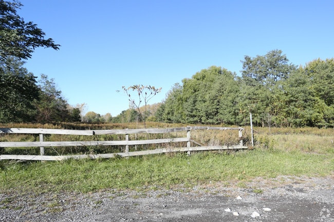
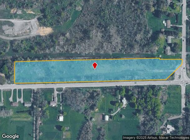
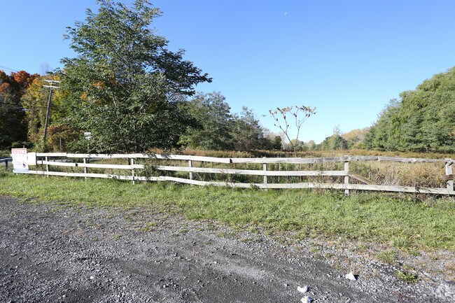
7050 4Th Section Rd
Rochester, NY
Triangular Tract
265289-083-010-0001-015-000
TRI TRACT L9,11 S4 T
Residentialacreage
Monroe
X
New York
36073C0355D
15.000
2025
6.80 AC
2024
Northwest
015304
Rochester
DEMOGRAPHICS near 7050 4Th Section Rd
1 Mile
3 Mile
5 Mile
2024 Total Population
2,641
15,839
24,299
2029 Population
2,613
15,715
24,059
Pop Growth 2024-2029
(1.06%)
(0.78%)
(0.99%)
Average Age
33
38
40
2024 Total Households
691
6,197
9,569
HH Growth 2024-2029
(0.72%)
(0.77%)
(1.03%)
Median Household Inc
$60,915
$52,858
$59,128
Avg Household Size
2.30
2.20
2.30
2024 Avg HH Vehicles
2.00
2.00
2.00
Median Home Value
$172,872
$150,028
$156,184
Median Year Built
1978
1971
1972
Nearby Places
- Restaurants
- Banks
- Shops
- Fitness
- Groceries
PUBLIC TRANSPORTATION
AIRPORT
Frederick Douglass/Greater Rochester International
DRIVE
WALK
Distance
Frederick Douglass/Greater Rochester International
25 min
19.7 mi
Freight Ports
Albany, NY Port
DRIVE
WALK
Distance
Albany, NY Port
290 min
246.0 mi
SALE & LEASE HISTORY
LISTING DATE
SALE/LEASE

Nov 06, 2018
For Sale
Nearby Properties
Address
Land Use
TOTAL SIZE
Lot Size
Zoning
Address
Land Use
TOTAL SIZE
Lot Size
Zoning
149,713 SF
208.91 AC
R1-2
Address
Land Use
TOTAL SIZE
Lot Size
Zoning
93,000 SF
94.60 AC
05 - COMME
Address
Land Use
TOTAL SIZE
Lot Size
Zoning
220,772 SF
23.20 AC
R1-2
Address
Land Use
TOTAL SIZE
Lot Size
Zoning
218,648 SF
25.55 AC
05 - COMME
Address
Land Use
TOTAL SIZE
Lot Size
Zoning
195,643 SF
33.20 AC
05 - COMME
Address
Land Use
TOTAL SIZE
Lot Size
Zoning
86,408 SF
18.90 AC
COM
Address
Land Use
TOTAL SIZE
Lot Size
Zoning
6,529 SF
28 AC
02 - SINGL
Address
Land Use
TOTAL SIZE
Lot Size
Zoning
8,928 SF
19.25 AC
02 - SINGL
Address
Land Use
TOTAL SIZE
Lot Size
Zoning
139,634 SF
19.94 AC
05 - COMME
Address
Land Use
TOTAL SIZE
Lot Size
Zoning
614,268 SF
55.10 AC
06 - INDUS
Address
Land Use
TOTAL SIZE
Lot Size
Zoning
50,303 SF
12.07 AC
05 - COMME
Address
Land Use
TOTAL SIZE
Lot Size
Zoning
924 SF
101.70 AC
BC
Address
Land Use
TOTAL SIZE
Lot Size
Zoning
3,640 SF
11.91 AC
02 - SINGL
Address
Land Use
TOTAL SIZE
Lot Size
Zoning
47,576 SF
7.55 AC
05 - COMME
Address
Land Use
TOTAL SIZE
Lot Size
Zoning
226,580 SF
8.70 AC
06 - INDUS
Address
Land Use
TOTAL SIZE
Lot Size
Zoning
26,628 SF
9 AC
05 - COMME
Address
Land Use
TOTAL SIZE
Lot Size
Zoning
392,000 SF
31.96 AC
06 - INDUS
Address
Land Use
TOTAL SIZE
Lot Size
Zoning
122,429 SF
18.68 AC
05 - COMME
Address
Land Use
TOTAL SIZE
Lot Size
Zoning
40,382 SF
11.50 AC
05 - COMME
Address
Land Use
TOTAL SIZE
Lot Size
Zoning
7,616 SF
3.80 AC
02 - SINGL
Address
Land Use
TOTAL SIZE
Lot Size
Zoning
13,548 SF
5.26 AC
C
Address
Land Use
TOTAL SIZE
Lot Size
Zoning
35,668 SF
8.80 AC
05 - COMME
Address
Land Use
TOTAL SIZE
Lot Size
Zoning
13,548 SF
5.40 AC
C
Address
Land Use
TOTAL SIZE
Lot Size
Zoning
29,621 SF
21.57 AC
06 - INDUS
Address
Land Use
TOTAL SIZE
Lot Size
Zoning
47,348 SF
2.33 AC
05 - COMME
Address
Land Use
TOTAL SIZE
Lot Size
Zoning
3.10 AC
02 - SINGL
Address
Land Use
TOTAL SIZE
Lot Size
Zoning
13,548 SF
5.02 AC
RS-10
Address
Land Use
TOTAL SIZE
Lot Size
Zoning
13,548 SF
4.14 AC
RS-10
Address
Land Use
TOTAL SIZE
Lot Size
Zoning
267,019 SF
6.80 AC
06 - INDUS
Address
Land Use
TOTAL SIZE
Lot Size
Zoning
29,497 SF
3.39 AC
05 - COMME
The World's #1 Commercial Real Estate Marketplace
Connect with us
© 2025 CoStar Group
The information above has been obtained from sources believed reliable. While we do not doubt its accuracy we have not verified it and make no guarantee, warranty or representation about it. It is your responsibility to independently confirm its accuracy and completeness. Any projections, opinions, assumptions, or estimates used are for example only and do not represent the current or future performance of the property. The value of this transaction to you depends on tax and other factors which should be evaluated by your tax, financial, and legal advisors. You and your advisors should conduct a careful, independent investigation of the property to determine to your satisfaction the suitability of the property for your needs.