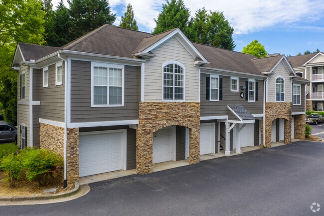
Property Record
7050 Dawson Blvd, Atlanta, GA 30340

NEARBY LISTINGS FOR SALE OR LEASE
Property Detail
7050 Dawson Blvd
18-317-02-004
DeKalb
Apartment
Georgia
X
1
13089C0038K
10.65 AC
2025
Tucker
2025
Atlanta
021813
Atlanta-Sandy Springs-Roswell, GA
199,342 SF
DEMOGRAPHICS near 7050 Dawson Blvd
1 Mile
3 Mile
5 Mile
2024 Total Population
12,481
99,782
266,092
2029 Population
12,639
101,588
270,454
Pop Growth 2024-2029
+ 1.27%
+ 1.81%
+ 1.64%
Average Age
32
35
36
2024 Total Households
5,201
36,052
100,842
HH Growth 2024-2029
+ 1.15%
+ 1.70%
+ 1.52%
Median Household Inc
$44,196
$51,831
$63,054
Avg Household Size
2.40
2.70
2.60
2024 Avg HH Vehicles
1.00
2.00
2.00
Median Home Value
$239,728
$293,246
$339,741
Median Year Built
1984
1982
1983
Nearby Places
Map Layers
Map Styles
 Street
 Aerial
- Restaurants
- Banks
- Shops
- Fitness
- Groceries
PUBLIC TRANSPORTATION
AIRPORT
Hartsfield - Jackson Atlanta International
DRIVE
WALK
Distance
Hartsfield - Jackson Atlanta International
38 min
25.1 mi
Nearby Properties
Address
Land Use
TOTAL SIZE
Lot Size
Zoning
Address
Land Use
TOTAL SIZE
Lot Size
Zoning
705,518 SF
39.09 AC
M
Address
Land Use
TOTAL SIZE
Lot Size
Zoning
709,399 SF
59.34 AC
RM13
Address
Land Use
TOTAL SIZE
Lot Size
Zoning
602,924 SF
75.93 AC
RM100
Address
Land Use
TOTAL SIZE
Lot Size
Zoning
103,056 SF
8.66 AC
OI
Address
Land Use
TOTAL SIZE
Lot Size
Zoning
349,619 SF
24.50 AC
RM75
Address
Land Use
TOTAL SIZE
Lot Size
Zoning
524,000 SF
44.93 AC
RM
Address
Land Use
TOTAL SIZE
Lot Size
Zoning
283,784 SF
30.88 AC
RM100
Address
Land Use
TOTAL SIZE
Lot Size
Zoning
247,662 SF
29.53 AC
RM
Address
Land Use
TOTAL SIZE
Lot Size
Zoning
317,595 SF
25.50 AC
RM75
Address
Land Use
TOTAL SIZE
Lot Size
Zoning
179,762 SF
4.96 AC
C1
Address
Land Use
TOTAL SIZE
Lot Size
Zoning
285,440 SF
24.68 AC
RM
Address
Land Use
TOTAL SIZE
Lot Size
Zoning
503,480 SF
50.04 AC
RM150
Address
Land Use
TOTAL SIZE
Lot Size
Zoning
208,466 SF
20.97 AC
RM
Address
Land Use
TOTAL SIZE
Lot Size
Zoning
475,389 SF
5.37 AC
NX
Address
Land Use
TOTAL SIZE
Lot Size
Zoning
297,057 SF
25 AC
X
Address
Land Use
TOTAL SIZE
Lot Size
Zoning
141,164 SF
4.74 AC
Address
Land Use
TOTAL SIZE
Lot Size
Zoning
249,766 SF
25.34 AC
RM100
Address
Land Use
TOTAL SIZE
Lot Size
Zoning
375,436 SF
33.24 AC
RM10
Address
Land Use
TOTAL SIZE
Lot Size
Zoning
320,947 SF
29.14 AC
RM
Address
Land Use
TOTAL SIZE
Lot Size
Zoning
185,066 SF
25.53 AC
O-1
Address
Land Use
TOTAL SIZE
Lot Size
Zoning
313,420 SF
12.74 AC
X
Address
Land Use
TOTAL SIZE
Lot Size
Zoning
439,205 SF
7.59 AC
C2
Address
Land Use
TOTAL SIZE
Lot Size
Zoning
420,576 SF
27.06 AC
M2
Address
Land Use
TOTAL SIZE
Lot Size
Zoning
321,756 SF
26.28 AC
RM
Address
Land Use
TOTAL SIZE
Lot Size
Zoning
340,962 SF
34.50 AC
PRD
Address
Land Use
TOTAL SIZE
Lot Size
Zoning
356,488 SF
33 AC
RM10
Address
Land Use
TOTAL SIZE
Lot Size
Zoning
255,398 SF
12.45 AC
MUR
Address
Land Use
TOTAL SIZE
Lot Size
Zoning
291,110 SF
22.10 AC
X
Address
Land Use
TOTAL SIZE
Lot Size
Zoning
454,220 SF
30 AC
M1
Address
Land Use
TOTAL SIZE
Lot Size
Zoning
720,051 SF
99.46 AC
MUR
The World's #1 Commercial Real Estate Marketplace
Connect with us
© 2026 CoStar Group
The information above has been obtained from sources believed reliable. While we do not doubt its accuracy we have not verified it and make no guarantee, warranty or representation about it. It is your responsibility to independently confirm its accuracy and completeness. Any projections, opinions, assumptions, or estimates used are for example only and do not represent the current or future performance of the property. The value of this transaction to you depends on tax and other factors which should be evaluated by your tax, financial, and legal advisors. You and your advisors should conduct a careful, independent investigation of the property to determine to your satisfaction the suitability of the property for your needs.