Property Record
7051 Bowling Dr, Sacramento, CA 95823


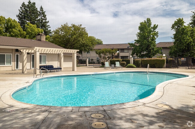
Property Detail
7051 Bowling Dr
042-0162-013
POR SEC 32, T 8 N, R 5 E, MDB&M DESC AS BEG AT SW COR LOT 131 BOWLING GREEN UNIT NO 2, TH FROM SD POB N 89%52'50E 87.73 FT, TH S 51%38'10E 28.45 FT, TH N 89%43'15E 1010.42 FT, TH S 00%07'10E 486.74 FT, TH S 89%43'15W 1160 FT M/L TO E LINE O
Apartment
Sacramento
RD-20
California
AE The base floodplain where base flood elevations are provided. AE Zones are now used on new format FIRMs instead of A1-A30 Zones.
131
2024
12.86 AC
2025
Parkway-South Sacramento
004502
Sacramento
177,180 SF
Sacramento-Roseville-Folsom, CA
NEARBY LISTINGS FOR SALE OR LEASE
DEMOGRAPHICS near 7051 Bowling Dr
1 mile
3 mile
5 mile
2025 Total Population
25,277
197,272
398,897
2030 Population
25,697
199,661
404,135
Pop Growth 2025-2030
+ 1.66%
+ 1.21%
+ 1.31%
Average Age
36
37
39
2025 Total Households
7,579
60,257
137,440
HH Growth 2025-2030
+ 1.72%
+ 1.22%
+ 1.39%
Median Household Inc
$57,233
$68,033
$81,977
Avg Household Size
3.10
3.10
2.80
2025 Avg HH Vehicles
2.00
2.00
2.00
Median Home Value
$347,887
$371,759
$473,600
Median Year Built
1971
1971
1974
Nearby Places
Map Layers
Map Styles
 Street
 Aerial
Transit
 Traffic
 Biking
Places
Listings with unknown addresses are not visible on the map
- Restaurants
- Banks
- Shops
- Fitness
- Groceries
PUBLIC TRANSPORTATION
COMMUTER RAIL
Sacramento (Capitol Corridor - Capitol Corridor Joint Powers Authority)
Drive
Walk
Distance
Sacramento (Capitol Corridor - Capitol Corridor Joint Powers Authority)
15 min
9.1 mi
AIRPORT
Sacramento International
Drive
Walk
Distance
Sacramento International
29 min
19.8 mi
Freight Ports
Port of Stockton
Drive
Walk
Distance
Port of Stockton
52 min
43.4 mi
Nearby Properties
Address
Land Use
TOTAL SIZE
Lot Size
Zoning
Address
Land Use
TOTAL SIZE
Lot Size
Zoning
728,235 SF
29.15 AC
H-R
Address
Land Use
TOTAL SIZE
Lot Size
Zoning
7.55 AC
SPA
Address
Land Use
TOTAL SIZE
Lot Size
Zoning
53,386 SF
7.75 AC
C-2-SPD
Address
Land Use
TOTAL SIZE
Lot Size
Zoning
173,323 SF
10.39 AC
C-2-PUD
Address
Land Use
TOTAL SIZE
Lot Size
Zoning
249,868 SF
15.23 AC
R-2B-R
Address
Land Use
TOTAL SIZE
Lot Size
Zoning
213,445 SF
18.25 AC
SC
Address
Land Use
TOTAL SIZE
Lot Size
Zoning
138,779 SF
44.77 AC
M-2S
Address
Land Use
TOTAL SIZE
Lot Size
Zoning
120,868 SF
53.03 AC
SPA
Address
Land Use
TOTAL SIZE
Lot Size
Zoning
55,344 SF
4.75 AC
M-2S
Address
Land Use
TOTAL SIZE
Lot Size
Zoning
86,094 SF
6.17 AC
H-PUD
Address
Land Use
TOTAL SIZE
Lot Size
Zoning
58.59 AC
R-1
Address
Land Use
TOTAL SIZE
Lot Size
Zoning
144,849 SF
5.72 AC
R-3
Address
Land Use
TOTAL SIZE
Lot Size
Zoning
69,411 SF
7.21 AC
OB
Address
Land Use
TOTAL SIZE
Lot Size
Zoning
109,532 SF
5.03 AC
R-3
Address
Land Use
TOTAL SIZE
Lot Size
Zoning
50,729 SF
12.30 AC
H-R
Address
Land Use
TOTAL SIZE
Lot Size
Zoning
95,548 SF
24.25 AC
R-1
Address
Land Use
TOTAL SIZE
Lot Size
Zoning
91,586 SF
6.03 AC
R-3-R
Address
Land Use
TOTAL SIZE
Lot Size
Zoning
95,427 SF
7.07 AC
LC
Address
Land Use
TOTAL SIZE
Lot Size
Zoning
100,704 SF
5.63 AC
RD-20
Address
Land Use
TOTAL SIZE
Lot Size
Zoning
162,259 SF
12.73 AC
R-3
Address
Land Use
TOTAL SIZE
Lot Size
Zoning
100,787 SF
8.78 AC
SPA
Address
Land Use
TOTAL SIZE
Lot Size
Zoning
6.90 AC
RD-20
Address
Land Use
TOTAL SIZE
Lot Size
Zoning
129,305 SF
9.37 AC
C-2-SPD
Address
Land Use
TOTAL SIZE
Lot Size
Zoning
90,716 SF
7.52 AC
C-2-R
Address
Land Use
TOTAL SIZE
Lot Size
Zoning
111,196 SF
5.40 AC
C-2-R
Address
Land Use
TOTAL SIZE
Lot Size
Zoning
126,358 SF
7.30 AC
RD-20
Address
Land Use
TOTAL SIZE
Lot Size
Zoning
49,884 SF
2.60 AC
R-3
Address
Land Use
TOTAL SIZE
Lot Size
Zoning
105,700 SF
12.41 AC
C-2-R
Address
Land Use
TOTAL SIZE
Lot Size
Zoning
82,404 SF
4.38 AC
RD-30 (NPA
Address
Land Use
TOTAL SIZE
Lot Size
Zoning
136,738 SF
11.92 AC
SC
The World's #1 Commercial Real Estate Marketplace
Connect with us
© 2026 CoStar Group
The information above has been obtained from sources believed reliable. While we do not doubt its accuracy we have not verified it and make no guarantee, warranty or representation about it. It is your responsibility to independently confirm its accuracy and completeness. Any projections, opinions, assumptions, or estimates used are for example only and do not represent the current or future performance of the property. The value of this transaction to you depends on tax and other factors which should be evaluated by your tax, financial, and legal advisors. You and your advisors should conduct a careful, independent investigation of the property to determine to your satisfaction the suitability of the property for your needs.