Property Record
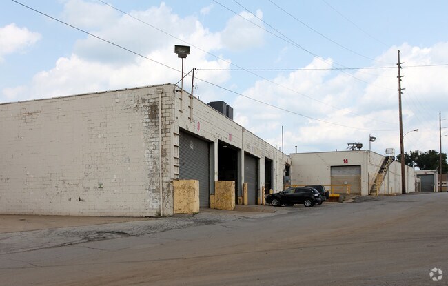
706 N State St, Girard, OH 44420

NEARBY LISTINGS FOR SALE OR LEASE
Property Detail
706 N State St
Youngstown-Warren-Boardman, OH-PA
Statefur Realty Plat #1
14-588506
1 203F STATEFUR PLAT 1 REPLAT STATE ST GIRARD CITY
Manufacturinglight
Trumbull
X
Ohio
39155C0414D
1
2024
8.14 AC
2024
Trumbull County
932300
Youngstown/Warren/Boardman
DEMOGRAPHICS near 706 N State St
1 Mile
3 Mile
5 Mile
2024 Total Population
5,340
36,805
103,071
2029 Population
5,318
36,451
102,180
Pop Growth 2024-2029
(0.41%)
(0.96%)
(0.86%)
Average Age
40
42
42
2024 Total Households
2,307
16,114
44,521
HH Growth 2024-2029
(0.43%)
(1.02%)
(0.98%)
Median Household Inc
$42,463
$45,718
$42,643
Avg Household Size
2.20
2.20
2.20
2024 Avg HH Vehicles
2.00
2.00
2.00
Median Home Value
$72,672
$88,835
$92,913
Median Year Built
1952
1957
1959
Nearby Places
Map Layers
Map Styles
 Street
 Aerial
- Restaurants
- Banks
- Shops
- Fitness
- Groceries
Nearby Properties
Address
Land Use
TOTAL SIZE
Lot Size
Zoning
Address
Land Use
TOTAL SIZE
Lot Size
Zoning
981,460 SF
74.87 AC
Address
Land Use
TOTAL SIZE
Lot Size
Zoning
10.30 AC
Address
Land Use
TOTAL SIZE
Lot Size
Zoning
67,680 SF
22.66 AC
Address
Land Use
TOTAL SIZE
Lot Size
Zoning
33,819 SF
25 AC
Address
Land Use
TOTAL SIZE
Lot Size
Zoning
55,398 SF
36.73 AC
Address
Land Use
TOTAL SIZE
Lot Size
Zoning
6,207 SF
0.88 AC
Address
Land Use
TOTAL SIZE
Lot Size
Zoning
446,250 SF
43.88 AC
Address
Land Use
TOTAL SIZE
Lot Size
Zoning
89,325 SF
28.74 AC
Address
Land Use
TOTAL SIZE
Lot Size
Zoning
116,176 SF
5.04 AC
Address
Land Use
TOTAL SIZE
Lot Size
Zoning
158,146 SF
22.30 AC
Address
Land Use
TOTAL SIZE
Lot Size
Zoning
95,231 SF
37.75 AC
ASER
Address
Land Use
TOTAL SIZE
Lot Size
Zoning
40,754 SF
4.14 AC
Address
Land Use
TOTAL SIZE
Lot Size
Zoning
9,999 SF
19.67 AC
Address
Land Use
TOTAL SIZE
Lot Size
Zoning
82,182 SF
17.19 AC
Address
Land Use
TOTAL SIZE
Lot Size
Zoning
23,760 SF
7.40 AC
Address
Land Use
TOTAL SIZE
Lot Size
Zoning
57,541 SF
1.50 AC
Address
Land Use
TOTAL SIZE
Lot Size
Zoning
5,616 SF
23.43 AC
Address
Land Use
TOTAL SIZE
Lot Size
Zoning
200,160 SF
19.03 AC
Address
Land Use
TOTAL SIZE
Lot Size
Zoning
54,969 SF
6.17 AC
Address
Land Use
TOTAL SIZE
Lot Size
Zoning
Address
Land Use
TOTAL SIZE
Lot Size
Zoning
315,482 SF
33.17 AC
I2
Address
Land Use
TOTAL SIZE
Lot Size
Zoning
68,888 SF
3 AC
Address
Land Use
TOTAL SIZE
Lot Size
Zoning
57,266 SF
5.84 AC
Address
Land Use
TOTAL SIZE
Lot Size
Zoning
11,316 SF
8.86 AC
Address
Land Use
TOTAL SIZE
Lot Size
Zoning
Address
Land Use
TOTAL SIZE
Lot Size
Zoning
53,934 SF
2.59 AC
Address
Land Use
TOTAL SIZE
Lot Size
Zoning
69,267 SF
12.72 AC
Address
Land Use
TOTAL SIZE
Lot Size
Zoning
44,298 SF
3.72 AC
Address
Land Use
TOTAL SIZE
Lot Size
Zoning
66,738 SF
9.35 AC
Address
Land Use
TOTAL SIZE
Lot Size
Zoning
143,789 SF
20.18 AC
The World's #1 Commercial Real Estate Marketplace
Connect with us
© 2025 CoStar Group
The information above has been obtained from sources believed reliable. While we do not doubt its accuracy we have not verified it and make no guarantee, warranty or representation about it. It is your responsibility to independently confirm its accuracy and completeness. Any projections, opinions, assumptions, or estimates used are for example only and do not represent the current or future performance of the property. The value of this transaction to you depends on tax and other factors which should be evaluated by your tax, financial, and legal advisors. You and your advisors should conduct a careful, independent investigation of the property to determine to your satisfaction the suitability of the property for your needs.