Property Record
706 Petersham Rd, Athol, MA 01331

Property Detail
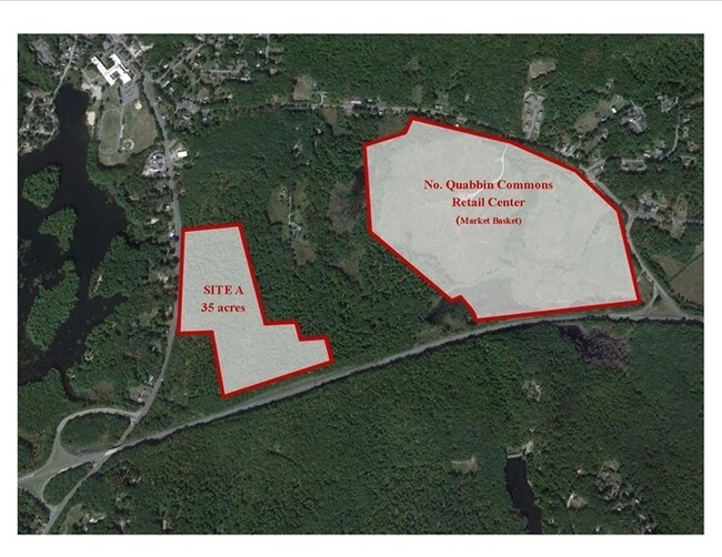
706 Petersham Rd
Worcester, MA
Worcester
ATHO-000046-000045
Massachusetts
Commercialacreage
9.64 AC
2025
Outlying Worcester
2025
Boston
703300
NEARBY LISTINGS FOR SALE OR LEASE
-
-
View all Athol listings for sale on LoopNet.com
DEMOGRAPHICS near 706 Petersham Rd
1 mile
3 mile
5 mile
2025 Total Population
987
11,175
18,309
2030 Population
1,037
11,600
18,944
Pop Growth 2025-2030
+ 5.07%
+ 3.80%
+ 3.47%
Average Age
44
43
44
2025 Total Households
396
4,564
7,516
HH Growth 2025-2030
+ 5.30%
+ 3.92%
+ 3.55%
Median Household Inc
$69,827
$67,500
$70,399
Avg Household Size
2.40
2.40
2.40
2025 Avg HH Vehicles
2.00
2.00
2.00
Median Home Value
$330,113
$298,470
$304,082
Median Year Built
1972
1954
1963
Nearby Places
Map Layers
Map Styles
 Street
 Aerial
Layers
 Traffic
 Biking
Places
Listings with unknown addresses are not visible on the map
- Restaurants
- Banks
- Shops
- Fitness
- Groceries
PUBLIC TRANSPORTATION
AIRPORT
Worcester Regional
Drive
Walk
Distance
Worcester Regional
59 min
32.9 mi
Freight Ports
Port of Boston
Drive
Walk
Distance
Port of Boston
103 min
70.3 mi
SALE & LEASE HISTORY
LISTING DATE
SALE/LEASE

Sep 24, 2016
For Sale
Nearby Properties
Address
Land Use
TOTAL SIZE
Lot Size
Zoning
Address
Land Use
TOTAL SIZE
Lot Size
Zoning
66,835 SF
12.39 AC
Address
Land Use
TOTAL SIZE
Lot Size
Zoning
76,943 SF
71.01 AC
Address
Land Use
TOTAL SIZE
Lot Size
Zoning
112,054 SF
10.48 AC
Address
Land Use
TOTAL SIZE
Lot Size
Zoning
22 AC
Address
Land Use
TOTAL SIZE
Lot Size
Zoning
66,766 SF
11 AC
Address
Land Use
TOTAL SIZE
Lot Size
Zoning
3.50 AC
Address
Land Use
TOTAL SIZE
Lot Size
Zoning
130,539 SF
Address
Land Use
TOTAL SIZE
Lot Size
Zoning
49,820 SF
0.75 AC
Address
Land Use
TOTAL SIZE
Lot Size
Zoning
27,129 SF
3 AC
Address
Land Use
TOTAL SIZE
Lot Size
Zoning
Address
Land Use
TOTAL SIZE
Lot Size
Zoning
25,156 SF
4.80 AC
Address
Land Use
TOTAL SIZE
Lot Size
Zoning
30,327 SF
0.56 AC
Address
Land Use
TOTAL SIZE
Lot Size
Zoning
7.05 AC
Address
Land Use
TOTAL SIZE
Lot Size
Zoning
20,065 SF
Address
Land Use
TOTAL SIZE
Lot Size
Zoning
29,090 SF
0.57 AC
Address
Land Use
TOTAL SIZE
Lot Size
Zoning
10,204 SF
1.60 AC
Address
Land Use
TOTAL SIZE
Lot Size
Zoning
1,080.01 AC
Address
Land Use
TOTAL SIZE
Lot Size
Zoning
25,840 SF
5.99 AC
Address
Land Use
TOTAL SIZE
Lot Size
Zoning
61,096 SF
2.16 AC
Address
Land Use
TOTAL SIZE
Lot Size
Zoning
3.50 AC
Address
Land Use
TOTAL SIZE
Lot Size
Zoning
14,474 SF
1.03 AC
Address
Land Use
TOTAL SIZE
Lot Size
Zoning
2.10 AC
Address
Land Use
TOTAL SIZE
Lot Size
Zoning
14,723 SF
0.16 AC
Address
Land Use
TOTAL SIZE
Lot Size
Zoning
2.80 AC
Address
Land Use
TOTAL SIZE
Lot Size
Zoning
9,192 SF
0.82 AC
Address
Land Use
TOTAL SIZE
Lot Size
Zoning
32,286 SF
0.24 AC
Address
Land Use
TOTAL SIZE
Lot Size
Zoning
0.11 AC
Address
Land Use
TOTAL SIZE
Lot Size
Zoning
4,683 SF
9.88 AC
Address
Land Use
TOTAL SIZE
Lot Size
Zoning
6.10 AC
Address
Land Use
TOTAL SIZE
Lot Size
Zoning
14,573 SF
0.65 AC
The World's #1 Commercial Real Estate Marketplace
Connect with us
© 2026 CoStar Group
The information above has been obtained from sources believed reliable. While we do not doubt its accuracy we have not verified it and make no guarantee, warranty or representation about it. It is your responsibility to independently confirm its accuracy and completeness. Any projections, opinions, assumptions, or estimates used are for example only and do not represent the current or future performance of the property. The value of this transaction to you depends on tax and other factors which should be evaluated by your tax, financial, and legal advisors. You and your advisors should conduct a careful, independent investigation of the property to determine to your satisfaction the suitability of the property for your needs.