Property Record
706 Saint Matthews Rd, Swansea, SC 29160
NEARBY LISTINGS FOR SALE OR LEASE
-
-
View all Swansea listings for sale on LoopNet.com
Property Detail
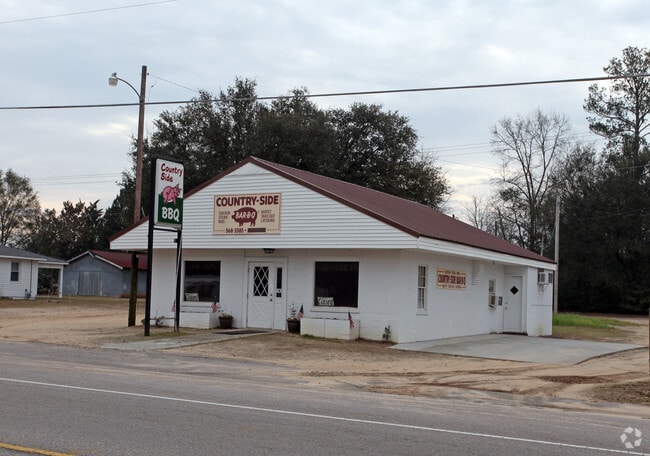
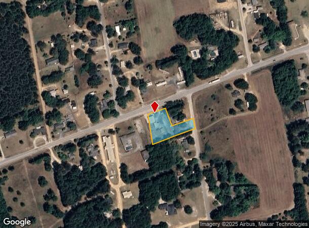
706 Saint Matthews Rd
013017-02-009
Prepared For Margaret Henry & Geneva W Z
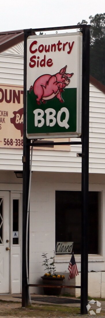
Restaurantbuilding
PARCELS A-2 & B
X
Lexington
45063C0530J
South Carolina
2025
0.94 AC
2024
Outlying Lexington County
020802
Columbia
2,125 SF
Columbia, SC
DEMOGRAPHICS near 706 Saint Matthews Rd
1 Mile
3 Mile
5 Mile
2024 Total Population
1,419
3,721
8,509
2029 Population
1,553
4,073
9,279
Pop Growth 2024-2029
+ 9.44%
+ 9.46%
+ 9.05%
Average Age
41
42
41
2024 Total Households
567
1,495
3,378
HH Growth 2024-2029
+ 9.52%
+ 9.50%
+ 9.06%
Median Household Inc
$51,923
$52,035
$50,545
Avg Household Size
2.50
2.40
2.50
2024 Avg HH Vehicles
2.00
2.00
2.00
Median Home Value
$82,060
$83,404
$81,098
Median Year Built
1978
1985
1988
Nearby Places
Map Layers
Map Styles
 Street
 Aerial
- Restaurants
- Banks
- Shops
- Fitness
- Groceries
PUBLIC TRANSPORTATION
AIRPORT
Columbia Metro
DRIVE
WALK
Distance
Columbia Metro
35 min
20.1 mi
Nearby Properties
Address
Land Use
TOTAL SIZE
Lot Size
Zoning
Address
Land Use
TOTAL SIZE
Lot Size
Zoning
64,200 SF
8.53 AC
LR
Address
Land Use
TOTAL SIZE
Lot Size
Zoning
2,304 SF
0.85 AC
LR
Address
Land Use
TOTAL SIZE
Lot Size
Zoning
12,752 SF
0.52 AC
NA
Address
Land Use
TOTAL SIZE
Lot Size
Zoning
111.56 AC
ID
Address
Land Use
TOTAL SIZE
Lot Size
Zoning
15,911 SF
4.80 AC
Address
Land Use
TOTAL SIZE
Lot Size
Zoning
145.70 AC
Address
Land Use
TOTAL SIZE
Lot Size
Zoning
12,871 SF
2.44 AC
Address
Land Use
TOTAL SIZE
Lot Size
Zoning
9,373 SF
0.85 AC
ID
Address
Land Use
TOTAL SIZE
Lot Size
Zoning
12,740 SF
7.89 AC
ID
Address
Land Use
TOTAL SIZE
Lot Size
Zoning
3,407 SF
100.78 AC
LR
Address
Land Use
TOTAL SIZE
Lot Size
Zoning
2,812 SF
1.16 AC
Address
Land Use
TOTAL SIZE
Lot Size
Zoning
5,048 SF
1.06 AC
LR
Address
Land Use
TOTAL SIZE
Lot Size
Zoning
3,829 SF
1.04 AC
LR
Address
Land Use
TOTAL SIZE
Lot Size
Zoning
3,600 SF
1.05 AC
Address
Land Use
TOTAL SIZE
Lot Size
Zoning
8,075 SF
28.95 AC
RD
Address
Land Use
TOTAL SIZE
Lot Size
Zoning
3,036 SF
0.52 AC
LR
Address
Land Use
TOTAL SIZE
Lot Size
Zoning
147.01 AC
Address
Land Use
TOTAL SIZE
Lot Size
Zoning
38.74 AC
LR
Address
Land Use
TOTAL SIZE
Lot Size
Zoning
2.27 AC
Address
Land Use
TOTAL SIZE
Lot Size
Zoning
2,814 SF
0.62 AC
LR
Address
Land Use
TOTAL SIZE
Lot Size
Zoning
108.87 AC
Address
Land Use
TOTAL SIZE
Lot Size
Zoning
6,350 SF
0.43 AC
Address
Land Use
TOTAL SIZE
Lot Size
Zoning
1,880 SF
10.48 AC
LR
Address
Land Use
TOTAL SIZE
Lot Size
Zoning
84.47 AC
Address
Land Use
TOTAL SIZE
Lot Size
Zoning
192.54 AC
Address
Land Use
TOTAL SIZE
Lot Size
Zoning
26.40 AC
Address
Land Use
TOTAL SIZE
Lot Size
Zoning
5,053 SF
2 AC
ID
Address
Land Use
TOTAL SIZE
Lot Size
Zoning
1,794 SF
0.98 AC
LR
Address
Land Use
TOTAL SIZE
Lot Size
Zoning
1,390 SF
3.14 AC
The World's #1 Commercial Real Estate Marketplace
Connect with us
© 2026 CoStar Group
The information above has been obtained from sources believed reliable. While we do not doubt its accuracy we have not verified it and make no guarantee, warranty or representation about it. It is your responsibility to independently confirm its accuracy and completeness. Any projections, opinions, assumptions, or estimates used are for example only and do not represent the current or future performance of the property. The value of this transaction to you depends on tax and other factors which should be evaluated by your tax, financial, and legal advisors. You and your advisors should conduct a careful, independent investigation of the property to determine to your satisfaction the suitability of the property for your needs.