Property Record
707 1St Ave N, Sartell, MN 56377
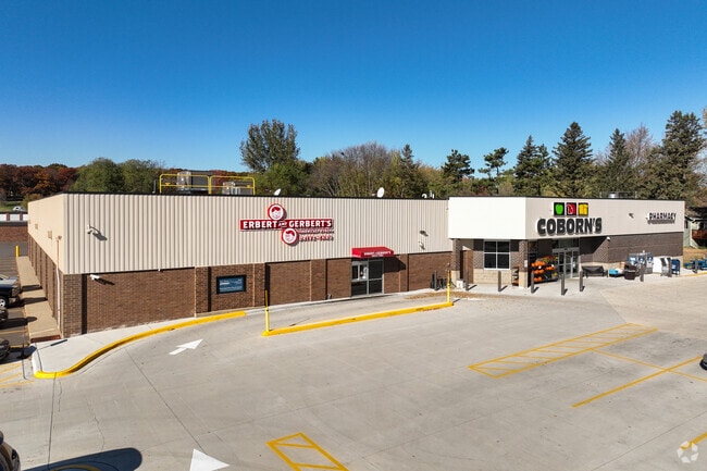

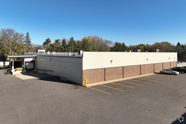
Property Detail
707 1St Ave N
St. Cloud, MN
2.05A BEG 358.1' N & 886' E OF SW COM LOT 4 N 186.62 TO S LINE GREEN ACRES - E415.75' - S6D E233.22' ON 1ST AVE - W438.26' TO
92.56511.0012
Stearns
Supermarket
Minnesota
B and X Area of moderate flood hazard, usually the area between the limits of the 100-year and 500-year floods.
4
2026
2.05 AC
2025
Stearns County
010101
Minneapolis/St Paul
26,639 SF
NEARBY LISTINGS FOR SALE OR LEASE
-
-
View all Sartell listings for sale on LoopNet.com
DEMOGRAPHICS near 707 1St Ave N
1 mile
3 mile
5 mile
2025 Total Population
5,484
26,992
62,777
2030 Population
5,589
27,708
64,492
Pop Growth 2025-2030
+ 1.91%
+ 2.65%
+ 2.73%
Average Age
38
38
39
2025 Total Households
2,068
10,413
25,329
HH Growth 2025-2030
+ 1.93%
+ 2.59%
+ 2.72%
Median Household Inc
$80,652
$74,599
$72,526
Avg Household Size
2.60
2.50
2.40
2025 Avg HH Vehicles
2.00
2.00
2.00
Median Home Value
$293,601
$291,257
$267,313
Median Year Built
1986
1996
1990
Nearby Places
Map Layers
Map Styles
 Street
 Aerial
Layers
 Traffic
 Biking
Places
Listings with unknown addresses are not visible on the map
- Restaurants
- Banks
- Shops
- Fitness
- Groceries
PUBLIC TRANSPORTATION
COMMUTER RAIL
Drive
Walk
Distance
14 min
6.6 mi
Nearby Properties
Address
Land Use
TOTAL SIZE
Lot Size
Zoning
Address
Land Use
TOTAL SIZE
Lot Size
Zoning
250,584 SF
77.75 AC
Address
Land Use
TOTAL SIZE
Lot Size
Zoning
183,964 SF
39.05 AC
Address
Land Use
TOTAL SIZE
Lot Size
Zoning
10,800 SF
24.94 AC
Address
Land Use
TOTAL SIZE
Lot Size
Zoning
11.82 AC
Address
Land Use
TOTAL SIZE
Lot Size
Zoning
30,096 SF
8.47 AC
Address
Land Use
TOTAL SIZE
Lot Size
Zoning
10.46 AC
Address
Land Use
TOTAL SIZE
Lot Size
Zoning
149,778 SF
7.86 AC
Address
Land Use
TOTAL SIZE
Lot Size
Zoning
184,285 SF
13.37 AC
Address
Land Use
TOTAL SIZE
Lot Size
Zoning
88,000 SF
37.63 AC
Address
Land Use
TOTAL SIZE
Lot Size
Zoning
15.78 AC
Address
Land Use
TOTAL SIZE
Lot Size
Zoning
9.75 AC
Address
Land Use
TOTAL SIZE
Lot Size
Zoning
197,115 SF
18.23 AC
Address
Land Use
TOTAL SIZE
Lot Size
Zoning
43,302 SF
5.67 AC
Address
Land Use
TOTAL SIZE
Lot Size
Zoning
3.89 AC
Address
Land Use
TOTAL SIZE
Lot Size
Zoning
10.96 AC
Address
Land Use
TOTAL SIZE
Lot Size
Zoning
22,425 SF
5.54 AC
Address
Land Use
TOTAL SIZE
Lot Size
Zoning
91,625 SF
7.02 AC
Address
Land Use
TOTAL SIZE
Lot Size
Zoning
27,984 SF
10.39 AC
Address
Land Use
TOTAL SIZE
Lot Size
Zoning
60,079 SF
4.75 AC
Address
Land Use
TOTAL SIZE
Lot Size
Zoning
4.21 AC
Address
Land Use
TOTAL SIZE
Lot Size
Zoning
5.76 AC
Address
Land Use
TOTAL SIZE
Lot Size
Zoning
13,217 SF
3.38 AC
Address
Land Use
TOTAL SIZE
Lot Size
Zoning
4.14 AC
Address
Land Use
TOTAL SIZE
Lot Size
Zoning
56,375 SF
2.33 AC
Address
Land Use
TOTAL SIZE
Lot Size
Zoning
32,805 SF
18.80 AC
Address
Land Use
TOTAL SIZE
Lot Size
Zoning
9.56 AC
Address
Land Use
TOTAL SIZE
Lot Size
Zoning
7.19 AC
Address
Land Use
TOTAL SIZE
Lot Size
Zoning
65,372 SF
6.94 AC
Address
Land Use
TOTAL SIZE
Lot Size
Zoning
3.39 AC
The World's #1 Commercial Real Estate Marketplace
Connect with us
© 2026 CoStar Group
The information above has been obtained from sources believed reliable. While we do not doubt its accuracy we have not verified it and make no guarantee, warranty or representation about it. It is your responsibility to independently confirm its accuracy and completeness. Any projections, opinions, assumptions, or estimates used are for example only and do not represent the current or future performance of the property. The value of this transaction to you depends on tax and other factors which should be evaluated by your tax, financial, and legal advisors. You and your advisors should conduct a careful, independent investigation of the property to determine to your satisfaction the suitability of the property for your needs.