Property Record
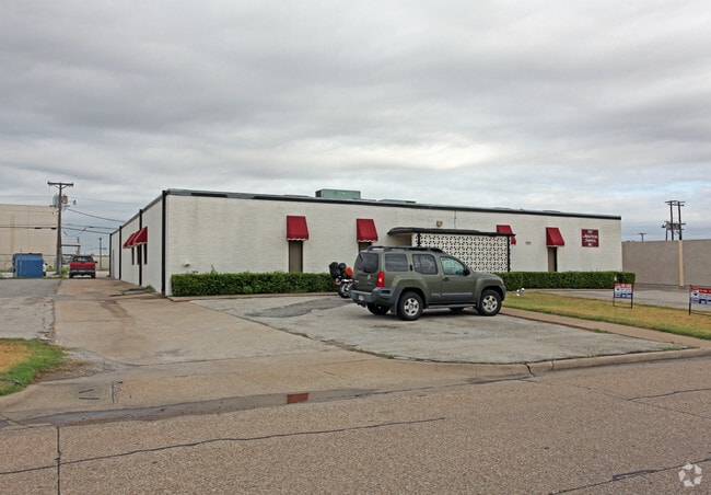
707 Easy St, Garland, TX 75042


NEARBY LISTINGS FOR SALE OR LEASE
Property Detail
707 Easy St
Dallas-Fort Worth-Arlington, TX
Access
26000500000260000
ACCESS N.50FT.LT25<26 INT201800035512 DD01172018 CO-DC 0005000002600 2CG00050000
Warehouse
Dallas
X
Texas
48113C0215K
25,26
2024
0.96 AC
2025
NE Dallas/Garland
018506
Dallas/Ft Worth
8,968 SF
DEMOGRAPHICS near 707 Easy St
1 Mile
3 Mile
5 Mile
2024 Total Population
11,288
158,594
409,945
2029 Population
11,087
157,057
406,247
Pop Growth 2024-2029
(1.78%)
(0.97%)
(0.90%)
Average Age
34
36
37
2024 Total Households
3,288
59,045
156,081
HH Growth 2024-2029
(2.04%)
(1.14%)
(0.97%)
Median Household Inc
$36,442
$53,230
$57,870
Avg Household Size
3.20
2.60
2.50
2024 Avg HH Vehicles
2.00
2.00
2.00
Median Home Value
$195,600
$284,351
$261,669
Median Year Built
1970
1977
1976
Nearby Places
Map Layers
Map Styles
 Street
 Aerial
- Restaurants
- Banks
- Shops
- Fitness
- Groceries
PUBLIC TRANSPORTATION
AIRPORT
Dallas Love Field
DRIVE
WALK
Distance
Dallas Love Field
25 min
17.5 mi
Dallas-Fort Worth International
DRIVE
WALK
Distance
Dallas-Fort Worth International
33 min
26.3 mi
Freight Ports
Port of Shreveport
DRIVE
WALK
Distance
Port of Shreveport
213 min
196.0 mi
Nearby Properties
Address
Land Use
TOTAL SIZE
Lot Size
Zoning
Address
Land Use
TOTAL SIZE
Lot Size
Zoning
428,956 SF
18.76 AC
Z291
Address
Land Use
TOTAL SIZE
Lot Size
Zoning
249,692 SF
244.62 AC
Z239
Address
Land Use
TOTAL SIZE
Lot Size
Zoning
316,085 SF
13.73 AC
Z107
Address
Land Use
TOTAL SIZE
Lot Size
Zoning
181,854 SF
14.51 AC
Z239
Address
Land Use
TOTAL SIZE
Lot Size
Zoning
319,969 SF
16.54 AC
Z163
Address
Land Use
TOTAL SIZE
Lot Size
Zoning
310,119 SF
9.65 AC
Z150
Address
Land Use
TOTAL SIZE
Lot Size
Zoning
391,774 SF
3.97 AC
Z239
Address
Land Use
TOTAL SIZE
Lot Size
Zoning
144,728 SF
46.87 AC
Z239
Address
Land Use
TOTAL SIZE
Lot Size
Zoning
517,500 SF
29.97 AC
Z116
Address
Land Use
TOTAL SIZE
Lot Size
Zoning
922,851 SF
52.30 AC
Z144
Address
Land Use
TOTAL SIZE
Lot Size
Zoning
431,982 SF
19.32 AC
Z164
Address
Land Use
TOTAL SIZE
Lot Size
Zoning
277,296 SF
13.54 AC
Z207
Address
Land Use
TOTAL SIZE
Lot Size
Zoning
107,686 SF
30.09 AC
Z386
Address
Land Use
TOTAL SIZE
Lot Size
Zoning
472,244 SF
25.25 AC
Z144
Address
Land Use
TOTAL SIZE
Lot Size
Zoning
275,557 SF
13.64 AC
Z291
Address
Land Use
TOTAL SIZE
Lot Size
Zoning
292,827 SF
13.81 AC
Z163
Address
Land Use
TOTAL SIZE
Lot Size
Zoning
531,950 SF
24.62 AC
Z239
Address
Land Use
TOTAL SIZE
Lot Size
Zoning
347,718 SF
18.61 AC
Z163
Address
Land Use
TOTAL SIZE
Lot Size
Zoning
922,851 SF
52.28 AC
Z144
Address
Land Use
TOTAL SIZE
Lot Size
Zoning
121,440 SF
17.02 AC
Z298
Address
Land Use
TOTAL SIZE
Lot Size
Zoning
227,584 SF
12.03 AC
Z165
Address
Land Use
TOTAL SIZE
Lot Size
Zoning
333,298 SF
10.91 AC
Z149
Address
Land Use
TOTAL SIZE
Lot Size
Zoning
265,986 SF
13.75 AC
Z163
Address
Land Use
TOTAL SIZE
Lot Size
Zoning
286,500 SF
14.98 AC
Z160
Address
Land Use
TOTAL SIZE
Lot Size
Zoning
468,220 SF
20.60 AC
Z144
Address
Land Use
TOTAL SIZE
Lot Size
Zoning
270,114 SF
8.50 AC
Z150
Address
Land Use
TOTAL SIZE
Lot Size
Zoning
203,027 SF
17.69 AC
Z294
Address
Land Use
TOTAL SIZE
Lot Size
Zoning
278,856 SF
9.57 AC
Z150
Address
Land Use
TOTAL SIZE
Lot Size
Zoning
220,989 SF
12.94 AC
Z163
Address
Land Use
TOTAL SIZE
Lot Size
Zoning
244,032 SF
11.06 AC
Z163
The World's #1 Commercial Real Estate Marketplace
Connect with us
© 2026 CoStar Group
The information above has been obtained from sources believed reliable. While we do not doubt its accuracy we have not verified it and make no guarantee, warranty or representation about it. It is your responsibility to independently confirm its accuracy and completeness. Any projections, opinions, assumptions, or estimates used are for example only and do not represent the current or future performance of the property. The value of this transaction to you depends on tax and other factors which should be evaluated by your tax, financial, and legal advisors. You and your advisors should conduct a careful, independent investigation of the property to determine to your satisfaction the suitability of the property for your needs.