Property Record
7070 Sw 90Th Loop All Units, Ocala, FL 34476


NEARBY LISTINGS FOR SALE OR LEASE
Property Detail
7070 Sw 90Th Loop All Units
35700-001-00
SEC 19 TWP 16 RGE 21 COM AT N 1/4 COR OF SEC 19 TH S 89-49-42 E 467.64 FT FOR POB TH S 89-49-42 E 2117.57 FT TH S 00-22-04 W 588.80 FT TH N 89-48-42 W 2113.45 FT (N 89-50-18 W PER DEED) TH NWLY 59.53 FT ALG ARC OF CURVE A RAD OF 840 FT A ANGLE OF 04-
Apartment
Marion
X
Florida
12083C0703E
31.62 AC
2025
Outlying Marion County
2025
Ocala
0010061067
Ocala, FL
DEMOGRAPHICS near 7070 Sw 90Th Loop All Units
1 mile
3 mile
5 mile
2024 Total Population
1,976
37,605
60,178
2029 Population
2,230
42,638
68,300
Pop Growth 2024-2029
+ 12.85%
+ 13.38%
+ 13.50%
Average Age
58
61
55
2024 Total Households
954
19,027
28,163
HH Growth 2024-2029
+ 12.79%
+ 13.28%
+ 13.35%
Median Household Inc
$49,662
$55,938
$59,570
Avg Household Size
2.00
1.90
2.10
2024 Avg HH Vehicles
1.00
1.00
2.00
Median Home Value
$199,999
$197,102
$206,843
Median Year Built
1995
1997
1999
Nearby Places
Map Layers
Map Styles
 Street
 Aerial
Transit
 Traffic
 Biking
Places
Listings with unknown addresses are not visible on the map
- Restaurants
- Banks
- Shops
- Fitness
- Groceries
SALE & LEASE HISTORY
LISTING DATE
SALE/LEASE

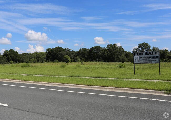
Sep 01, 2017
For Sale
Nearby Properties
Address
Land Use
TOTAL SIZE
Lot Size
Zoning
Address
Land Use
TOTAL SIZE
Lot Size
Zoning
380,749 SF
40.05 AC
PUD
Address
Land Use
TOTAL SIZE
Lot Size
Zoning
124,557 SF
39.04 AC
GU
Address
Land Use
TOTAL SIZE
Lot Size
Zoning
304,259 SF
31.62 AC
PUD
Address
Land Use
TOTAL SIZE
Lot Size
Zoning
96,094 SF
13.66 AC
B2
Address
Land Use
TOTAL SIZE
Lot Size
Zoning
62,253 SF
6.52 AC
PUD
Address
Land Use
TOTAL SIZE
Lot Size
Zoning
103,410 SF
27.04 AC
PUD
Address
Land Use
TOTAL SIZE
Lot Size
Zoning
95,496 SF
25.25 AC
R3
Address
Land Use
TOTAL SIZE
Lot Size
Zoning
74,928 SF
7.80 AC
PUD
Address
Land Use
TOTAL SIZE
Lot Size
Zoning
18,035 SF
3.33 AC
B2
Address
Land Use
TOTAL SIZE
Lot Size
Zoning
139,728 SF
22.86 AC
B4
Address
Land Use
TOTAL SIZE
Lot Size
Zoning
6,333 SF
415.60 AC
PD
Address
Land Use
TOTAL SIZE
Lot Size
Zoning
23,440 SF
242.06 AC
PD
Address
Land Use
TOTAL SIZE
Lot Size
Zoning
65,060 SF
11.90 AC
B2
Address
Land Use
TOTAL SIZE
Lot Size
Zoning
98,205 SF
13.41 AC
B2
Address
Land Use
TOTAL SIZE
Lot Size
Zoning
77,877 SF
13.38 AC
B2
Address
Land Use
TOTAL SIZE
Lot Size
Zoning
42,673 SF
13.72 AC
A1
Address
Land Use
TOTAL SIZE
Lot Size
Zoning
42,159 SF
5.95 AC
B2
Address
Land Use
TOTAL SIZE
Lot Size
Zoning
68,180 SF
5.40 AC
B5
Address
Land Use
TOTAL SIZE
Lot Size
Zoning
82,465 SF
6.13 AC
B2
Address
Land Use
TOTAL SIZE
Lot Size
Zoning
82,904 SF
10.51 AC
B2
Address
Land Use
TOTAL SIZE
Lot Size
Zoning
47,378 SF
23.26 AC
A1
Address
Land Use
TOTAL SIZE
Lot Size
Zoning
286.80 AC
PUD
Address
Land Use
TOTAL SIZE
Lot Size
Zoning
58,381 SF
5.12 AC
R3
Address
Land Use
TOTAL SIZE
Lot Size
Zoning
25,695 SF
4.68 AC
PUD
Address
Land Use
TOTAL SIZE
Lot Size
Zoning
16,214 SF
4.91 AC
B2
Address
Land Use
TOTAL SIZE
Lot Size
Zoning
25,128 SF
4.38 AC
PD
Address
Land Use
TOTAL SIZE
Lot Size
Zoning
38,062 SF
3.07 AC
B2
Address
Land Use
TOTAL SIZE
Lot Size
Zoning
37,213 SF
14.54 AC
A1
Address
Land Use
TOTAL SIZE
Lot Size
Zoning
27,862 SF
17.04 AC
A1
Address
Land Use
TOTAL SIZE
Lot Size
Zoning
35,280 SF
4.02 AC
B2
The World's #1 Commercial Real Estate Marketplace
Connect with us
© 2026 CoStar Group
The information above has been obtained from sources believed reliable. While we do not doubt its accuracy we have not verified it and make no guarantee, warranty or representation about it. It is your responsibility to independently confirm its accuracy and completeness. Any projections, opinions, assumptions, or estimates used are for example only and do not represent the current or future performance of the property. The value of this transaction to you depends on tax and other factors which should be evaluated by your tax, financial, and legal advisors. You and your advisors should conduct a careful, independent investigation of the property to determine to your satisfaction the suitability of the property for your needs.