Property Record
7071-7093 Shady Oak Rd, Eden Prairie, MN 55344


Current Lease Availabilities
NEARBY LISTINGS FOR SALE OR LEASE
Property Detail
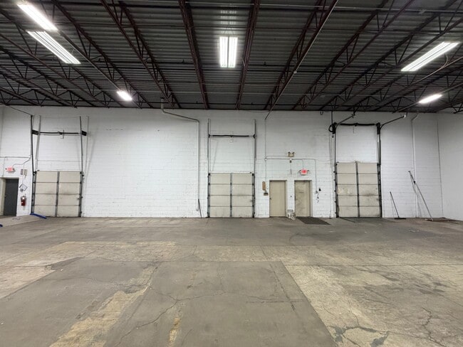
7071-7093 Shady Oak Rd
Minneapolis-St. Paul-Bloomington, MN-WI
Le Parc
12-116-22-11-0012
LOT 001 BLOCK 001 A LE PARC THAT PART OF LOT 1 BLK 1 LE PARC LYING WLY OF A LINE DES AS COM AT THE NW COR OF SAID LOT 1 TH ON AN ASSUMED BEARING OF N 88 DEG 5 MIN 3 T W683X350X470X260
Industrialgeneral
Hennepin
X
Minnesota
27053C0344F
1
2024
4.42 AC
2024
Southwest
026019
Minneapolis/St Paul
48,000 SF
DEMOGRAPHICS near 7071-7093 Shady Oak Rd
1 Mile
3 Mile
5 Mile
2024 Total Population
2,906
58,889
205,902
2029 Population
2,851
58,280
202,915
Pop Growth 2024-2029
(1.89%)
(1.03%)
(1.45%)
Average Age
42
42
42
2024 Total Households
1,186
25,509
88,074
HH Growth 2024-2029
(1.94%)
(1.08%)
(1.51%)
Median Household Inc
$129,062
$101,891
$100,278
Avg Household Size
2.40
2.20
2.30
2024 Avg HH Vehicles
2.00
2.00
2.00
Median Home Value
$724,712
$448,158
$405,202
Median Year Built
1985
1981
1976
Nearby Places
Map Layers
Map Styles
 Street
 Aerial
- Restaurants
- Banks
- Shops
- Fitness
- Groceries
PUBLIC TRANSPORTATION
AIRPORT
Minneapolis-St Paul International/Wold-Chamberlain
DRIVE
WALK
Distance
Minneapolis-St Paul International/Wold-Chamberlain
19 min
11.7 mi
Freight Ports
Port Milwaukee
DRIVE
WALK
Distance
Port Milwaukee
388 min
348.9 mi
Nearby Properties
Address
Land Use
TOTAL SIZE
Lot Size
Zoning
Address
Land Use
TOTAL SIZE
Lot Size
Zoning
22,654 SF
5.22 AC
Address
Land Use
TOTAL SIZE
Lot Size
Zoning
49,799 SF
4.96 AC
Address
Land Use
TOTAL SIZE
Lot Size
Zoning
7.68 AC
Address
Land Use
TOTAL SIZE
Lot Size
Zoning
4.89 AC
Address
Land Use
TOTAL SIZE
Lot Size
Zoning
6.83 AC
Address
Land Use
TOTAL SIZE
Lot Size
Zoning
461,748 SF
5.87 AC
Address
Land Use
TOTAL SIZE
Lot Size
Zoning
Address
Land Use
TOTAL SIZE
Lot Size
Zoning
49,757 SF
2.88 AC
Address
Land Use
TOTAL SIZE
Lot Size
Zoning
3.07 AC
Address
Land Use
TOTAL SIZE
Lot Size
Zoning
4.84 AC
Address
Land Use
TOTAL SIZE
Lot Size
Zoning
138,997 SF
14.03 AC
OFC
Address
Land Use
TOTAL SIZE
Lot Size
Zoning
25,780 SF
5.24 AC
Address
Land Use
TOTAL SIZE
Lot Size
Zoning
4.55 AC
Address
Land Use
TOTAL SIZE
Lot Size
Zoning
Address
Land Use
TOTAL SIZE
Lot Size
Zoning
3.15 AC
Address
Land Use
TOTAL SIZE
Lot Size
Zoning
216,984 SF
14.48 AC
RM25
Address
Land Use
TOTAL SIZE
Lot Size
Zoning
233,320 SF
17.37 AC
PUD
Address
Land Use
TOTAL SIZE
Lot Size
Zoning
93,982 SF
9.33 AC
OFC
Address
Land Use
TOTAL SIZE
Lot Size
Zoning
226,252 SF
5.40 AC
Address
Land Use
TOTAL SIZE
Lot Size
Zoning
25,909 SF
6.09 AC
Address
Land Use
TOTAL SIZE
Lot Size
Zoning
38.20 AC
Address
Land Use
TOTAL SIZE
Lot Size
Zoning
175,506 SF
14.32 AC
Address
Land Use
TOTAL SIZE
Lot Size
Zoning
10.01 AC
RM25
Address
Land Use
TOTAL SIZE
Lot Size
Zoning
Address
Land Use
TOTAL SIZE
Lot Size
Zoning
314,234 SF
2.31 AC
RM25
Address
Land Use
TOTAL SIZE
Lot Size
Zoning
39,118 SF
3.48 AC
Address
Land Use
TOTAL SIZE
Lot Size
Zoning
327,536 SF
4.76 AC
CCOM
Address
Land Use
TOTAL SIZE
Lot Size
Zoning
18,536 SF
3.67 AC
Address
Land Use
TOTAL SIZE
Lot Size
Zoning
166,989 SF
9.70 AC
RM25
Address
Land Use
TOTAL SIZE
Lot Size
Zoning
181,201 SF
8.30 AC
OFC
The World's #1 Commercial Real Estate Marketplace
Connect with us
© 2025 CoStar Group
The information above has been obtained from sources believed reliable. While we do not doubt its accuracy we have not verified it and make no guarantee, warranty or representation about it. It is your responsibility to independently confirm its accuracy and completeness. Any projections, opinions, assumptions, or estimates used are for example only and do not represent the current or future performance of the property. The value of this transaction to you depends on tax and other factors which should be evaluated by your tax, financial, and legal advisors. You and your advisors should conduct a careful, independent investigation of the property to determine to your satisfaction the suitability of the property for your needs.