Property Record
7075 N Marks Ave, Fresno, CA 93711


Save to a Folder
{{folder.Name}}
{{folder.ListingIds.length}} Properties
{{folder.ListingIds.length}} Property
Create a New Folder
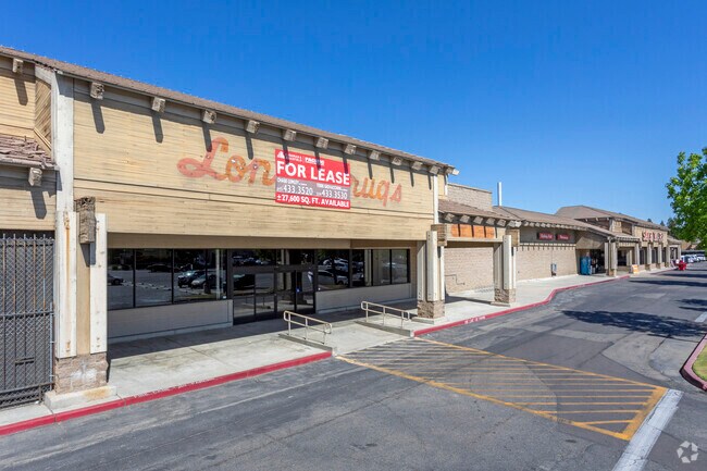
Property Detail
7075 N Marks Ave
500-200-16S
SUR RT 3.21 AC IN PARS E & F P/M 82-06 BK 38 PG 95
Supermarket
Fresno
C1
California
B and X Area of moderate flood hazard, usually the area between the limits of the 100-year and 500-year floods.
3.20 AC
2025
N Shaw/W Blackstone
2025
Fresno
004301
Fresno, CA
41,424 SF
NEARBY LISTINGS FOR SALE OR LEASE
DEMOGRAPHICS near 7075 N Marks Ave
1 mile
3 mile
5 mile
2025 Total Population
9,620
88,507
231,855
2030 Population
9,697
89,598
234,644
Pop Growth 2025-2030
+ 0.80%
+ 1.23%
+ 1.20%
Average Age
47
40
38
2025 Total Households
3,932
32,970
81,289
HH Growth 2025-2030
+ 0.84%
+ 1.24%
+ 1.20%
Median Household Inc
$113,894
$85,999
$76,499
Avg Household Size
2.40
2.60
2.80
2025 Avg HH Vehicles
2.00
2.00
2.00
Median Home Value
$605,962
$445,994
$409,878
Median Year Built
1984
1985
1980
Nearby Places
Map Layers
Map Styles
 Street
 Aerial
Layers
 Traffic
 Biking
Places
Listings with unknown addresses are not visible on the map
- Restaurants
- Banks
- Shops
- Fitness
- Groceries
PUBLIC TRANSPORTATION
AIRPORT
Fresno Yosemite International
Drive
Walk
Distance
Fresno Yosemite International
20 min
11.8 mi
Freight Ports
Port of Stockton
Drive
Walk
Distance
Port of Stockton
145 min
121.3 mi
Nearby Properties
Address
Land Use
TOTAL SIZE
Lot Size
Zoning
Address
Land Use
TOTAL SIZE
Lot Size
Zoning
477,820 SF
18.78 AC
RA
Address
Land Use
TOTAL SIZE
Lot Size
Zoning
412,974 SF
29.02 AC
R2
Address
Land Use
TOTAL SIZE
Lot Size
Zoning
197,659 SF
11.80 AC
CC
Address
Land Use
TOTAL SIZE
Lot Size
Zoning
423,568 SF
32.25 AC
R2
Address
Land Use
TOTAL SIZE
Lot Size
Zoning
234,370 SF
23 AC
SPLIT
Address
Land Use
TOTAL SIZE
Lot Size
Zoning
278,502 SF
19.42 AC
SPLIT
Address
Land Use
TOTAL SIZE
Lot Size
Zoning
251,904 SF
16.70 AC
SPLIT
Address
Land Use
TOTAL SIZE
Lot Size
Zoning
178,900 SF
11.68 AC
CP
Address
Land Use
TOTAL SIZE
Lot Size
Zoning
54,758 SF
8 AC
AE5
Address
Land Use
TOTAL SIZE
Lot Size
Zoning
126,346 SF
5.31 AC
CP
Address
Land Use
TOTAL SIZE
Lot Size
Zoning
218,838 SF
19.06 AC
R2
Address
Land Use
TOTAL SIZE
Lot Size
Zoning
176,228 SF
10.17 AC
R2
Address
Land Use
TOTAL SIZE
Lot Size
Zoning
150,437 SF
14.72 AC
SPLIT
Address
Land Use
TOTAL SIZE
Lot Size
Zoning
70,678 SF
4.23 AC
Address
Land Use
TOTAL SIZE
Lot Size
Zoning
56,331 SF
5.31 AC
CM
Address
Land Use
TOTAL SIZE
Lot Size
Zoning
83,026 SF
5.02 AC
RM1
Address
Land Use
TOTAL SIZE
Lot Size
Zoning
124,055 SF
9.35 AC
R2
Address
Land Use
TOTAL SIZE
Lot Size
Zoning
92,279 SF
0.01 AC
CM
Address
Land Use
TOTAL SIZE
Lot Size
Zoning
42,166 SF
1.63 AC
CM
Address
Land Use
TOTAL SIZE
Lot Size
Zoning
124,828 SF
5.70 AC
C2
Address
Land Use
TOTAL SIZE
Lot Size
Zoning
46,938 SF
9.25 AC
C6
Address
Land Use
TOTAL SIZE
Lot Size
Zoning
83,800 SF
4.04 AC
R2
Address
Land Use
TOTAL SIZE
Lot Size
Zoning
45,226 SF
2.77 AC
C2
Address
Land Use
TOTAL SIZE
Lot Size
Zoning
210,336 SF
11.97 AC
CP
Address
Land Use
TOTAL SIZE
Lot Size
Zoning
43,944 SF
3.21 AC
CM
Address
Land Use
TOTAL SIZE
Lot Size
Zoning
38,016 SF
3.18 AC
CM
Address
Land Use
TOTAL SIZE
Lot Size
Zoning
45,944 SF
2.30 AC
CP
Address
Land Use
TOTAL SIZE
Lot Size
Zoning
53,033 SF
7.09 AC
C1
Address
Land Use
TOTAL SIZE
Lot Size
Zoning
111,149 SF
8.22 AC
RM1
Address
Land Use
TOTAL SIZE
Lot Size
Zoning
128,386 SF
8.30 AC
R2
The World's #1 Commercial Real Estate Marketplace
Connect with us
© 2026 CoStar Group
The information above has been obtained from sources believed reliable. While we do not doubt its accuracy we have not verified it and make no guarantee, warranty or representation about it. It is your responsibility to independently confirm its accuracy and completeness. Any projections, opinions, assumptions, or estimates used are for example only and do not represent the current or future performance of the property. The value of this transaction to you depends on tax and other factors which should be evaluated by your tax, financial, and legal advisors. You and your advisors should conduct a careful, independent investigation of the property to determine to your satisfaction the suitability of the property for your needs.