Property Record
7075 W Gowan Rd, Las Vegas, NV 89129
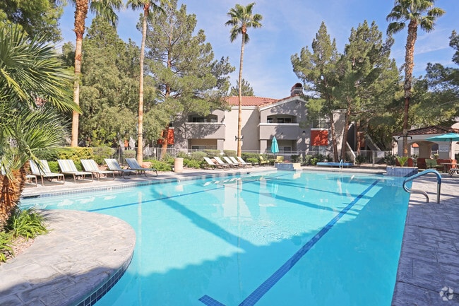


Property Detail
7075 W Gowan Rd
138-10-702-001
PARCEL MAP FILE 57 PAGE 6 LOT 2
Apartment
Clark
L:R-3
Nevada
B and X Area of moderate flood hazard, usually the area between the limits of the 100-year and 500-year floods.
2
2026
14.27 AC
2026
Lone Mountain
003411
Las Vegas
7,103 SF
Las Vegas-Henderson-North Las Vegas, NV
NEARBY LISTINGS FOR SALE OR LEASE
-
-
View all Las Vegas listings for sale on LoopNet.com
DEMOGRAPHICS near 7075 W Gowan Rd
1 mile
3 mile
5 mile
2025 Total Population
17,437
172,521
433,387
2030 Population
18,255
180,327
453,865
Pop Growth 2025-2030
+ 4.69%
+ 4.52%
+ 4.73%
Average Age
40
41
41
2025 Total Households
6,838
66,407
161,677
HH Growth 2025-2030
+ 4.84%
+ 4.58%
+ 4.78%
Median Household Inc
$68,403
$73,930
$75,585
Avg Household Size
2.50
2.50
2.60
2025 Avg HH Vehicles
2.00
2.00
2.00
Median Home Value
$388,795
$419,532
$414,004
Median Year Built
1991
1992
1994
Nearby Places
Map Layers
Map Styles
 Street
 Aerial
Layers
 Traffic
 Biking
Places
Listings with unknown addresses are not visible on the map
- Restaurants
- Banks
- Shops
- Fitness
- Groceries
PUBLIC TRANSPORTATION
AIRPORT
Harry Reid International
Drive
Walk
Distance
Harry Reid International
26 min
15.5 mi
Boulder City Municipal
Drive
Walk
Distance
Boulder City Municipal
45 min
35.4 mi
Freight Ports
Port of Long Beach
Drive
Walk
Distance
Port of Long Beach
327 min
291.0 mi
Nearby Properties
Address
Land Use
TOTAL SIZE
Lot Size
Zoning
Address
Land Use
TOTAL SIZE
Lot Size
Zoning
647,754 SF
38.57 AC
C2
Address
Land Use
TOTAL SIZE
Lot Size
Zoning
161.14 AC
CV
Address
Land Use
TOTAL SIZE
Lot Size
Zoning
5,643 SF
10.29 AC
Address
Land Use
TOTAL SIZE
Lot Size
Zoning
3,193 SF
11.77 AC
Address
Land Use
TOTAL SIZE
Lot Size
Zoning
37.31 AC
CV
Address
Land Use
TOTAL SIZE
Lot Size
Zoning
7,148 SF
7.26 AC
Address
Land Use
TOTAL SIZE
Lot Size
Zoning
14,793 SF
9.57 AC
CPB
Address
Land Use
TOTAL SIZE
Lot Size
Zoning
5,057 SF
9.46 AC
RE
Address
Land Use
TOTAL SIZE
Lot Size
Zoning
3,518 SF
11.95 AC
Address
Land Use
TOTAL SIZE
Lot Size
Zoning
263,881 SF
7.49 AC
R-4
Address
Land Use
TOTAL SIZE
Lot Size
Zoning
5,750 SF
19.67 AC
R3
Address
Land Use
TOTAL SIZE
Lot Size
Zoning
21.12 AC
RE
Address
Land Use
TOTAL SIZE
Lot Size
Zoning
4,084 SF
1.84 AC
CPB
Address
Land Use
TOTAL SIZE
Lot Size
Zoning
178,800 SF
16.79 AC
TC
Address
Land Use
TOTAL SIZE
Lot Size
Zoning
211,331 SF
6.70 AC
USC
Address
Land Use
TOTAL SIZE
Lot Size
Zoning
86,946 SF
162.05 AC
M2
Address
Land Use
TOTAL SIZE
Lot Size
Zoning
6,280 SF
8.72 AC
RPD18
Address
Land Use
TOTAL SIZE
Lot Size
Zoning
3,618 SF
10 AC
L:R-3
Address
Land Use
TOTAL SIZE
Lot Size
Zoning
99,487 SF
22.61 AC
PC
Address
Land Use
TOTAL SIZE
Lot Size
Zoning
196,873 SF
5.25 AC
C2
Address
Land Use
TOTAL SIZE
Lot Size
Zoning
7,148 SF
15.33 AC
L:R-PD20
Address
Land Use
TOTAL SIZE
Lot Size
Zoning
1,838 SF
24.69 AC
R3
Address
Land Use
TOTAL SIZE
Lot Size
Zoning
2,006 SF
13.79 AC
RPD20
Address
Land Use
TOTAL SIZE
Lot Size
Zoning
18.02 AC
PF
Address
Land Use
TOTAL SIZE
Lot Size
Zoning
141,881 SF
57.85 AC
M2
Address
Land Use
TOTAL SIZE
Lot Size
Zoning
267,271 SF
22.36 AC
C1
Address
Land Use
TOTAL SIZE
Lot Size
Zoning
4,978 SF
15.05 AC
R3
Address
Land Use
TOTAL SIZE
Lot Size
Zoning
6,020 SF
10.30 AC
PC
The World's #1 Commercial Real Estate Marketplace
Connect with us
© 2026 CoStar Group
The information above has been obtained from sources believed reliable. While we do not doubt its accuracy we have not verified it and make no guarantee, warranty or representation about it. It is your responsibility to independently confirm its accuracy and completeness. Any projections, opinions, assumptions, or estimates used are for example only and do not represent the current or future performance of the property. The value of this transaction to you depends on tax and other factors which should be evaluated by your tax, financial, and legal advisors. You and your advisors should conduct a careful, independent investigation of the property to determine to your satisfaction the suitability of the property for your needs.