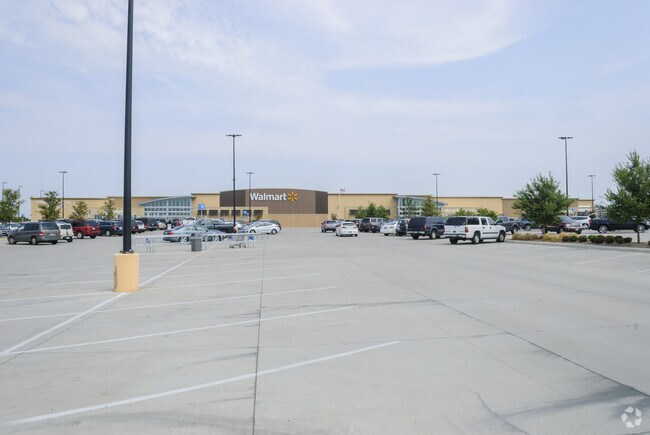
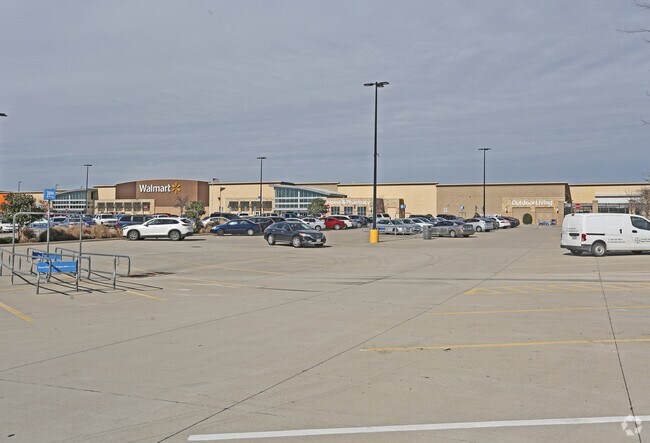
Property Record
7075 W Wheatland Rd, Dallas, TX 75249
NEARBY LISTINGS FOR SALE OR LEASE
Property Detail
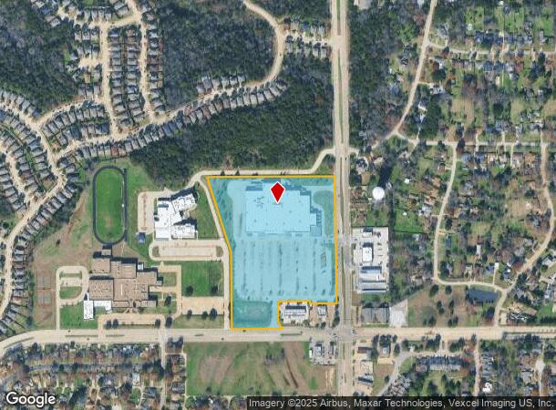
7075 W Wheatland Rd
Dallas-Fort Worth-Arlington, TX
Nwc Clark & Wheatland
008721000A0030000
NWC CLARK & WHEATLAND BLK A/8721 LT 3 ACS 18.358 INT201200377457 DD12202012 CO-DC 8721 00A 00300 5DA8721 00A
Departmentstore
Dallas
X
Texas
48113C0465L
3
2024
18.36 AC
2025
C Hill/Dunc'vlle/Deso
016528
Dallas/Ft Worth
155,166 SF
DEMOGRAPHICS near 7075 W Wheatland Rd
1 Mile
3 Mile
5 Mile
2024 Total Population
8,983
62,925
172,000
2029 Population
8,740
61,835
169,563
Pop Growth 2024-2029
(2.71%)
(1.73%)
(1.42%)
Average Age
39
37
37
2024 Total Households
2,911
20,438
58,152
HH Growth 2024-2029
(3.09%)
(1.97%)
(1.57%)
Median Household Inc
$60,214
$64,300
$62,870
Avg Household Size
3.00
3.00
2.90
2024 Avg HH Vehicles
2.00
2.00
2.00
Median Home Value
$201,513
$213,479
$226,661
Median Year Built
1982
1982
1986
Nearby Places
Map Layers
Map Styles
 Street
 Aerial
- Restaurants
- Banks
- Shops
- Fitness
- Groceries
PUBLIC TRANSPORTATION
AIRPORT
Dallas Love Field
DRIVE
WALK
Distance
Dallas Love Field
29 min
18.7 mi
Dallas-Fort Worth International
DRIVE
WALK
Distance
Dallas-Fort Worth International
34 min
26.3 mi
Freight Ports
Port of Shreveport
DRIVE
WALK
Distance
Port of Shreveport
222 min
206.0 mi
Nearby Properties
Address
Land Use
TOTAL SIZE
Lot Size
Zoning
Address
Land Use
TOTAL SIZE
Lot Size
Zoning
875,800 SF
82.21 AC
Z239
Address
Land Use
TOTAL SIZE
Lot Size
Zoning
350,000 SF
31.28 AC
Z239
Address
Land Use
TOTAL SIZE
Lot Size
Zoning
762,985 SF
74.96 AC
Z239
Address
Land Use
TOTAL SIZE
Lot Size
Zoning
381,633 SF
21.25 AC
Z239
Address
Land Use
TOTAL SIZE
Lot Size
Zoning
670,880 SF
38.60 AC
Z239
Address
Land Use
TOTAL SIZE
Lot Size
Zoning
663,000 SF
40.70 AC
Z116
Address
Land Use
TOTAL SIZE
Lot Size
Zoning
287,697 SF
18.15 AC
Z411
Address
Land Use
TOTAL SIZE
Lot Size
Zoning
559,500 SF
32.60 AC
Z239
Address
Land Use
TOTAL SIZE
Lot Size
Zoning
274,581 SF
15.55 AC
Z46
Address
Land Use
TOTAL SIZE
Lot Size
Zoning
0.05 AC
Z109
Address
Land Use
TOTAL SIZE
Lot Size
Zoning
305,724 SF
7.02 AC
Z357
Address
Land Use
TOTAL SIZE
Lot Size
Zoning
350,000 SF
19.77 AC
Z109
Address
Land Use
TOTAL SIZE
Lot Size
Zoning
186,100 SF
11.12 AC
Address
Land Use
TOTAL SIZE
Lot Size
Zoning
441,000 SF
21.47 AC
Z239
Address
Land Use
TOTAL SIZE
Lot Size
Zoning
179,100 SF
9.91 AC
Z163
Address
Land Use
TOTAL SIZE
Lot Size
Zoning
180,659 SF
8.19 AC
Z137
Address
Land Use
TOTAL SIZE
Lot Size
Zoning
230,513 SF
18.44 AC
Z239
Address
Land Use
TOTAL SIZE
Lot Size
Zoning
194,837 SF
10.79 AC
Z09
Address
Land Use
TOTAL SIZE
Lot Size
Zoning
161,560 SF
9 AC
Z163
Address
Land Use
TOTAL SIZE
Lot Size
Zoning
189,584 SF
10.09 AC
Z09
Address
Land Use
TOTAL SIZE
Lot Size
Zoning
346,756 SF
21.21 AC
Z239
Address
Land Use
TOTAL SIZE
Lot Size
Zoning
189,052 SF
17.95 AC
Z239
Address
Land Use
TOTAL SIZE
Lot Size
Zoning
177,692 SF
9.07 AC
Z09
Address
Land Use
TOTAL SIZE
Lot Size
Zoning
197,558 SF
10.44 AC
Z09
Address
Land Use
TOTAL SIZE
Lot Size
Zoning
310,500 SF
22.82 AC
Z239
Address
Land Use
TOTAL SIZE
Lot Size
Zoning
169,436 SF
11.64 AC
Z09
Address
Land Use
TOTAL SIZE
Lot Size
Zoning
110,126 SF
6.73 AC
Z163
Address
Land Use
TOTAL SIZE
Lot Size
Zoning
724,328 SF
37.81 AC
Z109
Address
Land Use
TOTAL SIZE
Lot Size
Zoning
128,606 SF
47.43 AC
Z239
Address
Land Use
TOTAL SIZE
Lot Size
Zoning
93,342 SF
8.19 AC
Z97
The World's #1 Commercial Real Estate Marketplace
Connect with us
© 2026 CoStar Group
The information above has been obtained from sources believed reliable. While we do not doubt its accuracy we have not verified it and make no guarantee, warranty or representation about it. It is your responsibility to independently confirm its accuracy and completeness. Any projections, opinions, assumptions, or estimates used are for example only and do not represent the current or future performance of the property. The value of this transaction to you depends on tax and other factors which should be evaluated by your tax, financial, and legal advisors. You and your advisors should conduct a careful, independent investigation of the property to determine to your satisfaction the suitability of the property for your needs.