Property Record
708 Burmont Rd, Drexel Hill, PA 19026
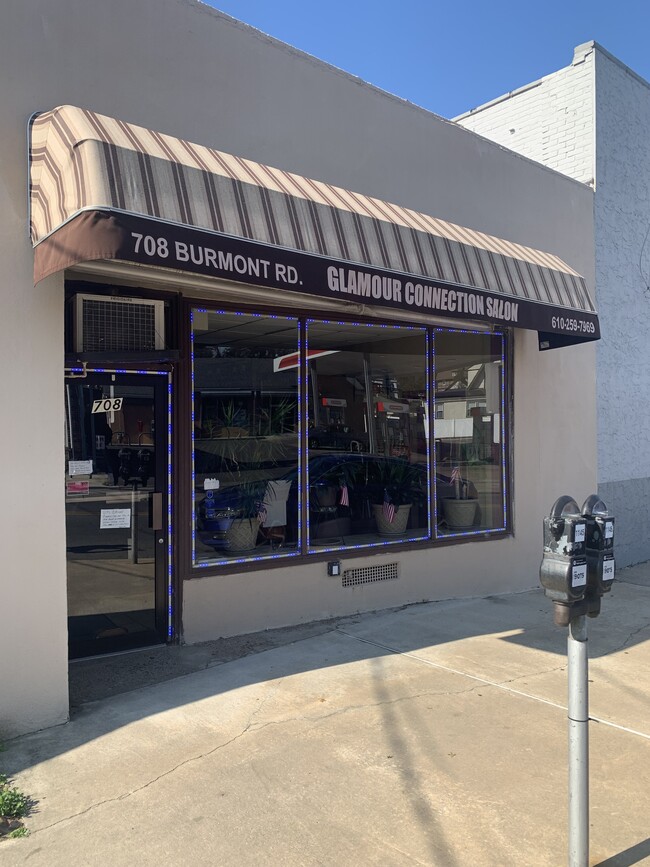
This Property Is For Sale
NEARBY LISTINGS FOR SALE OR LEASE
Property Detail
708 Burmont Rd
16-11-00704-00
1 STY STORE 23 X 112 X IRR
Restaurantbuilding
Delaware
X
Pennsylvania
42045C0108F
0.05 AC
2024
Delaware County
2025
Philadelphia
401200
Philadelphia-Camden-Wilmington, PA-NJ-DE-MD
2,280 SF
DEMOGRAPHICS near 708 Burmont Rd
1 Mile
3 Mile
5 Mile
2024 Total Population
24,672
200,219
565,898
2029 Population
24,302
196,710
555,914
Pop Growth 2024-2029
(1.50%)
(1.75%)
(1.76%)
Average Age
40
40
40
2024 Total Households
9,646
74,830
217,328
HH Growth 2024-2029
(1.79%)
(1.80%)
(1.85%)
Median Household Inc
$84,673
$75,132
$64,588
Avg Household Size
2.50
2.60
2.50
2024 Avg HH Vehicles
2.00
2.00
1.00
Median Home Value
$245,813
$250,559
$232,343
Median Year Built
1949
1951
1949
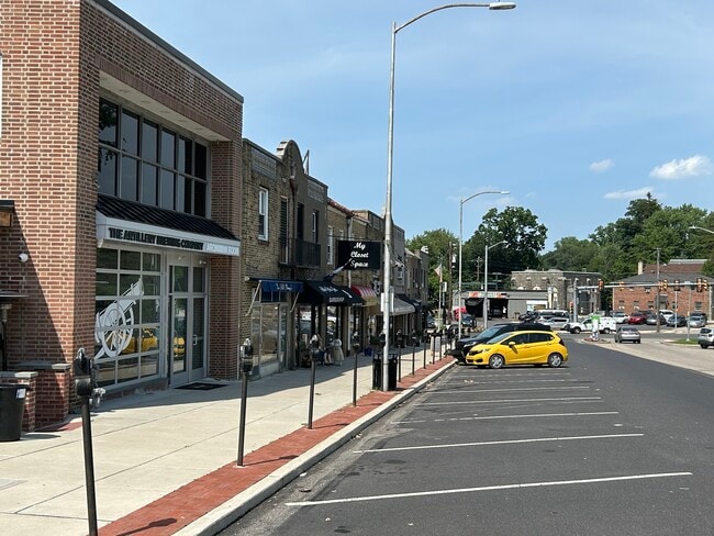
Nearby Places
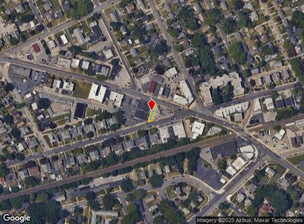
Map Layers
Map Styles
 Street
 Aerial
- Restaurants
- Banks
- Shops
- Fitness
- Groceries
PUBLIC TRANSPORTATION
TRANSIT/SUBWAY
Aronimink (Route 101 - SEPTA)
DRIVE
WALK
Distance
Aronimink (Route 101 - SEPTA)
0 min
2 min
0.1 mi
Anderson Avenue (Route 101 - SEPTA)
DRIVE
WALK
Distance
Anderson Avenue (Route 101 - SEPTA)
1 min
6 min
0.3 mi
School Lane (Route 101 - SEPTA)
DRIVE
WALK
Distance
School Lane (Route 101 - SEPTA)
1 min
10 min
0.5 mi
Drexelbrook (Route 101 - SEPTA)
DRIVE
WALK
Distance
Drexelbrook (Route 101 - SEPTA)
2 min
12 min
0.6 mi
Huey Avenue (Route 101 - SEPTA)
DRIVE
WALK
Distance
Huey Avenue (Route 101 - SEPTA)
1 min
13 min
0.7 mi
COMMUTER RAIL
Gladstone (R3 - Southeastern Pennsylvania Transportation Authority Regional Rail (SEPTA Regional Rail))
DRIVE
WALK
Distance
Gladstone (R3 - Southeastern Pennsylvania Transportation Authority Regional Rail (SEPTA Regional Rail))
6 min
2.1 mi
Clifton-Aldan (R3 - Southeastern Pennsylvania Transportation Authority Regional Rail (SEPTA Regional Rail))
DRIVE
WALK
Distance
Clifton-Aldan (R3 - Southeastern Pennsylvania Transportation Authority Regional Rail (SEPTA Regional Rail))
7 min
3.1 mi
AIRPORT
Philadelphia International
DRIVE
WALK
Distance
Philadelphia International
23 min
10.4 mi
Freight Ports
South Jersey Port
DRIVE
WALK
Distance
South Jersey Port
28 min
13.2 mi
Nearby Properties
Address
Land Use
TOTAL SIZE
Lot Size
Zoning
Address
Land Use
TOTAL SIZE
Lot Size
Zoning
158,496 SF
Address
Land Use
TOTAL SIZE
Lot Size
Zoning
15,660 SF
56.60 AC
Address
Land Use
TOTAL SIZE
Lot Size
Zoning
448,864 SF
32.89 AC
Address
Land Use
TOTAL SIZE
Lot Size
Zoning
48,739 SF
30 AC
Address
Land Use
TOTAL SIZE
Lot Size
Zoning
90,784 SF
26.26 AC
Address
Land Use
TOTAL SIZE
Lot Size
Zoning
112,268 SF
28.27 AC
Address
Land Use
TOTAL SIZE
Lot Size
Zoning
82,153 SF
13.97 AC
Address
Land Use
TOTAL SIZE
Lot Size
Zoning
702,532 SF
11 AC
Address
Land Use
TOTAL SIZE
Lot Size
Zoning
20,880 SF
27.20 AC
Address
Land Use
TOTAL SIZE
Lot Size
Zoning
6,040 SF
16.45 AC
Address
Land Use
TOTAL SIZE
Lot Size
Zoning
136,972 SF
27 AC
Address
Land Use
TOTAL SIZE
Lot Size
Zoning
30,204 SF
13.75 AC
Address
Land Use
TOTAL SIZE
Lot Size
Zoning
131,980 SF
9.17 AC
Address
Land Use
TOTAL SIZE
Lot Size
Zoning
114,058 SF
3.20 AC
Address
Land Use
TOTAL SIZE
Lot Size
Zoning
261,618 SF
30.57 AC
Address
Land Use
TOTAL SIZE
Lot Size
Zoning
68,096 SF
7.78 AC
Address
Land Use
TOTAL SIZE
Lot Size
Zoning
69,420 SF
17.12 AC
Address
Land Use
TOTAL SIZE
Lot Size
Zoning
282,520 SF
24.44 AC
Address
Land Use
TOTAL SIZE
Lot Size
Zoning
140,820 SF
3.57 AC
RM2
Address
Land Use
TOTAL SIZE
Lot Size
Zoning
86,052 SF
7.63 AC
Address
Land Use
TOTAL SIZE
Lot Size
Zoning
Address
Land Use
TOTAL SIZE
Lot Size
Zoning
72,564 SF
24.44 AC
Address
Land Use
TOTAL SIZE
Lot Size
Zoning
60,588 SF
9.43 AC
Address
Land Use
TOTAL SIZE
Lot Size
Zoning
33,326 SF
7.73 AC
Address
Land Use
TOTAL SIZE
Lot Size
Zoning
140,426 SF
10.46 AC
Address
Land Use
TOTAL SIZE
Lot Size
Zoning
100,242 SF
5 AC
Address
Land Use
TOTAL SIZE
Lot Size
Zoning
122,018 SF
16.24 AC
Address
Land Use
TOTAL SIZE
Lot Size
Zoning
90,368 SF
124 AC
Address
Land Use
TOTAL SIZE
Lot Size
Zoning
43,132 SF
29.60 AC
Address
Land Use
TOTAL SIZE
Lot Size
Zoning
152,403 SF
16.98 AC
The World's #1 Commercial Real Estate Marketplace
Connect with us
© 2026 CoStar Group
The information above has been obtained from sources believed reliable. While we do not doubt its accuracy we have not verified it and make no guarantee, warranty or representation about it. It is your responsibility to independently confirm its accuracy and completeness. Any projections, opinions, assumptions, or estimates used are for example only and do not represent the current or future performance of the property. The value of this transaction to you depends on tax and other factors which should be evaluated by your tax, financial, and legal advisors. You and your advisors should conduct a careful, independent investigation of the property to determine to your satisfaction the suitability of the property for your needs.