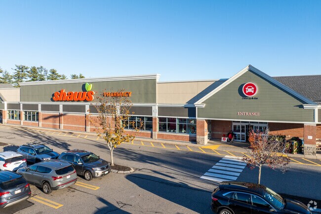
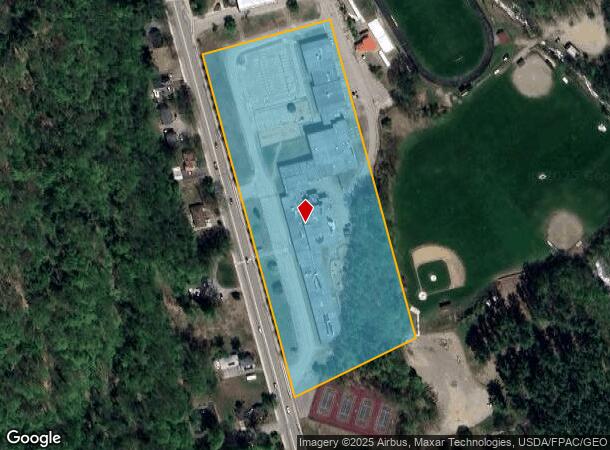
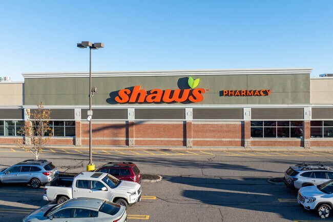
Property Record
708 Main St, Sanford, ME 04073
NEARBY LISTINGS FOR SALE OR LEASE
Property Detail
708 Main St
Governmentalpublicusegeneral
York
X
Maine
23031C0383G
8.29 AC
0
York County
2025
Portland/South Portland
030102
Portland-South Portland, ME
78,259 SF
SANF-000012-L000023
DEMOGRAPHICS near 708 Main St
1 Mile
3 Mile
5 Mile
2024 Total Population
1,871
15,000
25,340
2029 Population
1,909
15,302
25,824
Pop Growth 2024-2029
+ 2.03%
+ 2.01%
+ 1.91%
Average Age
45
42
43
2024 Total Households
792
6,182
10,464
HH Growth 2024-2029
+ 1.89%
+ 1.96%
+ 1.83%
Median Household Inc
$75,495
$67,096
$73,769
Avg Household Size
2.30
2.30
2.30
2024 Avg HH Vehicles
2.00
2.00
2.00
Median Home Value
$314,388
$278,832
$297,682
Median Year Built
1982
1972
1974
Nearby Places
Map Layers
Map Styles
 Street
 Aerial
- Restaurants
- Banks
- Shops
- Fitness
- Groceries
PUBLIC TRANSPORTATION
AIRPORT
Portland International Jetport
DRIVE
WALK
Distance
Portland International Jetport
46 min
32.3 mi
Portsmouth International at Pease
DRIVE
WALK
Distance
Portsmouth International at Pease
57 min
36.0 mi
Freight Ports
Portland, ME
DRIVE
WALK
Distance
Portland, ME
47 min
35.0 mi
Nearby Properties
Address
Land Use
TOTAL SIZE
Lot Size
Zoning
Address
Land Use
TOTAL SIZE
Lot Size
Zoning
220,000 SF
137 AC
GR
Address
Land Use
TOTAL SIZE
Lot Size
Zoning
61,542 SF
11.50 AC
Address
Land Use
TOTAL SIZE
Lot Size
Zoning
94,234 SF
17.65 AC
OR
Address
Land Use
TOTAL SIZE
Lot Size
Zoning
Address
Land Use
TOTAL SIZE
Lot Size
Zoning
9 AC
GR
Address
Land Use
TOTAL SIZE
Lot Size
Zoning
18.86 AC
SFR
Address
Land Use
TOTAL SIZE
Lot Size
Zoning
55,418 SF
1.54 AC
DB
Address
Land Use
TOTAL SIZE
Lot Size
Zoning
83,505 SF
17 AC
RD
Address
Land Use
TOTAL SIZE
Lot Size
Zoning
81.92 AC
SFR
Address
Land Use
TOTAL SIZE
Lot Size
Zoning
61,457 SF
0.87 AC
IR
Address
Land Use
TOTAL SIZE
Lot Size
Zoning
Address
Land Use
TOTAL SIZE
Lot Size
Zoning
16,708 SF
3 AC
DB
Address
Land Use
TOTAL SIZE
Lot Size
Zoning
8.60 AC
ORBP
Address
Land Use
TOTAL SIZE
Lot Size
Zoning
19,019 SF
19.41 AC
SFR
Address
Land Use
TOTAL SIZE
Lot Size
Zoning
71,566 SF
12 AC
UB
Address
Land Use
TOTAL SIZE
Lot Size
Zoning
1,080 SF
3.50 AC
GR
Address
Land Use
TOTAL SIZE
Lot Size
Zoning
2.25 AC
GR
Address
Land Use
TOTAL SIZE
Lot Size
Zoning
4.72 AC
SFR
Address
Land Use
TOTAL SIZE
Lot Size
Zoning
3.64 AC
UB
Address
Land Use
TOTAL SIZE
Lot Size
Zoning
4 AC
GR
Address
Land Use
TOTAL SIZE
Lot Size
Zoning
17,176 SF
2.84 AC
IB
Address
Land Use
TOTAL SIZE
Lot Size
Zoning
28.15 AC
Address
Land Use
TOTAL SIZE
Lot Size
Zoning
4.40 AC
GR
Address
Land Use
TOTAL SIZE
Lot Size
Zoning
43,747 SF
1.12 AC
DB
Address
Land Use
TOTAL SIZE
Lot Size
Zoning
93,920 SF
11 AC
SB
Address
Land Use
TOTAL SIZE
Lot Size
Zoning
24,060 SF
0.92 AC
DB
Address
Land Use
TOTAL SIZE
Lot Size
Zoning
6.06 AC
SB
Address
Land Use
TOTAL SIZE
Lot Size
Zoning
24,300 SF
2.79 AC
SB
Address
Land Use
TOTAL SIZE
Lot Size
Zoning
278,108 SF
2.78 AC
IR
The World's #1 Commercial Real Estate Marketplace
Connect with us
© 2026 CoStar Group
The information above has been obtained from sources believed reliable. While we do not doubt its accuracy we have not verified it and make no guarantee, warranty or representation about it. It is your responsibility to independently confirm its accuracy and completeness. Any projections, opinions, assumptions, or estimates used are for example only and do not represent the current or future performance of the property. The value of this transaction to you depends on tax and other factors which should be evaluated by your tax, financial, and legal advisors. You and your advisors should conduct a careful, independent investigation of the property to determine to your satisfaction the suitability of the property for your needs.