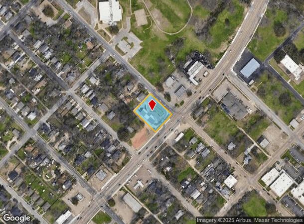
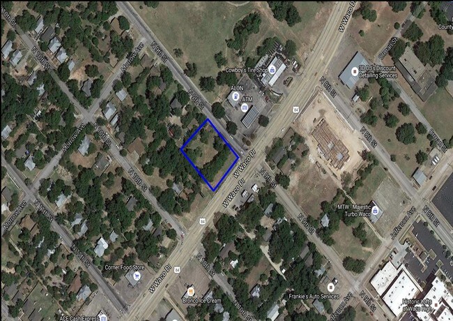
Property Record
708 N 9Th St, Waco, TX 76707

Property Detail
708 N 9Th St
Waco, TX
REYNOLDS LOT 25 BLOCK 228 ACRES 0.724
48-034800-024100-0
MCLENNAN
Commercialnec
Texas
B and X Area of moderate flood hazard, usually the area between the limits of the 100-year and 500-year floods.
25
2024
0.72 AC
2025
Downtown Waco
001200
Other Market Areas
4,267 SF
NEARBY LISTINGS FOR SALE OR LEASE
DEMOGRAPHICS near 708 N 9Th St
1 mile
3 mile
5 mile
2025 Total Population
9,868
84,948
134,955
2030 Population
10,365
88,041
139,615
Pop Growth 2025-2030
+ 5.04%
+ 3.64%
+ 3.45%
Average Age
34
33
35
2025 Total Households
3,882
30,640
50,829
HH Growth 2025-2030
+ 5.31%
+ 3.82%
+ 3.53%
Median Household Inc
$28,791
$39,049
$45,685
Avg Household Size
2.40
2.50
2.40
2025 Avg HH Vehicles
2.00
2.00
2.00
Median Home Value
$147,727
$159,429
$186,945
Median Year Built
1968
1970
1973
Nearby Places
Map Layers
Map Styles
 Street
 Aerial
Layers
 Traffic
 Biking
Places
Listings with unknown addresses are not visible on the map
- Restaurants
- Banks
- Shops
- Fitness
- Groceries
PUBLIC TRANSPORTATION
AIRPORT
Waco Regional
Drive
Walk
Distance
Waco Regional
18 min
8.4 mi
SALE & LEASE HISTORY
LISTING DATE
SALE/LEASE

Nov 10, 2016
For Sale
Feb 21, 2018
For Sale
Nearby Properties
Address
Land Use
TOTAL SIZE
Lot Size
Zoning
Address
Land Use
TOTAL SIZE
Lot Size
Zoning
93.17 AC
2007 TIF
Address
Land Use
TOTAL SIZE
Lot Size
Zoning
549,274 SF
34.05 AC
O2
Address
Land Use
TOTAL SIZE
Lot Size
Zoning
120,623 SF
55.15 AC
2007 TIF
Address
Land Use
TOTAL SIZE
Lot Size
Zoning
560,620 SF
3.70 AC
O2
Address
Land Use
TOTAL SIZE
Lot Size
Zoning
576,501 SF
4.21 AC
Address
Land Use
TOTAL SIZE
Lot Size
Zoning
452,498 SF
39.43 AC
C-2
Address
Land Use
TOTAL SIZE
Lot Size
Zoning
394,674 SF
21.31 AC
O2
Address
Land Use
TOTAL SIZE
Lot Size
Zoning
206,452 SF
11.97 AC
2007 TIF
Address
Land Use
TOTAL SIZE
Lot Size
Zoning
339,476 SF
Address
Land Use
TOTAL SIZE
Lot Size
Zoning
250,924 SF
17.73 AC
O-2
Address
Land Use
TOTAL SIZE
Lot Size
Zoning
27.28 AC
C
Address
Land Use
TOTAL SIZE
Lot Size
Zoning
399,747 SF
2.86 AC
C-3,C
Address
Land Use
TOTAL SIZE
Lot Size
Zoning
24.75 AC
O2
Address
Land Use
TOTAL SIZE
Lot Size
Zoning
213,814 SF
7.05 AC
2007 TIF
Address
Land Use
TOTAL SIZE
Lot Size
Zoning
69,809 SF
8.12 AC
2007 TIF
Address
Land Use
TOTAL SIZE
Lot Size
Zoning
3,096 SF
51.73 AC
2007 TIF
Address
Land Use
TOTAL SIZE
Lot Size
Zoning
126,592 SF
5.05 AC
2007 TIF
Address
Land Use
TOTAL SIZE
Lot Size
Zoning
188,746 SF
1.14 AC
O2
Address
Land Use
TOTAL SIZE
Lot Size
Zoning
188,465 SF
5.85 AC
2007 TIF
Address
Land Use
TOTAL SIZE
Lot Size
Zoning
Address
Land Use
TOTAL SIZE
Lot Size
Zoning
136,295 SF
6.09 AC
2007 TIF
Address
Land Use
TOTAL SIZE
Lot Size
Zoning
193,780 SF
14.12 AC
C
Address
Land Use
TOTAL SIZE
Lot Size
Zoning
237,081 SF
12.52 AC
2007 TIF
Address
Land Use
TOTAL SIZE
Lot Size
Zoning
107,925 SF
2.20 AC
2007TIF
Address
Land Use
TOTAL SIZE
Lot Size
Zoning
16.78 AC
2007 TIF
Address
Land Use
TOTAL SIZE
Lot Size
Zoning
200,951 SF
7.09 AC
R-3E
Address
Land Use
TOTAL SIZE
Lot Size
Zoning
77,089 SF
5.09 AC
O2
Address
Land Use
TOTAL SIZE
Lot Size
Zoning
155,900 SF
2.85 AC
O2
Address
Land Use
TOTAL SIZE
Lot Size
Zoning
142,734 SF
18.95 AC
R1B
Address
Land Use
TOTAL SIZE
Lot Size
Zoning
206,113 SF
7.33 AC
2007TIF
The World's #1 Commercial Real Estate Marketplace
Connect with us
© 2026 CoStar Group
The information above has been obtained from sources believed reliable. While we do not doubt its accuracy we have not verified it and make no guarantee, warranty or representation about it. It is your responsibility to independently confirm its accuracy and completeness. Any projections, opinions, assumptions, or estimates used are for example only and do not represent the current or future performance of the property. The value of this transaction to you depends on tax and other factors which should be evaluated by your tax, financial, and legal advisors. You and your advisors should conduct a careful, independent investigation of the property to determine to your satisfaction the suitability of the property for your needs.